

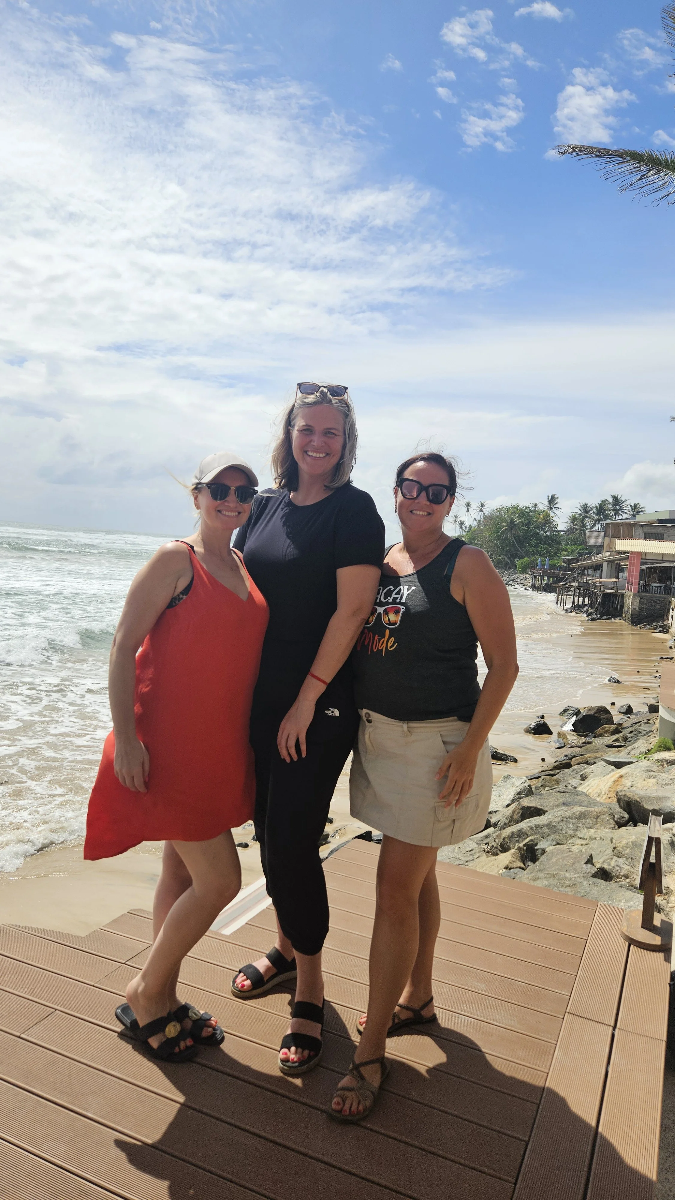
Ahangama: Sri Lanka's laid-back coastal escape
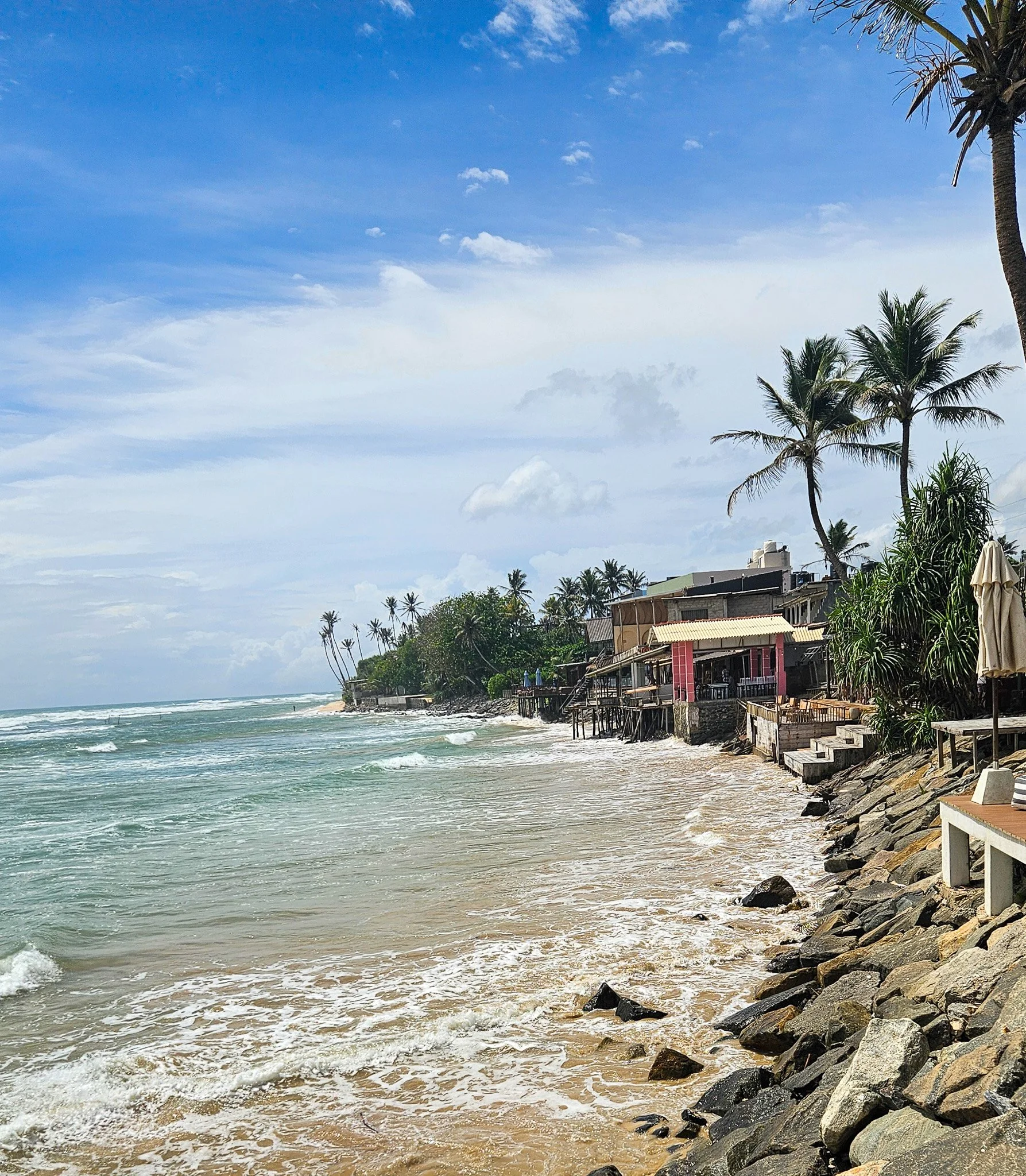
After weaving through the organised chaos of Sri Lanka's cities, arriving on the south coast feels like someone has suddenly turned the volume down.
After weaving through the organised chaos of Sri Lanka's cities and winding through mountainous roads, arriving on the south coast feels like someone has suddenly turned the volume down.
Ahangama isn't polished in the resort-town sense, and thankfully, it doesn't try to be. Instead, it's a laid-back stretch of coastline where local fishermen, wandering dogs, digital nomads, surfers and curious travellers all seem to coexist perfectly. The best bit is, it is one of many such towns along the south coast and they are close enough to each other to explore together.
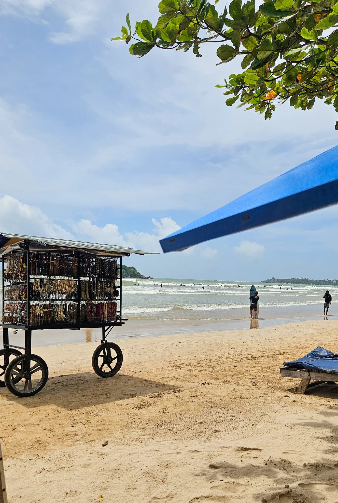
Weligama Beach
Learning to surf
If you're dreaming of learning to surf, Ahangama itself isn't always the easiest place to start but it is a great place for more experienced board riders to head out.
Many of the breaks right here sit over reefs and, when we visited in October, the swell was pumping. It was right on the edge of shoulder season for the south coast, which meant plenty of powerful waves rolling through.
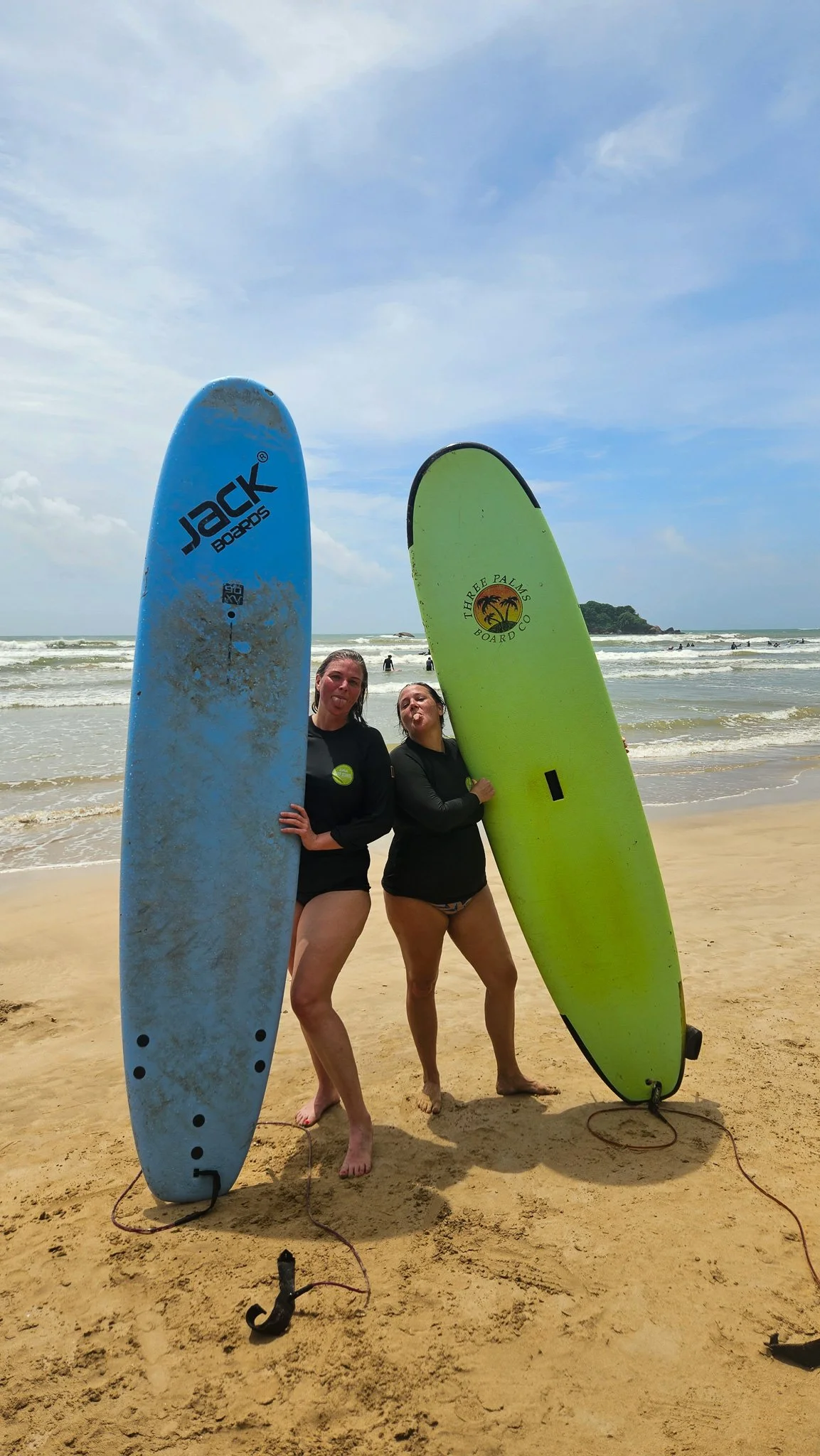
Surf lesson fun
Instead, Mandy and I headed just down the road to Weligama, where beginner surfers will be much more comfortable!
Weligama Bay is a huge, wide, shallow beach with forgiving waves and dozens of surf schools lining the foreshore. The best part? You don't need to book ahead. Simply wander down to the beach and you'll have no shortage of instructors offering lessons.
We ended up surfing with Weligama Surf, where Samee gave the two of us a private lesson. His calm approach, local knowledge and endless encouragement made learning far less intimidating. It was such a fun and easy break to play around on for me, and Mandy had a blast on her first-ever lesson.
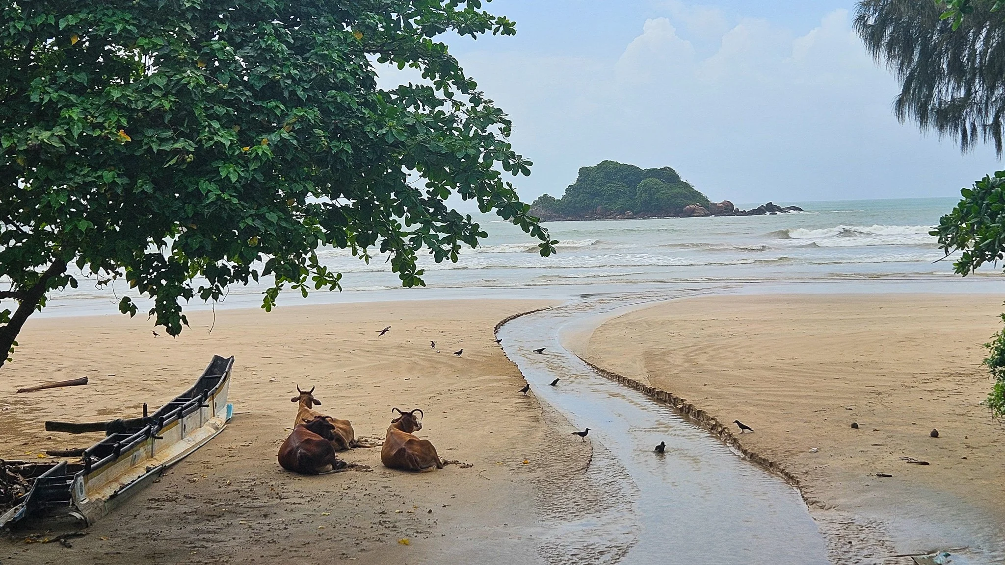
So chill the cows hang out at Weligama Beach
Slow mornings done properly
One thing the south coast absolutely nails is brunch.
Cactus Ahangama quickly became one of our favourite spots, serving colourful smoothie bowls, excellent coffee (with alternate milks!) and ocean views that make lingering over breakfast dangerously easy.
Brunch at Cactus
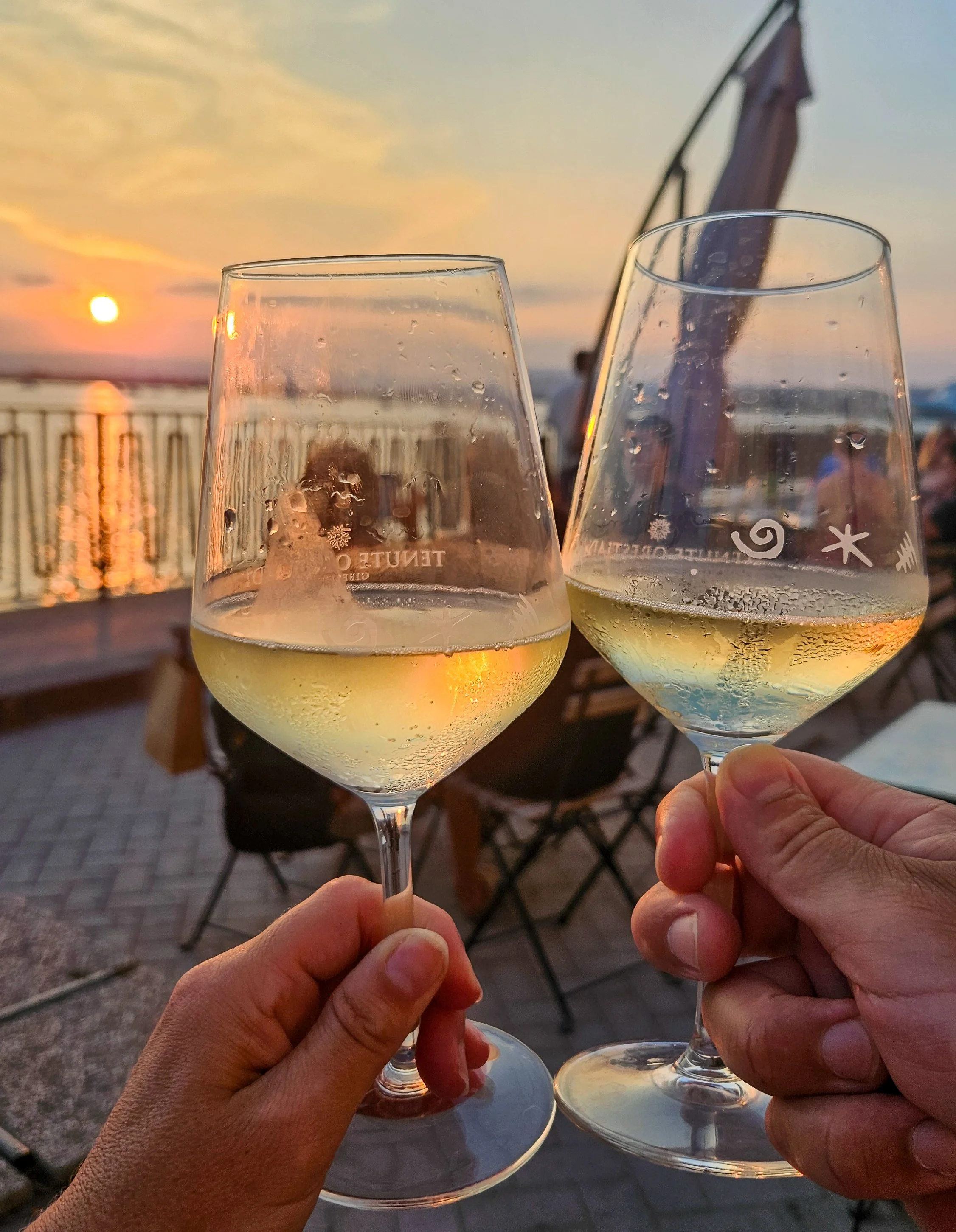
For sunset, head upstairs to Kai Ahangama Rooftop Café & Bar. Grab a cocktail, settle in and watch the surfers chase their final waves of the day while the sky puts on a show.
If you're after something after dark, House des Uncles is the perfect place for an evening drink. Relaxed, stylish and effortlessly cool, the cocktails here are creative and they had live music when we visited.

Cocktail time
Boutiques worth wandering into
Unlike many beach towns that are packed with souvenir stores selling the same fridge magnets, Ahangama has developed a genuinely interesting collection of independent boutiques.
You'll find locally made clothing, jewellery, ceramics, surf brands and homewares tucked between cafés, though the footpath is almost non-existent and walking around can be a little challenging.
Take time out with a massage
We definitely needed a bit of relaxation and pampering after surfing lessons…
The south coast has no shortage of beautiful spas and wellness studios offering everything from traditional Ayurvedic treatments to relaxing full-body massages.
One tip though: book ahead. The popular places can fill up quickly, especially during peak season, and there's nothing more disappointing than finally deciding it's massage time only to discover there are no appointments left. We had to call around (or send Whatsapp messages in my case), to find somewhere close that would take us all.
Don't skip Galle
One of the biggest advantages of staying in Ahangama is that Galle is less than an hour away, making it an easy day trip. It’s even easier to hire a driver to take you there for the day.
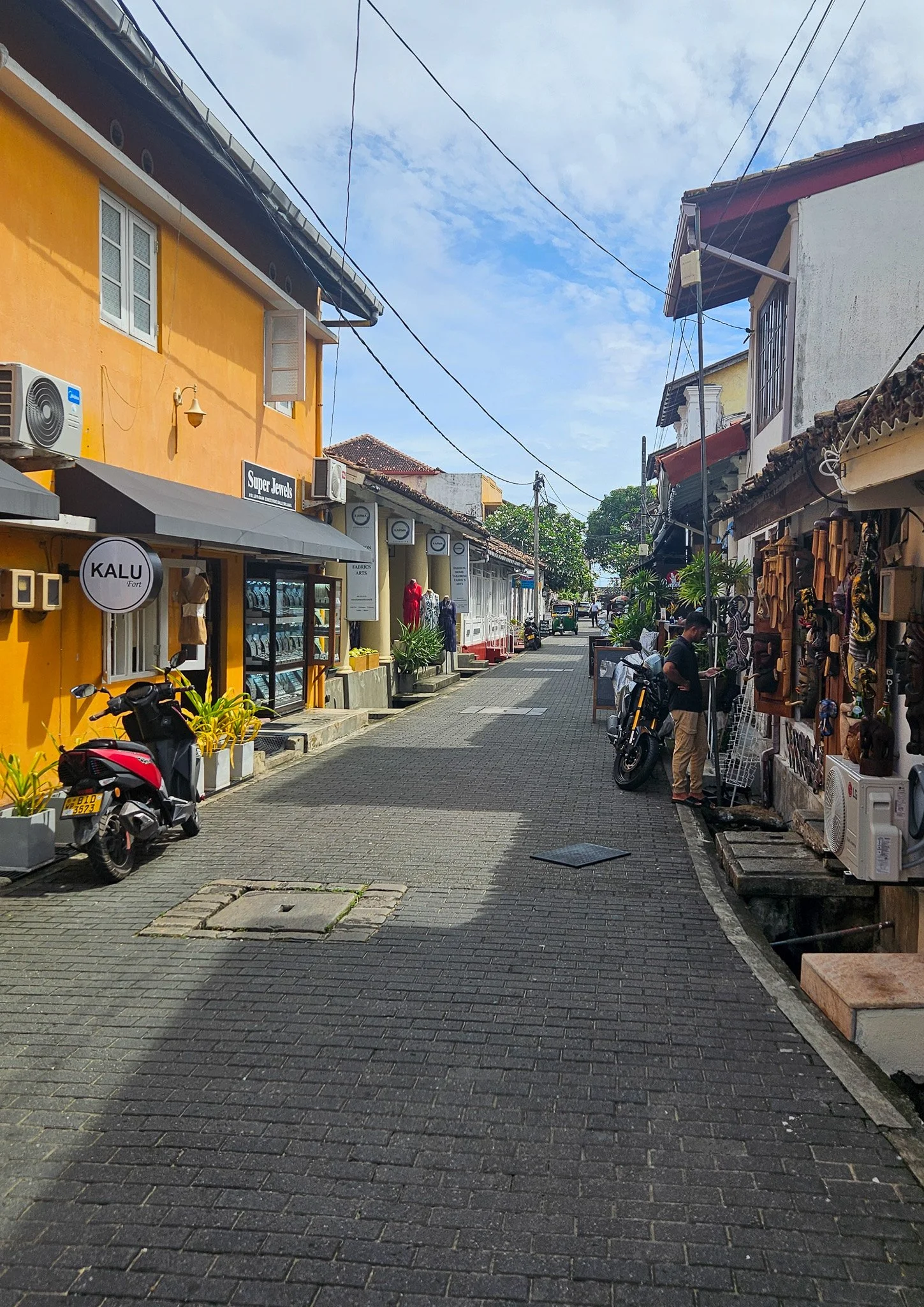
Calm streets of Galle
Walking into Galle Fort feels like you've accidentally crossed into another country.
The noisy streets, tuk-tuks and organised chaos that define much of Sri Lanka disappear behind centuries-old stone walls. In their place are narrow cobblestone laneways winding past Dutch colonial buildings, grand churches, boutique hotels, cafés and beautifully restored homes.
It's charming, incredibly walkable and wonderfully slow.
Perhaps the best part? There are no towering international hotel chains dominating the skyline. Galle has managed to retain its character behind the Fort walls.
-
Sri Lanka isn't just famous for its blue sapphires. You will discover an incredible rainbow of colours, including the iconic Padparadscha sapphire – a rare bright-pink gemstone found almost exclusively in Sri Lanka and considered one of the world's most valuable.
Within Galle Fort you'll find a number of reputable jewellers selling certified gemstones and handcrafted jewellery. Whether you're after a special keepsake or simply curious, it's well worth popping in to learn about Sri Lanka's centuries-old gemstone industry.
If you are planning to buy, take your time, compare a few stores and always ask for certification. Even if you leave empty-handed, seeing these stunning stones up close is an experience in itself.
My friends and I all came home with a sapphire ring as a souvenir of the trip – mine was a unique orange colour.
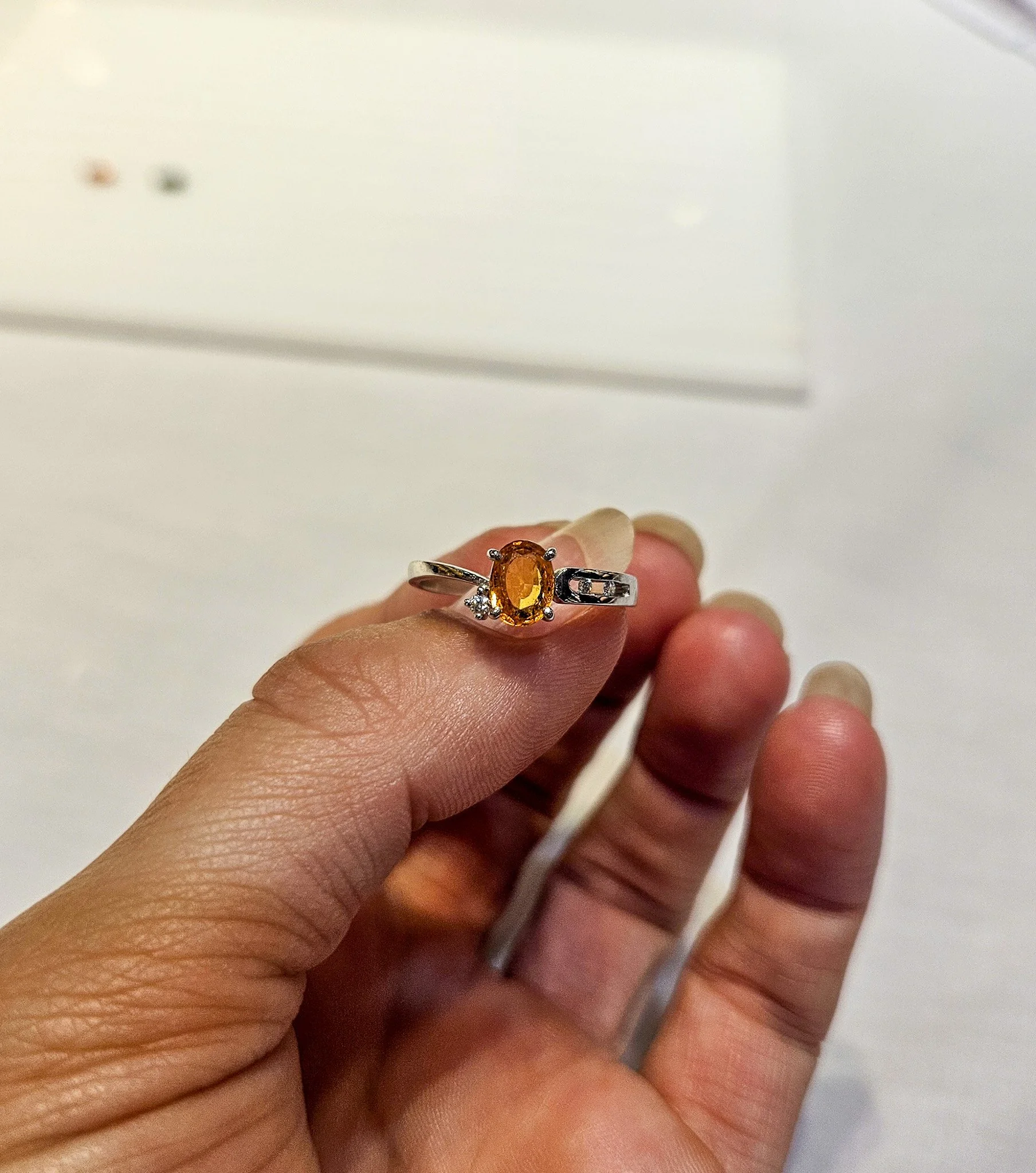
My new saphhire ring
Where we stayed
One of the highlights of our stay was Gad's Villa, a beautifully designed Colonial-era property that perfectly captures the relaxed vibe of the south coast. It was built in 1924 and has so much character.
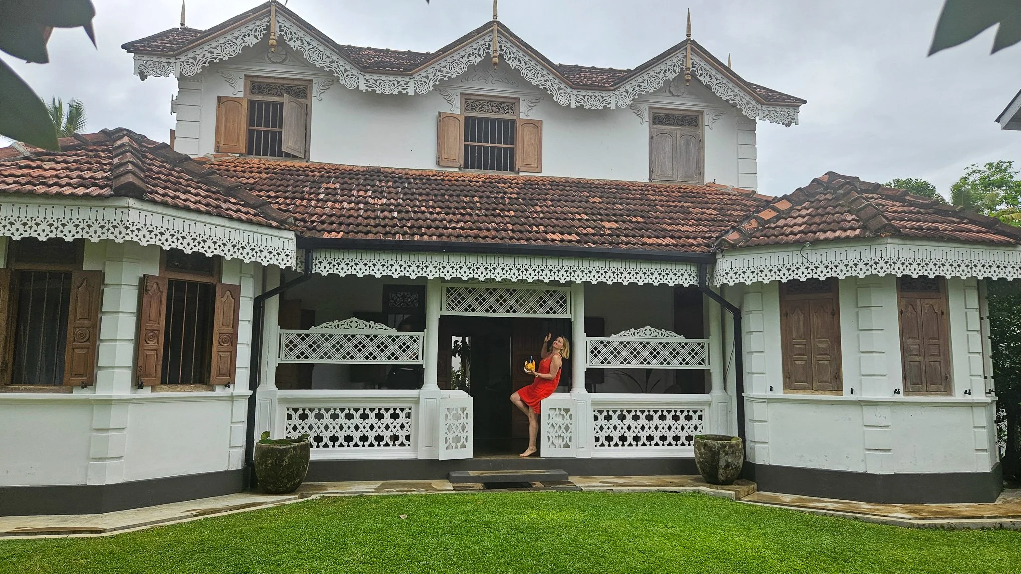
Our colonial palace
From the moment we arrived with a refreshing welcome coconut in hand, we knew we'd chosen well.
The villa's pool became our favourite place to cool off after mornings exploring and also a great place to enjoy a drink at the end of the day. Having the extra space compared to a hotel made it feel more like a home than just somewhere to sleep.
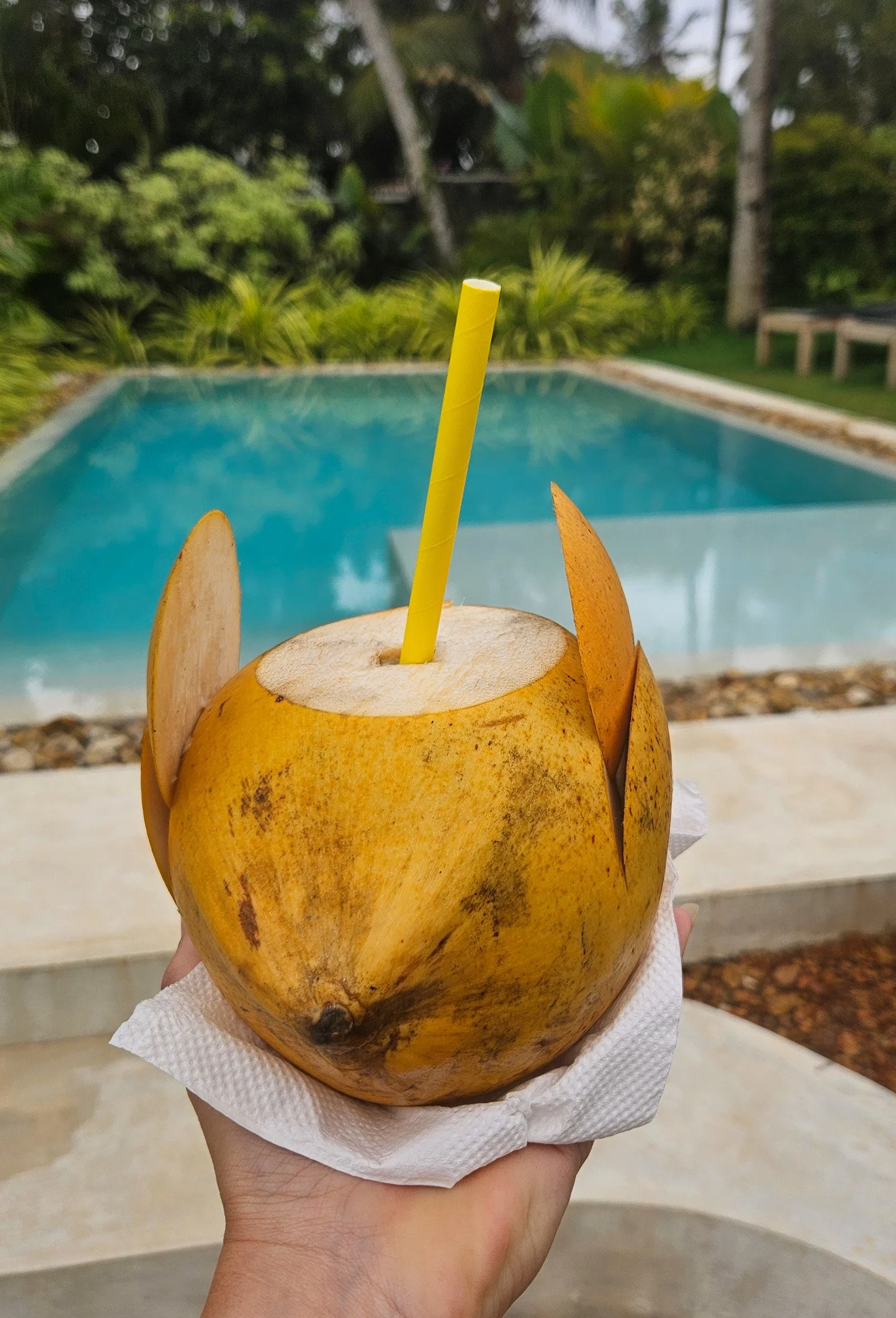
Our chilled welcome coconut
What really made the stay, though, was the hospitality. The caretaker, Hasintha, was so welcoming and always happy to help organise anything we needed.
One morning we arranged for breakfast to be cooked by Hasintha's mum, and it ended up being one of the highlights of our entire Sri Lanka trip. The feast just kept coming. We enjoyed fresh fruit, hoppers, curries, sambols and more than we could possibly eat. It was delicious, incredibly generous and a wonderful opportunity to experience authentic Sri Lankan home cooking.
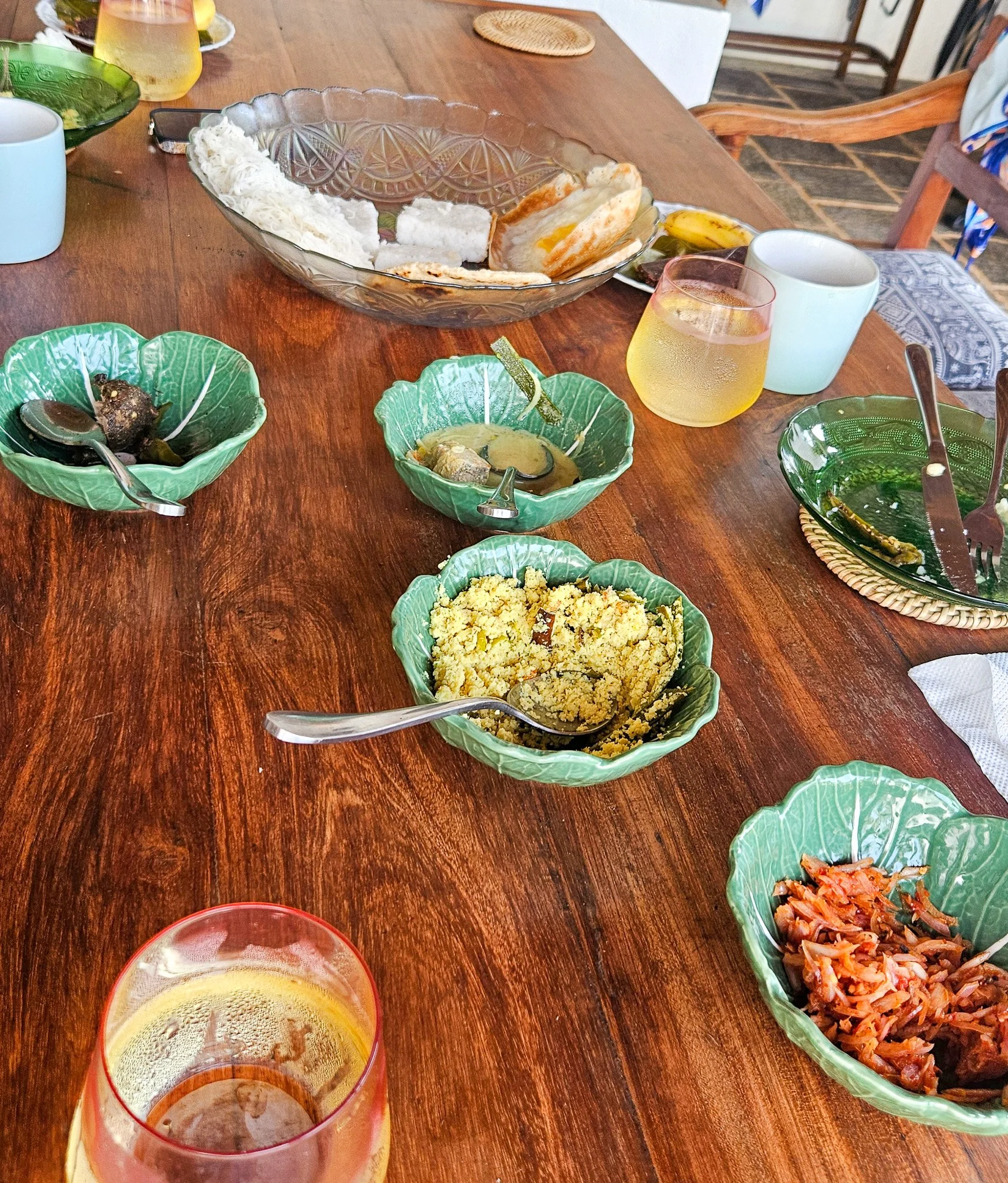
Breakfast for Queens
If you're looking for somewhere with character, genuine hospitality and a peaceful base to explore the south coast, Gad's Villa is hard to beat.
You can check it out here.
Is Ahangama worth visiting?
Absolutely.
If you're looking for nightlife, mega resorts and all-inclusive holidays, you'll probably be happier elsewhere.
But if your perfect day involves surfing, long brunches, boutique shopping, lazy afternoons by the pool and watching the sun disappear into the Indian Ocean with a cocktail in hand, Ahangama delivers in spades.
Southern Sicily might be Italy’s most underrated destination
Southern Sicily doesn’t put on a show for you because it doesn’t need to. The beauty here isn’t polished or packaged like some of Italy’s northern towns - it’s a little rough around the edges but that is what makes it such an incredible place to visit.
Our journey south started with a drive out from Catania, immediately escaping the hustle of a larger city.
First stop: Sutera. You can see this town looming from a distance and the village clings to the hillside beneath this looming rock formation, and everything about it feels stripped back.
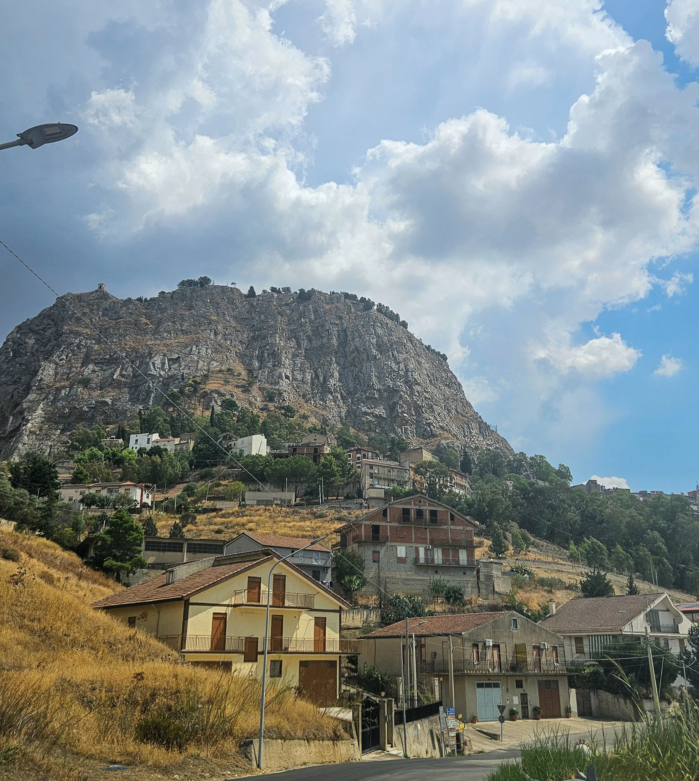
Sutera from a distance
Driving in, I found myself breathing in, in the hopes that would help our car fit through the narrow alleys!
You walk uphill through narrow lanes, past homes that look lived in rather than styled, and eventually the landscape just opens up and you can see for miles.
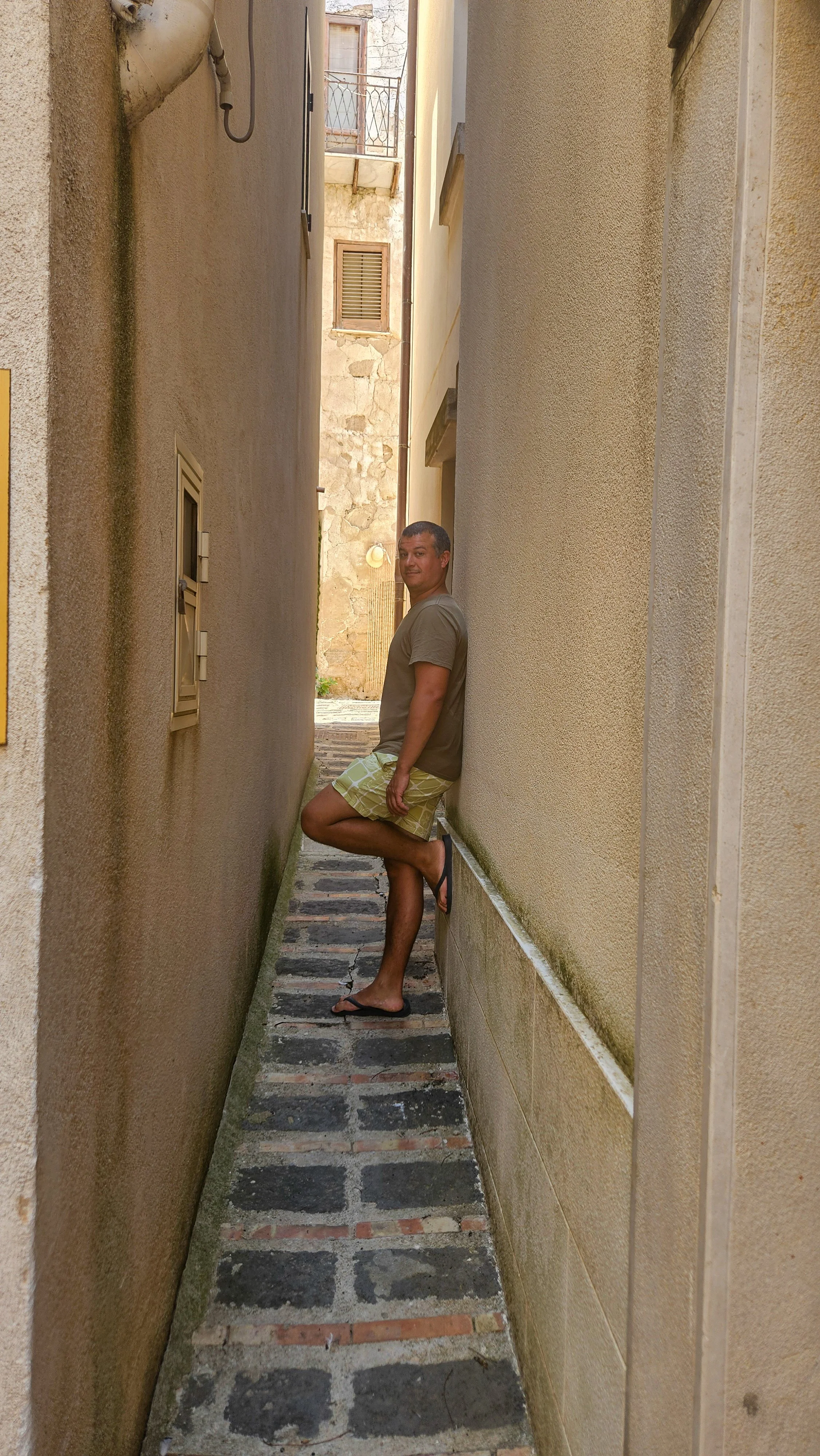
The alleys of Sutera are no joke
There’s not a lot to ‘do’ in Sutera, and that’s exactly the point – especially when you visit during lunchtime as we did and there was no one else in the street.
Agrigento, on the other hand, is one of those places where you do need a bit of intent. The Valley of the Temples is undeniably impressive, but it’s also exposed and unforgiving in the heat. Go early or go late, keep it tight, and don’t try to turn it into an all-day affair.
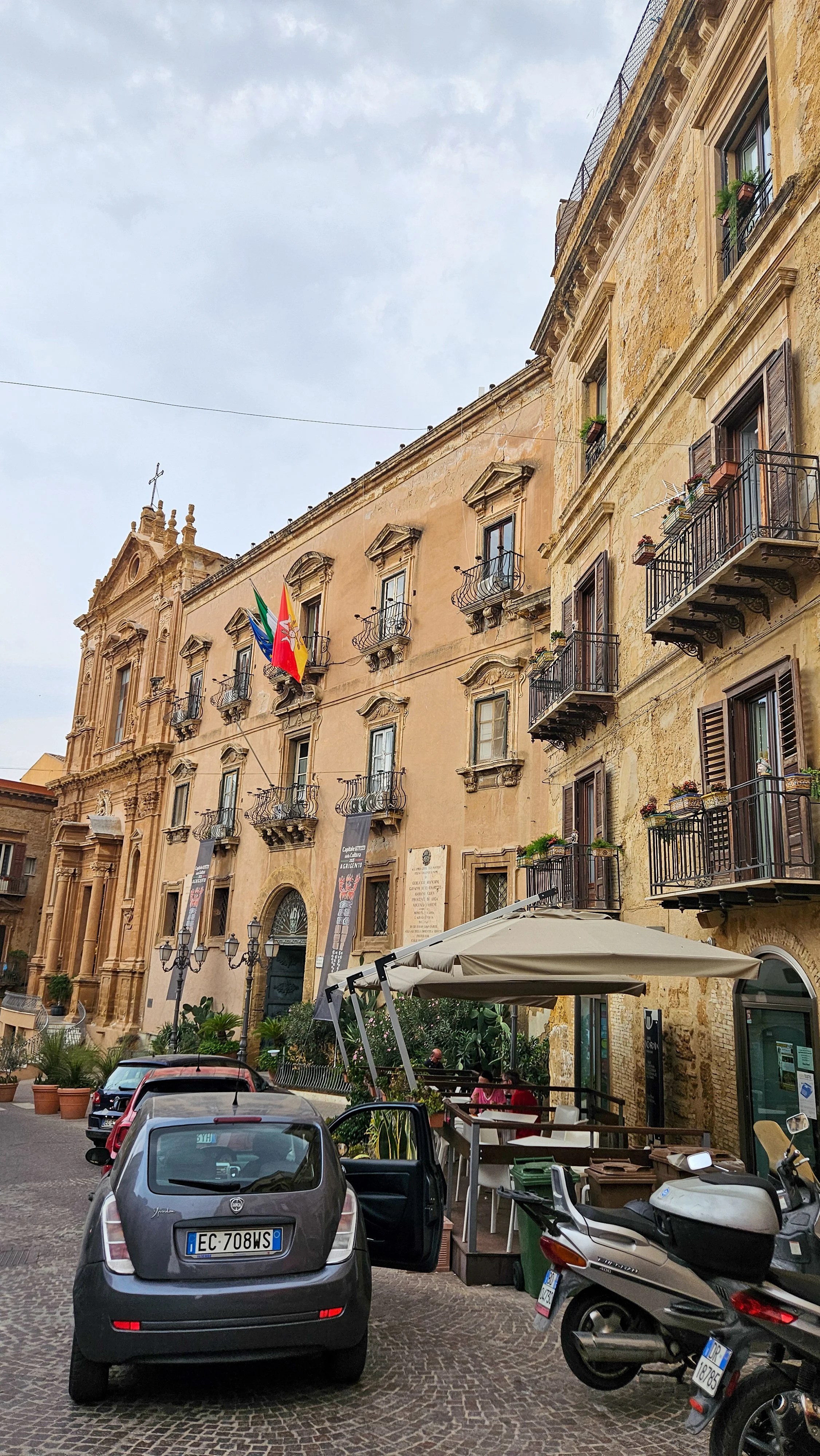
The charming streets of Agrigento
Wandering the town itself, you feel like part of every-day life. We discovered incredible local delis and pockets of charm where we could enjoy a drink.
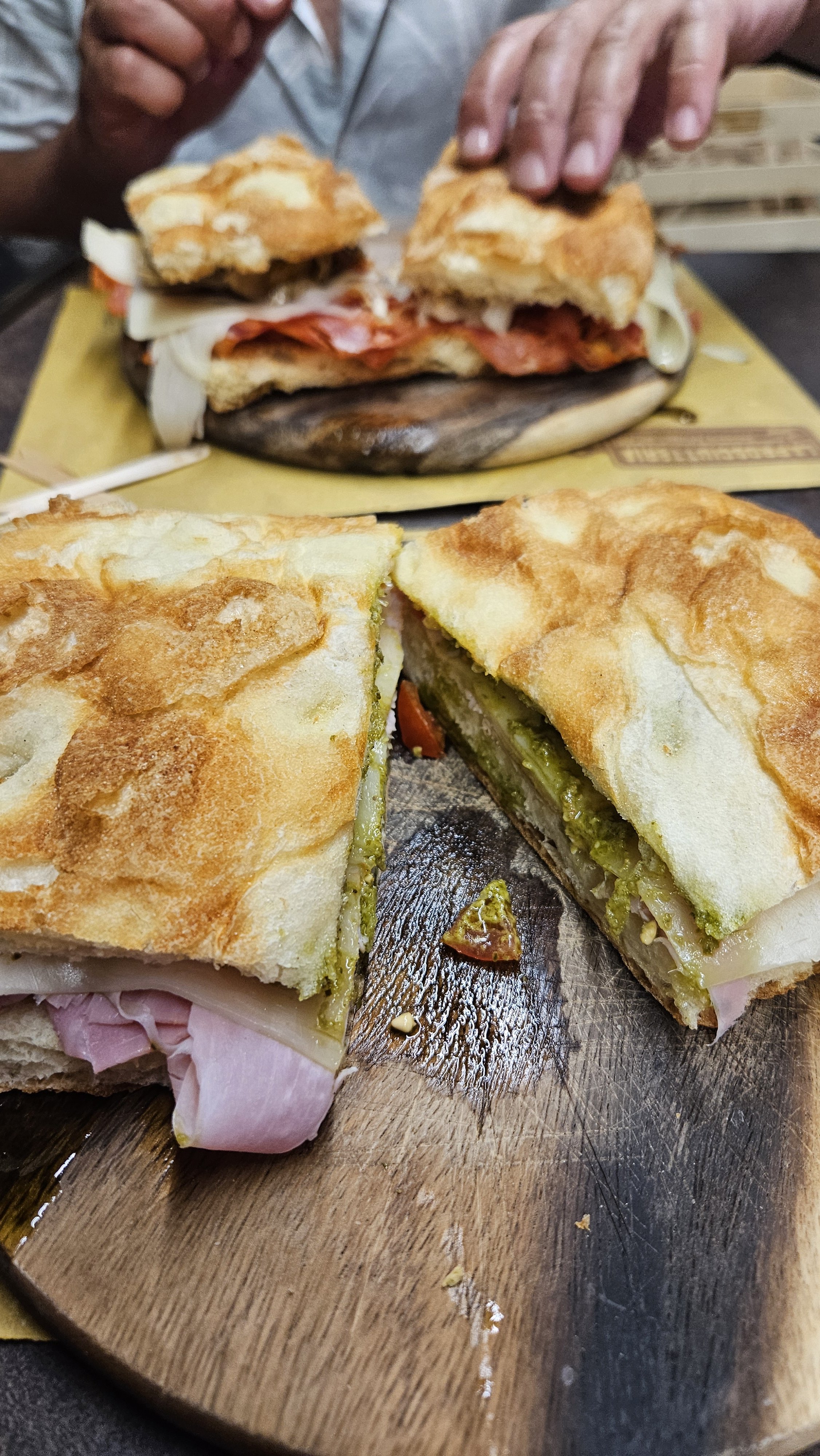
The sandwich of my dreams
The next stop is the coast, and Scala dei Turchi (Stairs of the Turks) feels almost surreal.
The first thing that catches you is the vibrance – you will definitely need your sunnies here. The limestone is this striking, chalky white that almost glows against the sea. The rock has been worn smooth over time, forming these soft, curved terraces that spill down toward the water. It genuinely feels like something sculpted rather than natural.
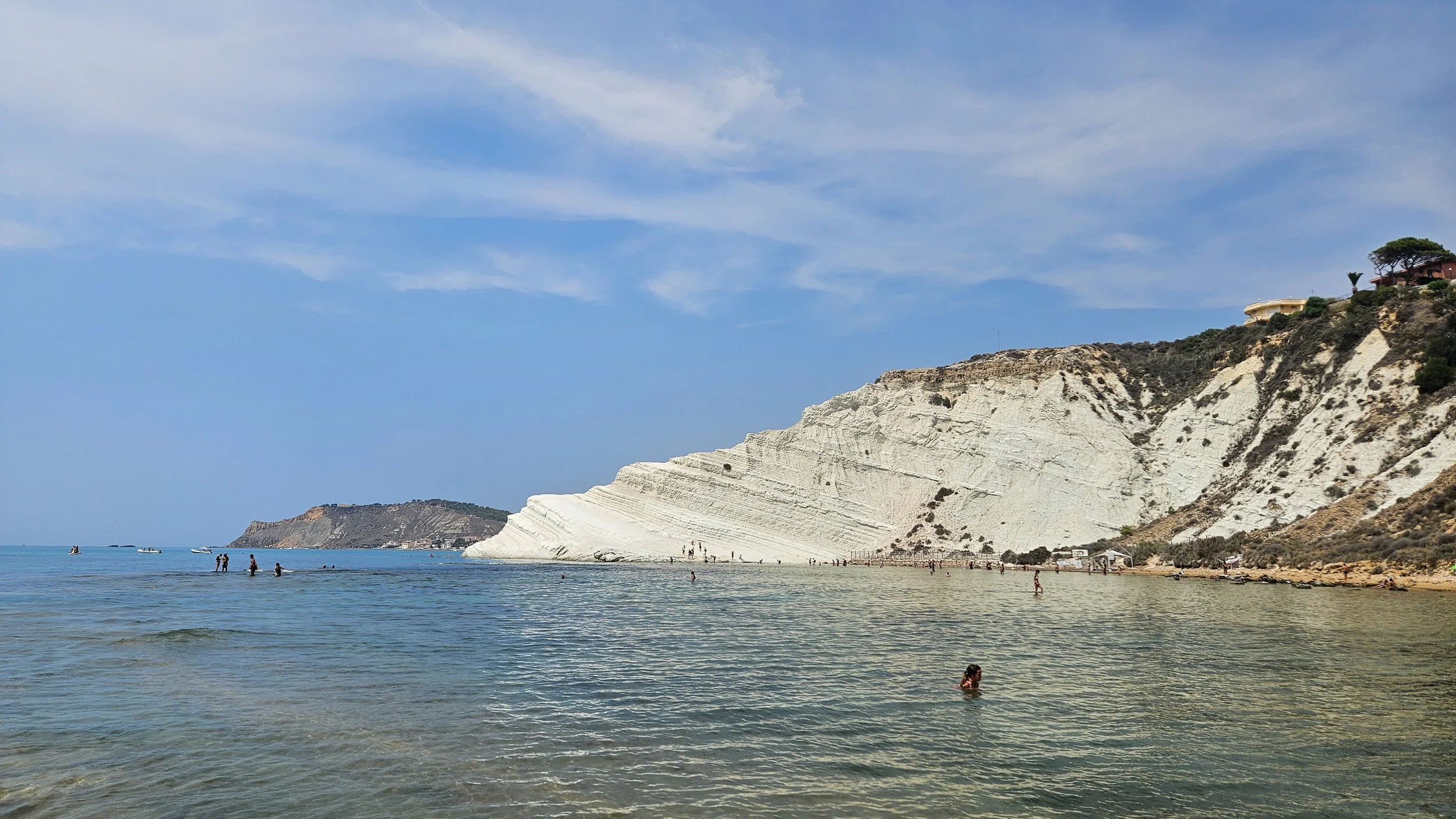
Scala dei Turchi
Walking on it is part of the experience. The surface is warm underfoot, almost polished in places, and you find yourself moving slowly without really thinking about it. People tend to spread out along the curves, sitting, lying back, watching the water shift colour as the light changes.
Timing matters here as in recent years, authorities are limiting how many people and when they can visit. Don’t come too late or you will miss out, though you can still swim nearby.
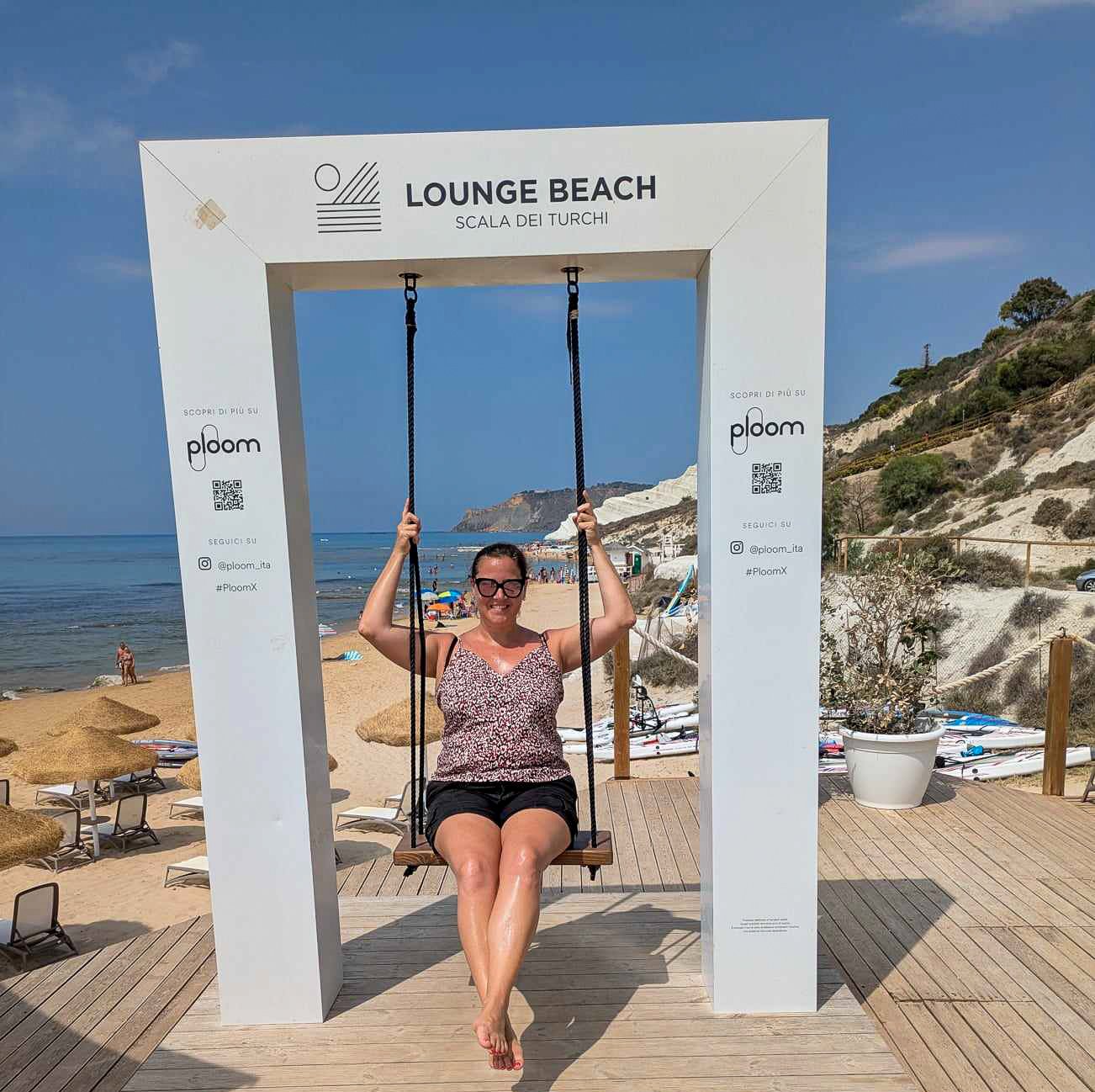
Fun at the Beach Lounge
If you do miss out, or just feel like admiring it from a distance, there are beach lounges like Lounge Beach Scala dei Turchi along the way, and this is the perfect spot for a cooling beverage.
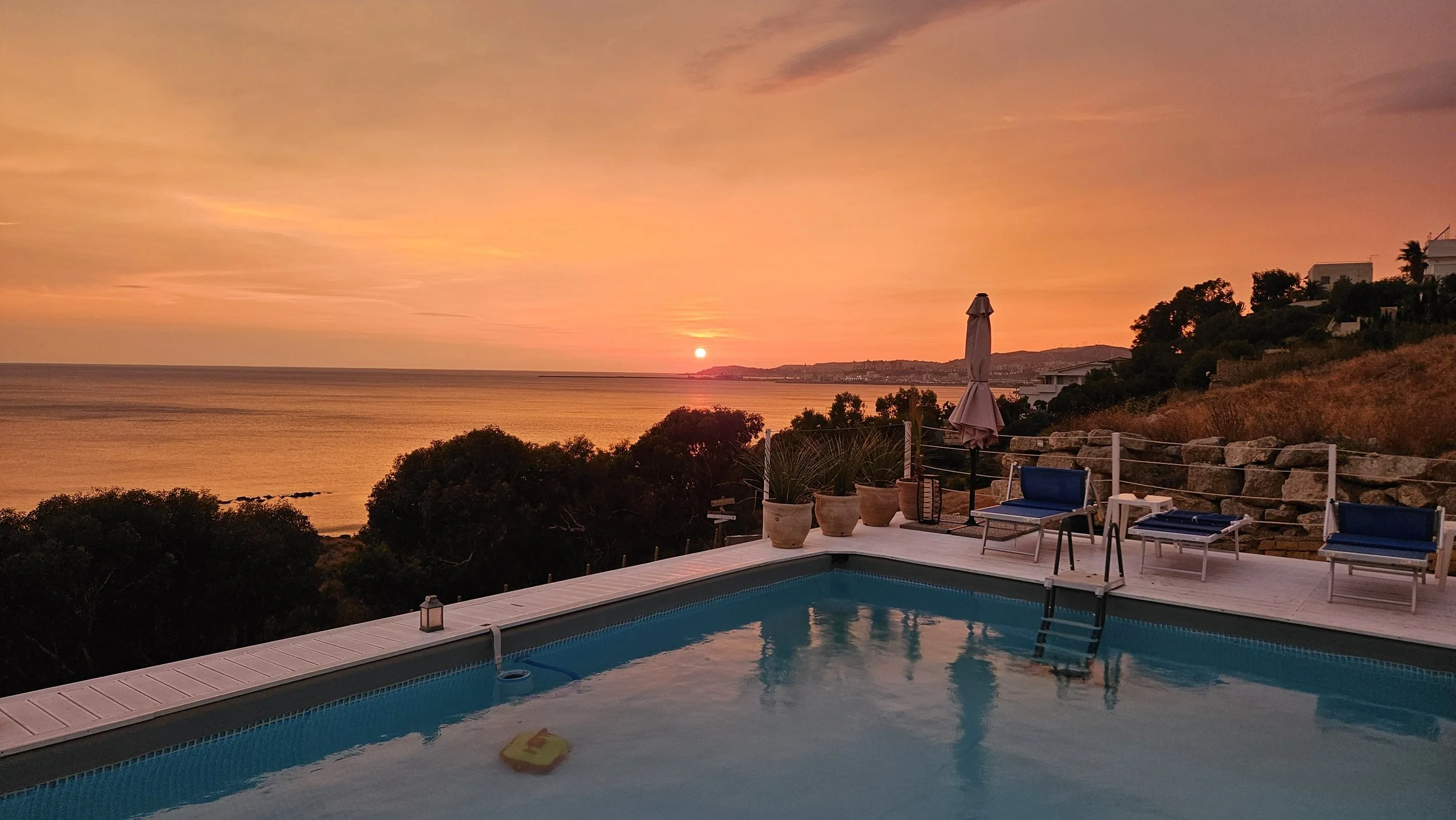
Not far from there, the coastal region of San Leone is a great spot to enjoy sunset. You can walk along the water’s edge or really lean as we did with sundowners as Al Calante.
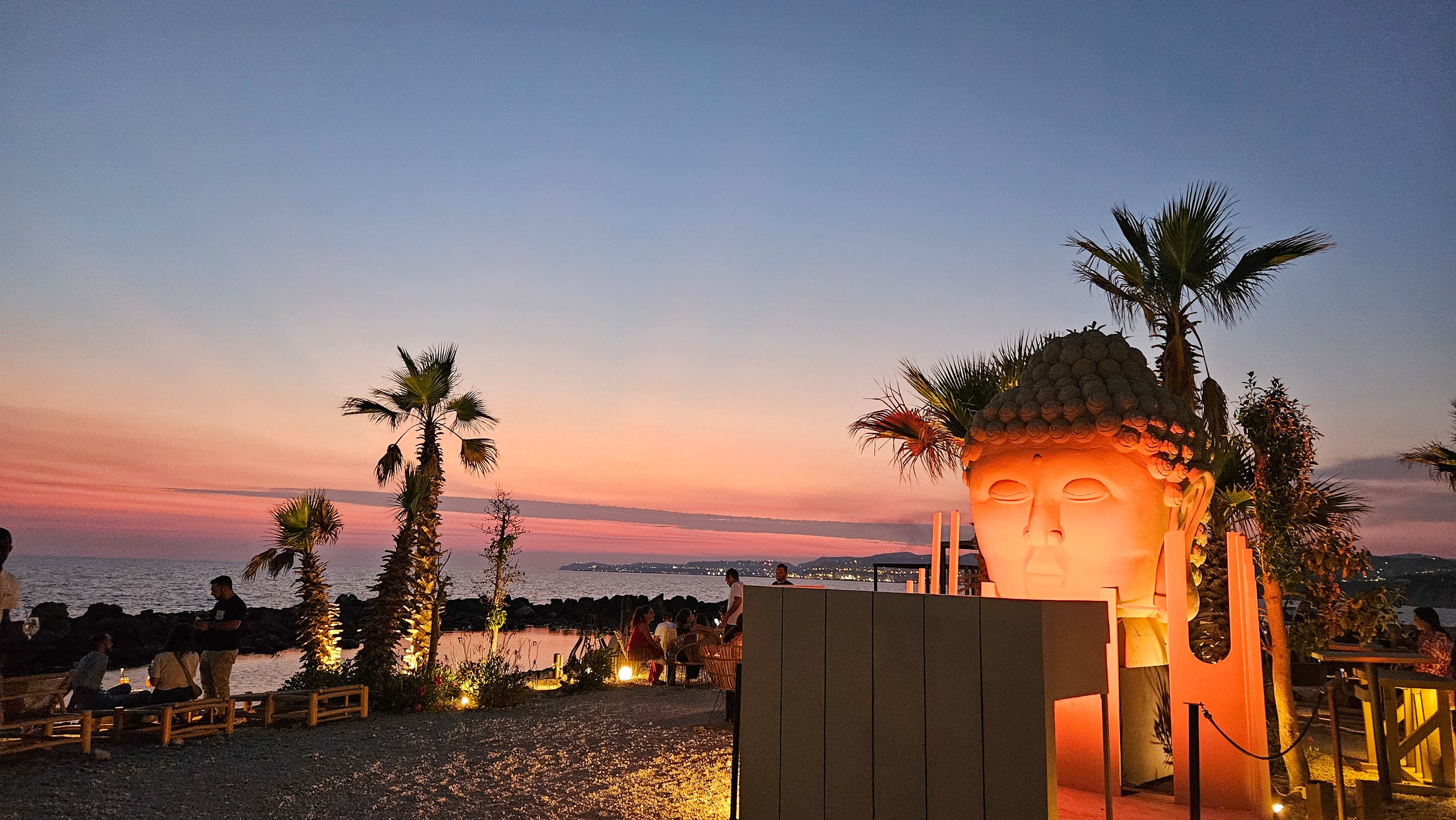
Al Calante
This is a sunset drinks spot, and it does that exceptionally well. There’s a definite Café del Mar energy to it, but without the pretence. Music drifting in the background, the light softening over the sea, people settling in rather than moving on and families embracing the vibe too.
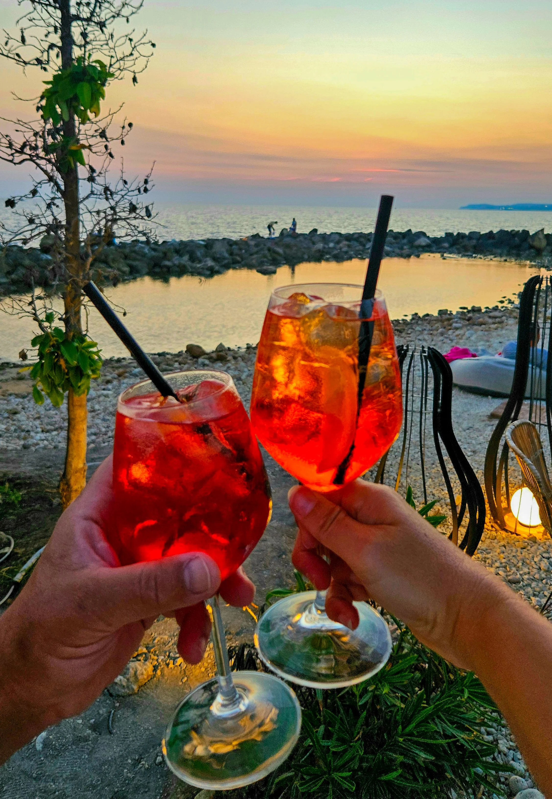
Sometimes an Aperol is the only answer
You grab a drink, find a spot facing the water, and the whole place just eases into the evening.
After all that exploring, you will want to have a spot to rest your head. We chose somewhere with a water view (because why not?)
Casa Vacanze Il Tucano delivers. It’s relaxed, personal, and far enough from the noise to give you space, but still close to everything you need. Plus, the views and the pool are the perfect reprieve from that hot Sicilian sun.
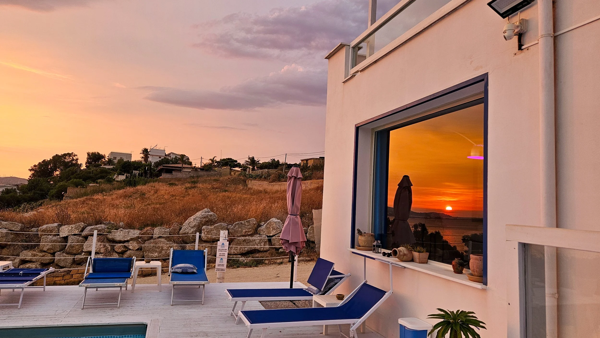
Casa Vacanze il Tucano
If you prefer beaches over pools, the accommodation is just a short walk from Lido Maddalusa. This is a quiet, more local-feeling stretch of coast just outside Agrigento with calm seas that welcome you for a dip any time of day.
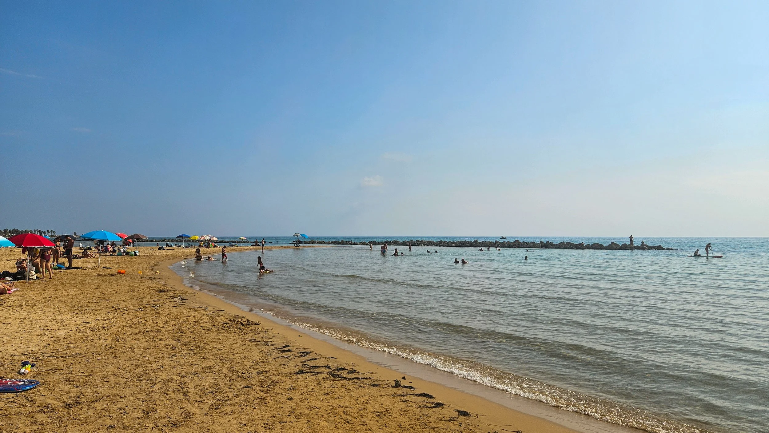
Lido Maddalusa
Leaving the coast again on our drive east, we made another lunchtime stop in Noto. This UNESCO-listed town is undeniably pretty, but it also feels a bit more curated than everywhere else you’ve been.
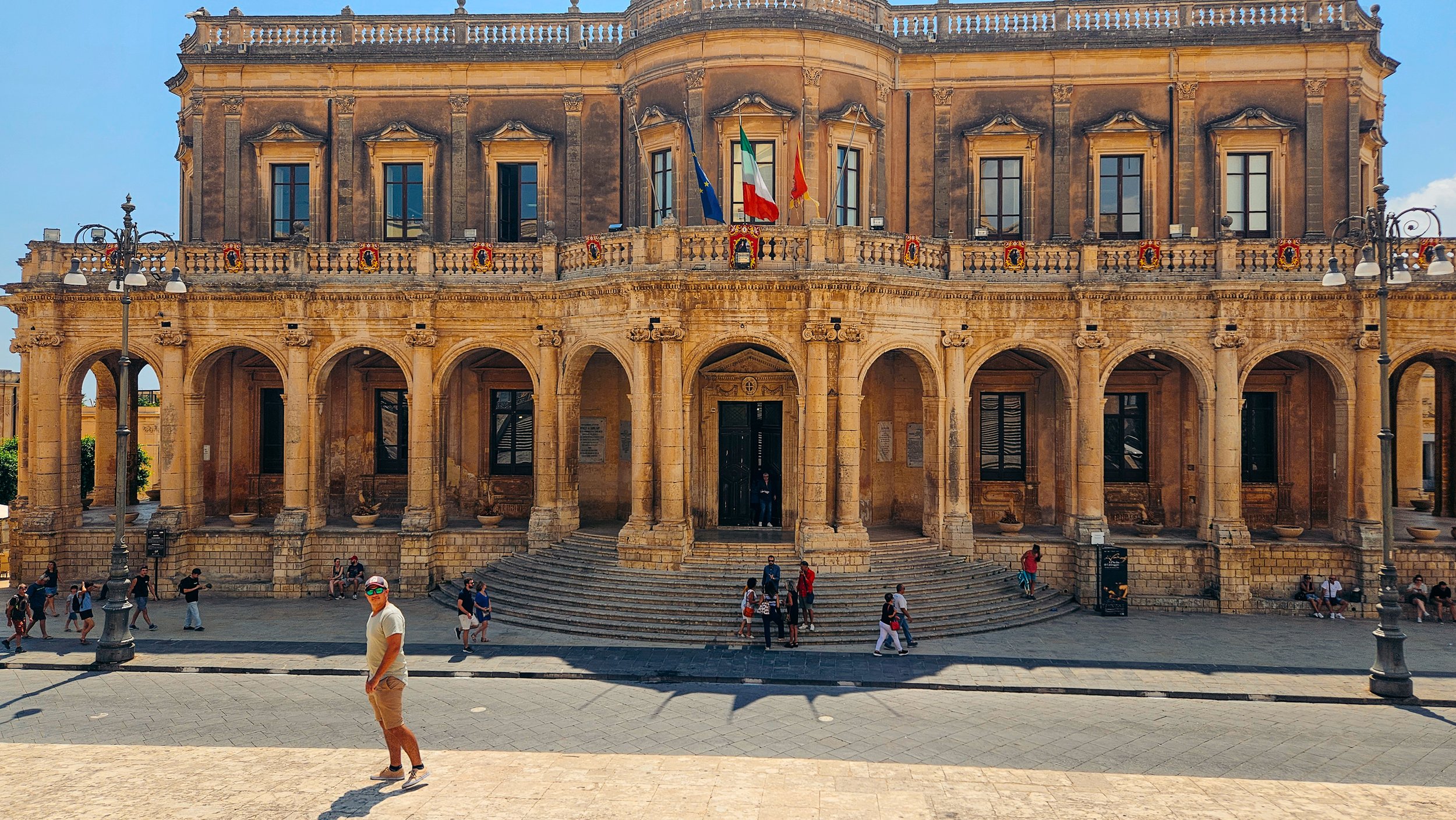
Noto
All golden Baroque architecture, wide streets, and that honey-coloured glow in the late afternoon. You don’t need long here. We spent a few hours wandering, had some gelato and lunch before moving on again.
Our last stop in Southern Sicily was by far my favourite.
The twin towns of Syracuse and Ortgia aren’t just good looking. Syracuse was once one of the most powerful cities in the entire ancient Greek world. We’re talking on par with Athens at its peak.
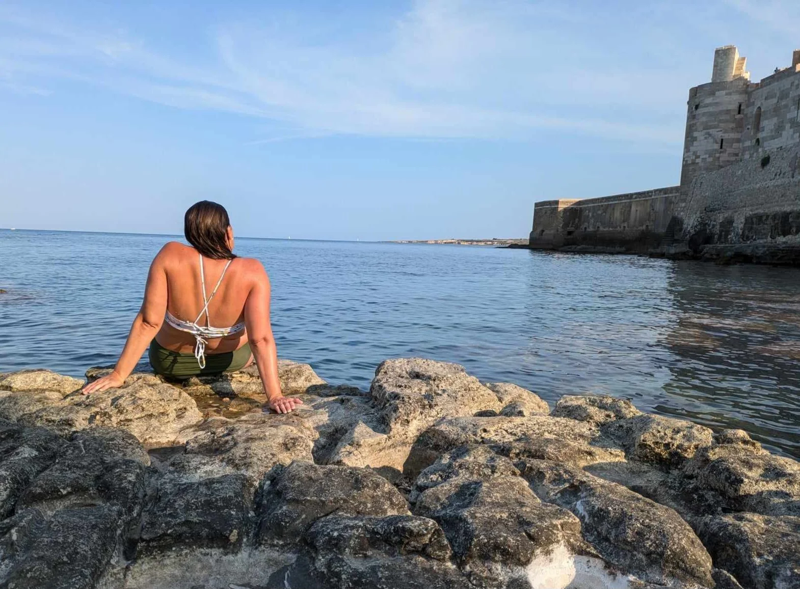
A rocky dip on Ortiga
Ortigia is small island at the heart of Syracuse, and you can still feel that layered history when you walk through it. Over time, it’s been shaped by just about everyone who’s passed through Sicily. That’s why Ortigia feels the way it does now. Greek foundations, Roman remnants, Baroque facades, all stacked on top of each other. It’s a place that’s been fought over, rebuilt, and reshaped for nearly 3,000 years.
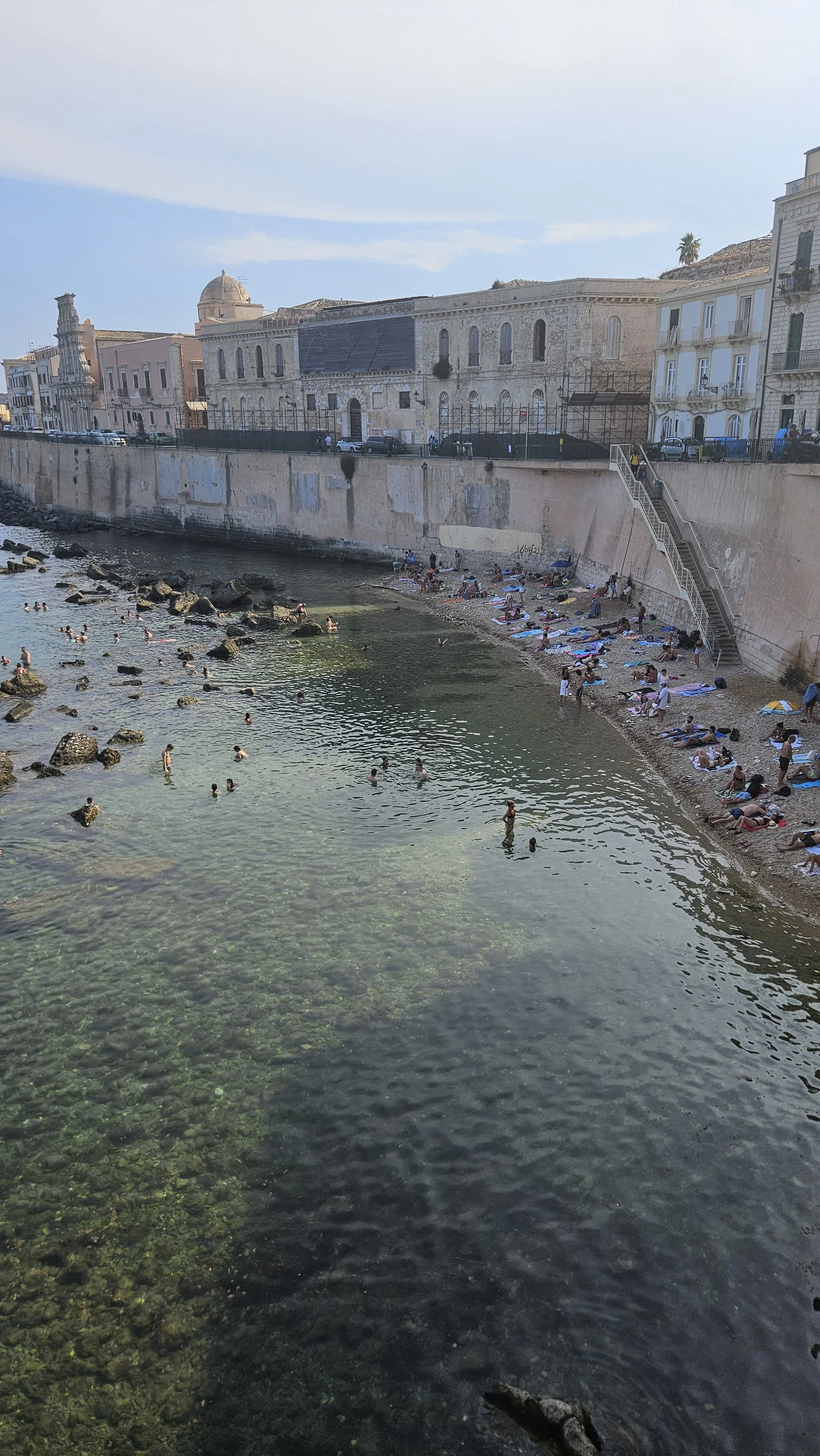
The relaxed daily life on Ortiga
We stayed in an Airbnb in Syracuse and walked onto the island each day of our visit.
Wandering the tight streets, you will find beautiful squares and then the next corner delivers stunning sea views. It’s a place you can wander without a plan and still fill an entire day.
Sunset on Ortiga
At the far edge on the island of Ortiga sits Castello Maniace, and it’s worth the walk out.
Built in the 13th century under Frederick II, the castle (or more accurately, fortress) was designed to control access to the city and defend one of the most strategically important ports in the Mediterranean.
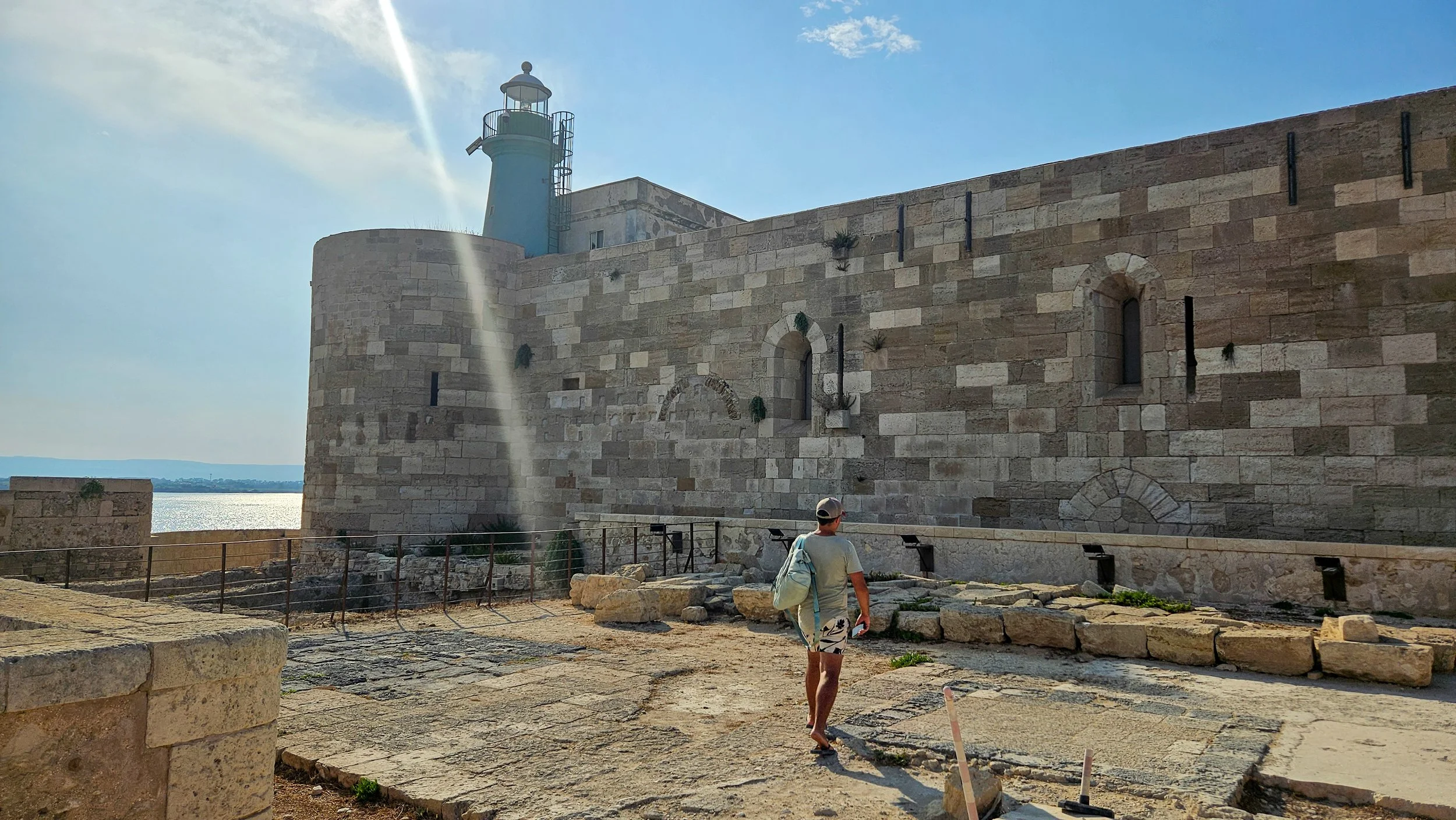
Castello Maniace
Inside, it’s fairly minimal (don’t expect curated exhibits) but still so interesting to see. You can buy a ticket for around €6.
Southern Sicily isn’t just about ticking boxes. It’s about moments like the unexpected village, the sandwich I dream of finding again, the stunning sunsets that seem to last hours and I can 100 per cent see myself returning here someday…

Sunset in San Leone
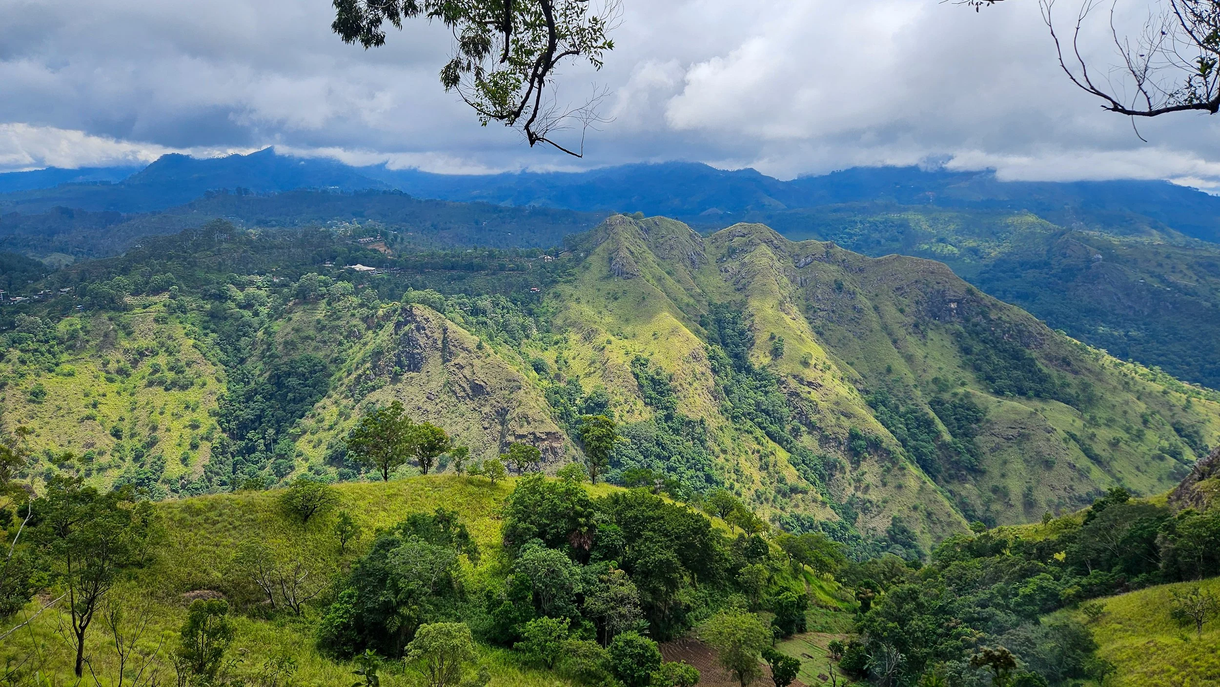
Epic views and wild roads: an adventure in Ella’s mountains
A trip to the mountainous centre of Sri Lanka in Ella is always going to dish up epic views – but sometimes they don’t come without a little effort!
We arrived on the iconic train from Nuwara Eliya as the light was starting to fade, unprepared for the chaos of drivers touting for our business. In hindsight, we should have booked a transfer to our accommodation, but we didn’t realise what the roads in these mountains were like and everything looks much closer on a map…
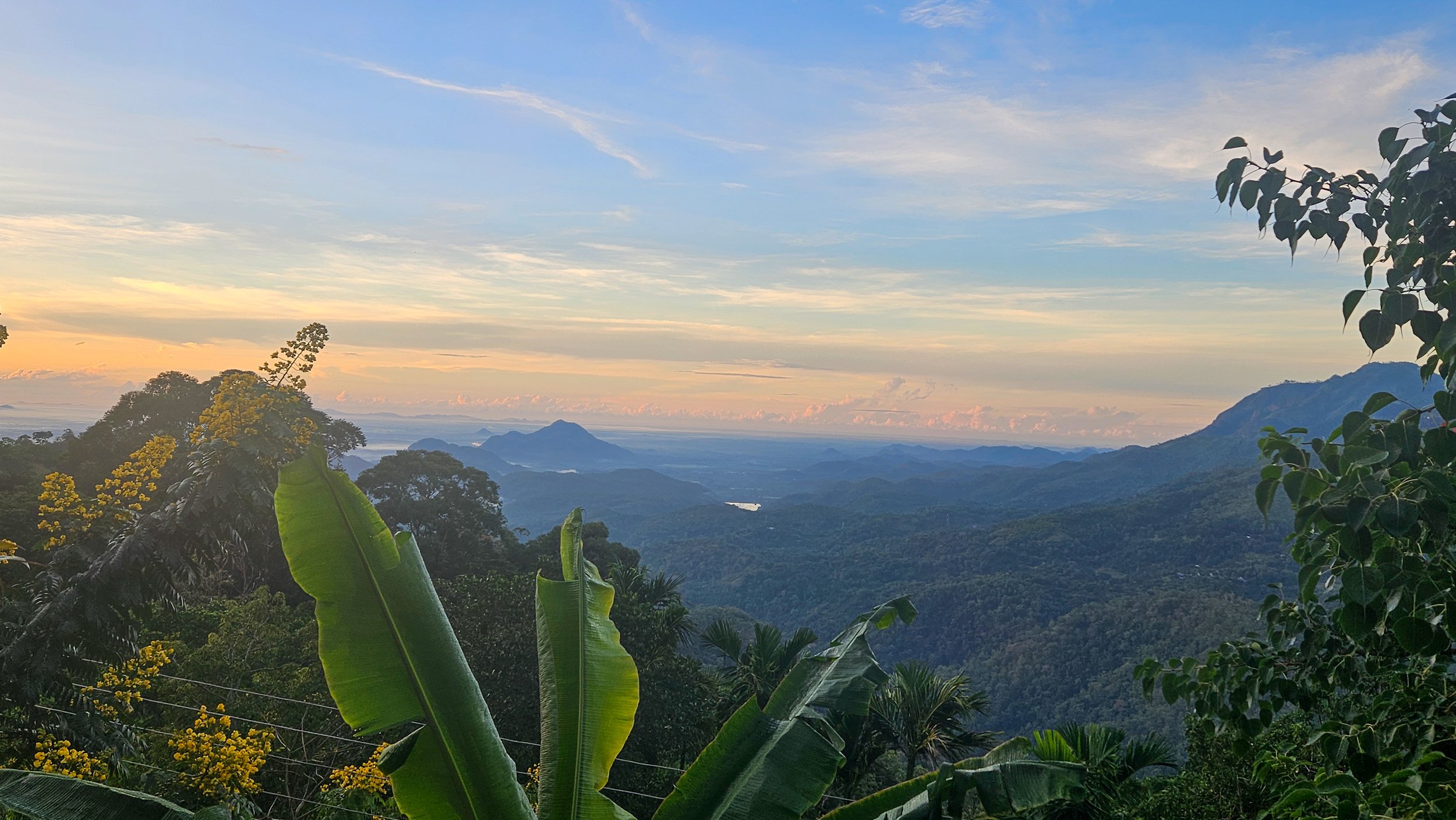
A view from above the clouds
We booked a driver through the popular Pick Me app that could fit three people and our luggage, and it all started well as we climbed higher in the mountains. As we got closer to Awesome Place (our accommodation), the road became dirt, full of potholes, and quite literally on the edge of a cliff.
Our driver was naturally cautious and after he got out to check the size of some of the holes in the dark, I am pretty sure my eyes were closed for the last, very bouncy section of our trip.
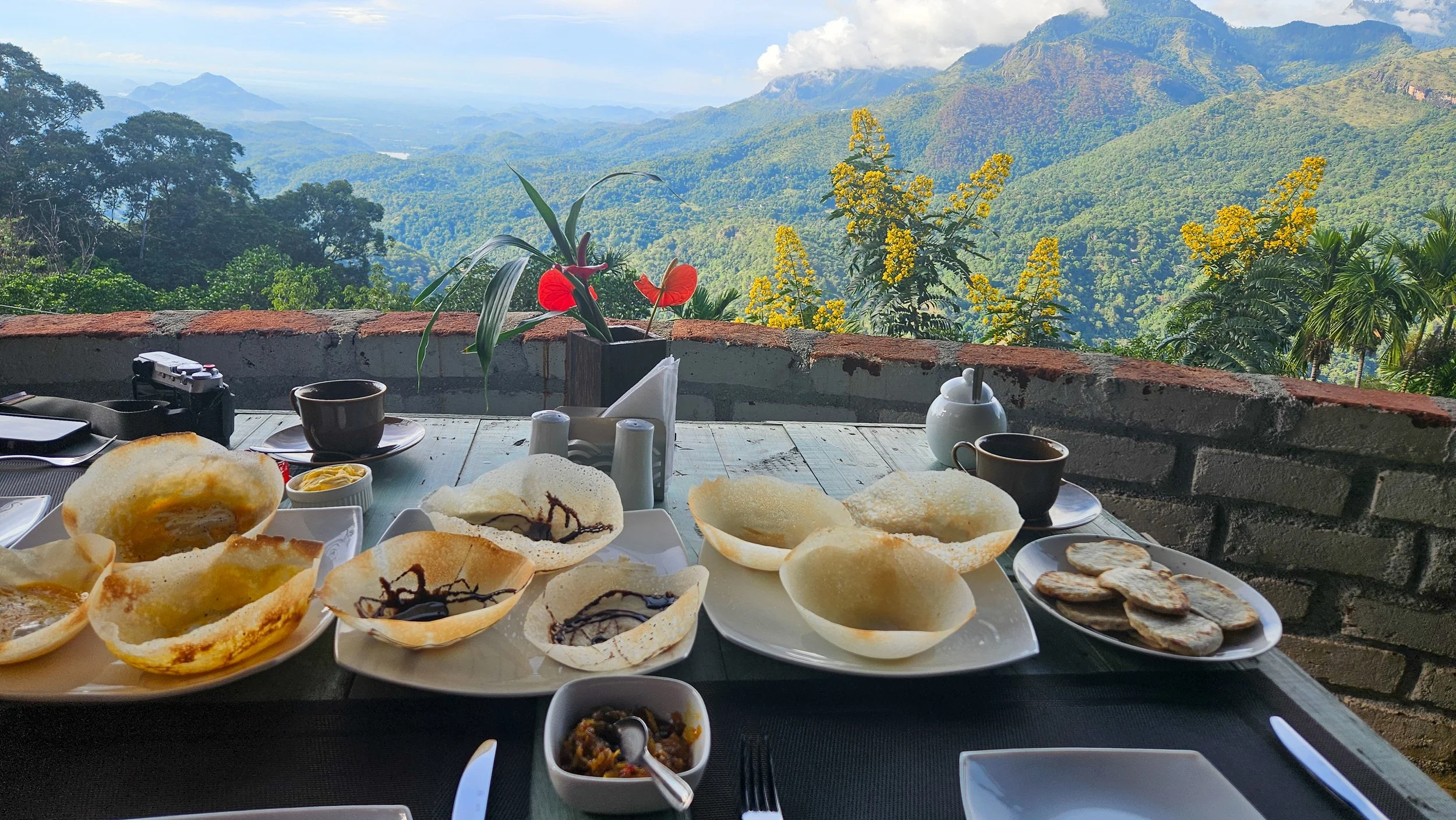
Breakfast with a view
It was all worth it and for all remaining trips to and from Awesome Place, we used drivers from the villa!
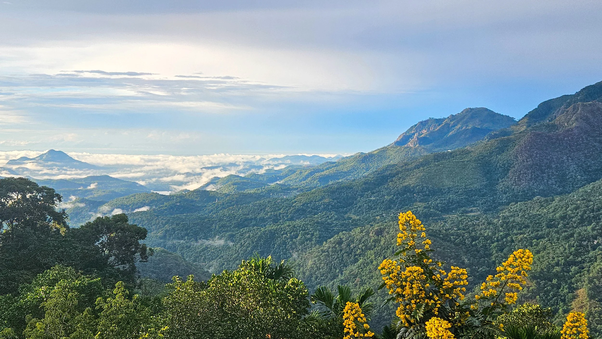
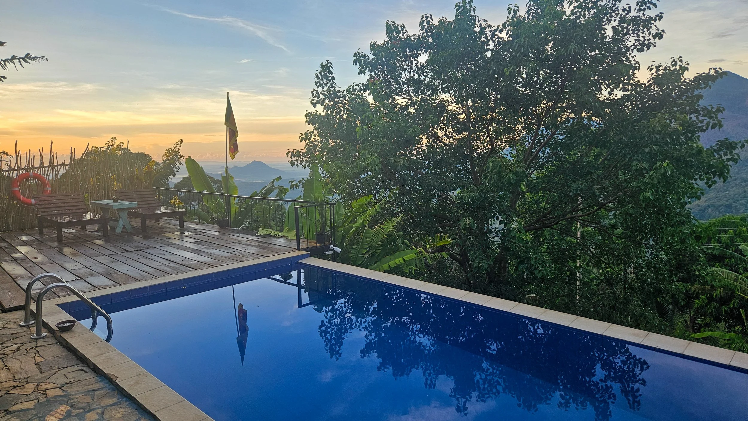
Awesome Place may only be 10km from the train station, but it can take about 40 minutes to travel the distance. The pay off is, the views from this 3-villa boutique stay are epic, and the staff could not be more accommodating. With only three rooms, it also never felt busy and we always got the best spot to enjoy coffee with the sunrise.
It was an incredible place to start your day with coffee and breakfast overlooking lush mountains and finish it with a swim or a drink by the pool that looks like it is sitting on the edge of the world.
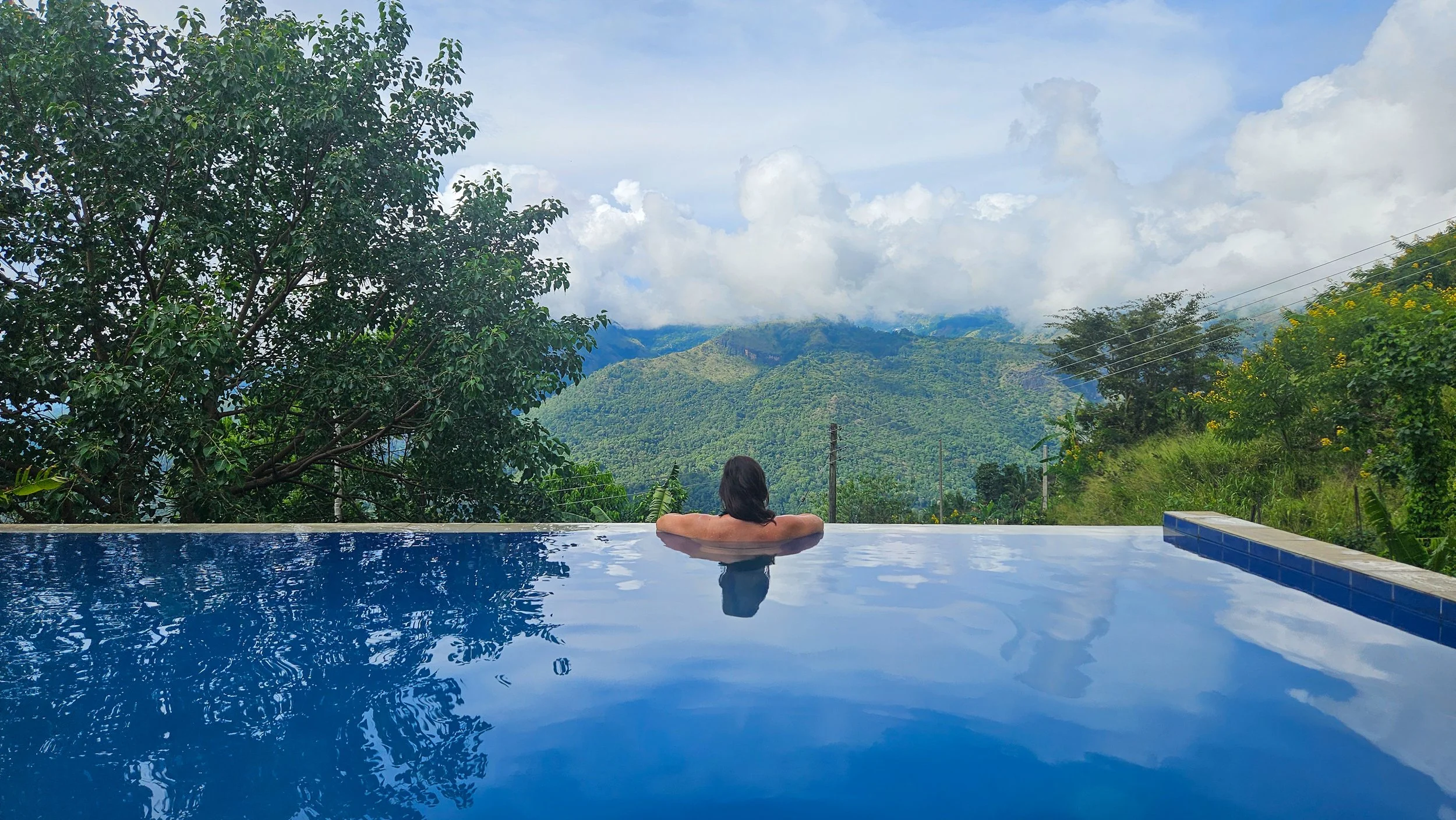
A pool on the edge
Being in the mountains always makes me want to climb to the top of them, so that is exactly what we did. We could see Ella Rock from our pool so started early one morning with a drive down to the starting point at Kithaella Railway Station.
From the station, you cross the train tracks and then head across a small creek before actually getting to the official trail head. We attempted to make our way up on our own from there with instructions from blogs but the paths around here can be a bit confusing and there is definitely more than one way up!
A the top of Ella Rock
We took a few wrong turns, ended up on someone’s backyard but managed to gain a guide to lead us all the way to the top from here.
The trail starts easily enough through some tea plantations but before long, I felt like I was hiking at home through eucalypts! It is through here that the path gets a little steeper (and sweatier).
Coming out of the bush, you will reach a clearing at the top of Ella Rock. Here, you will see a small hut, with wooden fencing around it. This is where you will need to pay a small fee to access the viewpoint above. It is totally worth it.
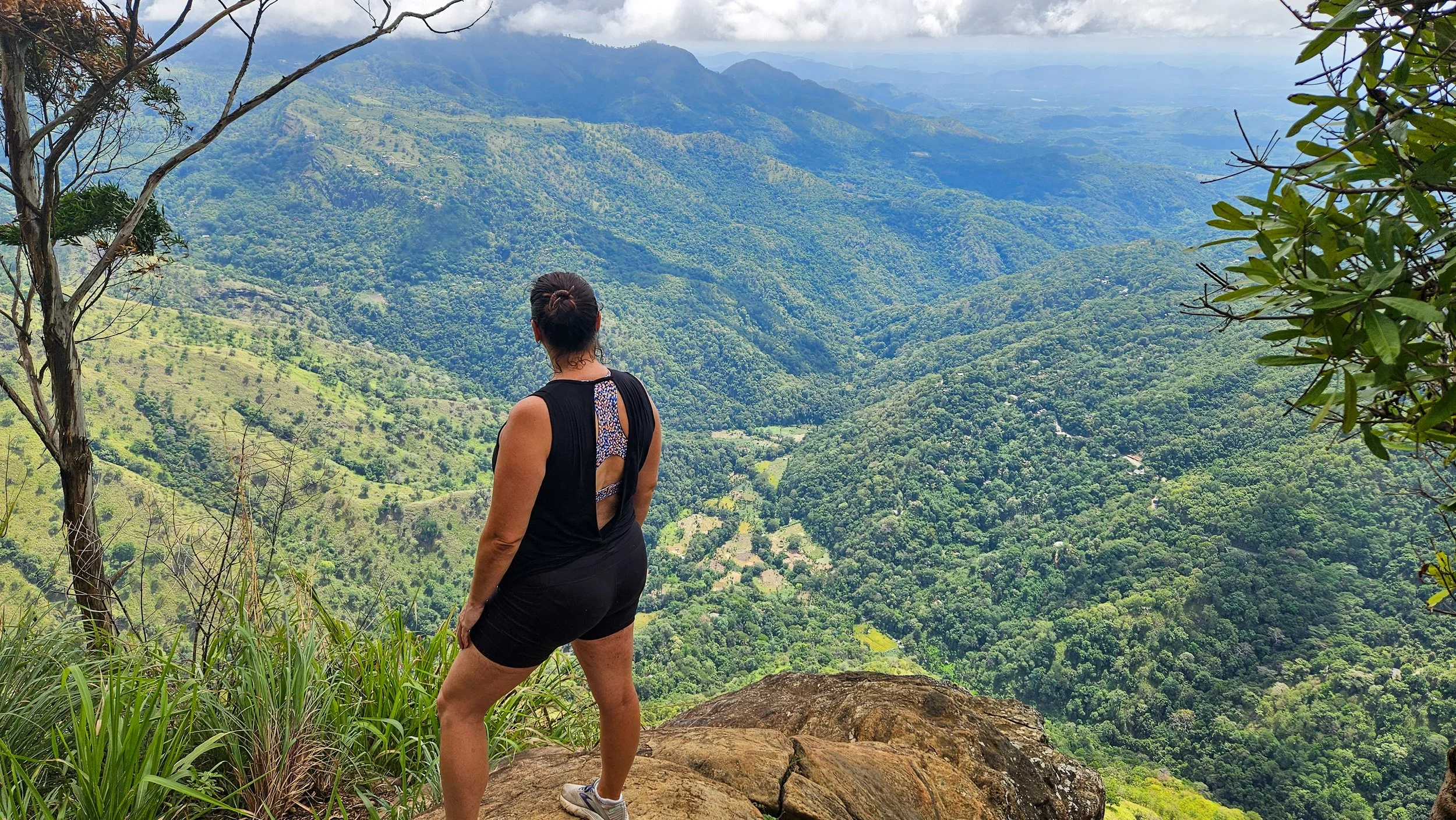
Looking down at the valley
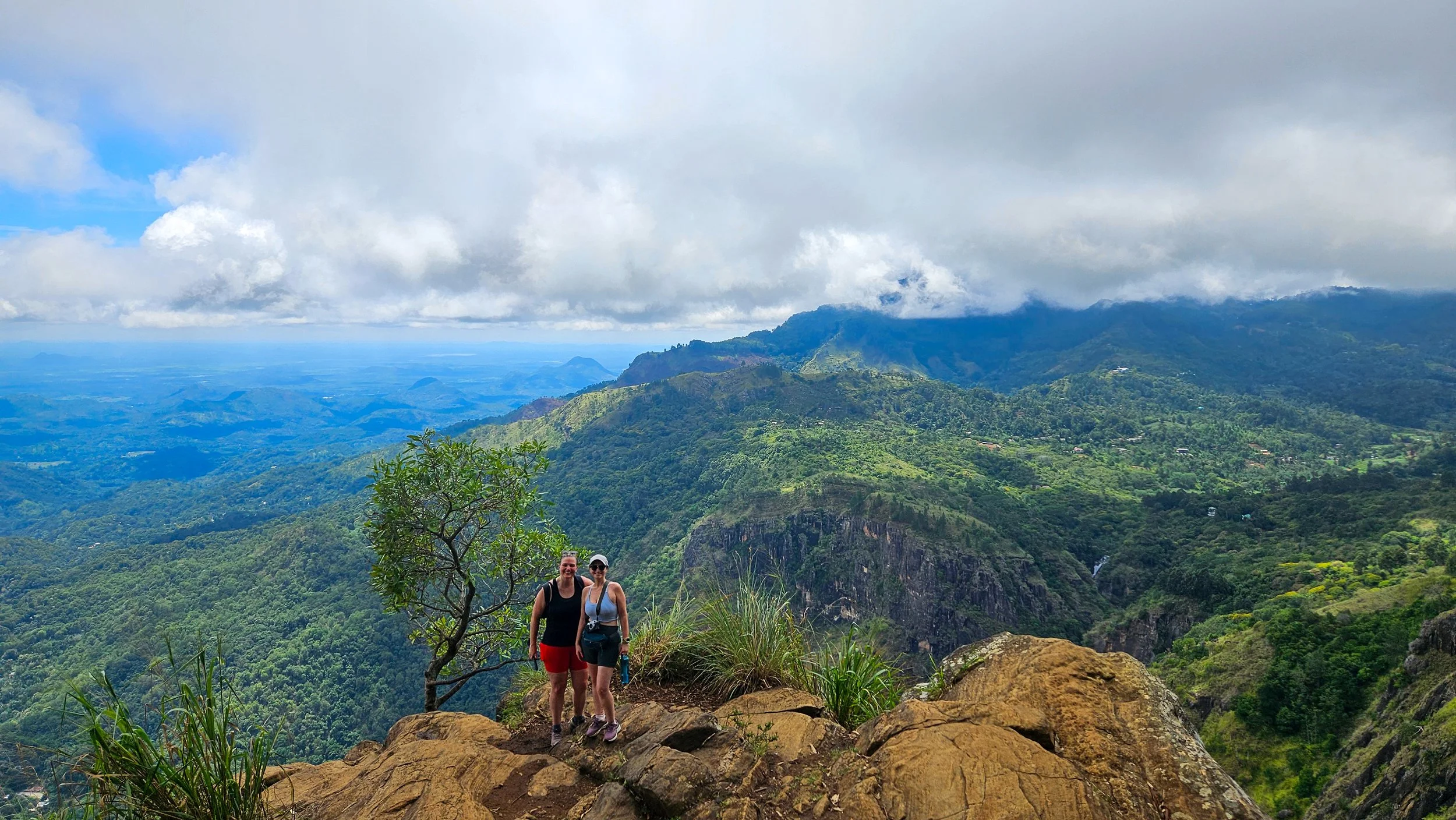
A little perspective
There are two viewpoints from the top. The first looks out over Ella and the railway, the second is about 10 minutes around and you can see incredible waterfalls from here. We probably spent close to an hour just enjoying the views (and catching our breath) before heading back down.
On the way back down, I managed to pick a few leeches on the way trying to get into my shoes through my shoelace holes. Thankfully, they were quite easy to flick off but something to look out for!
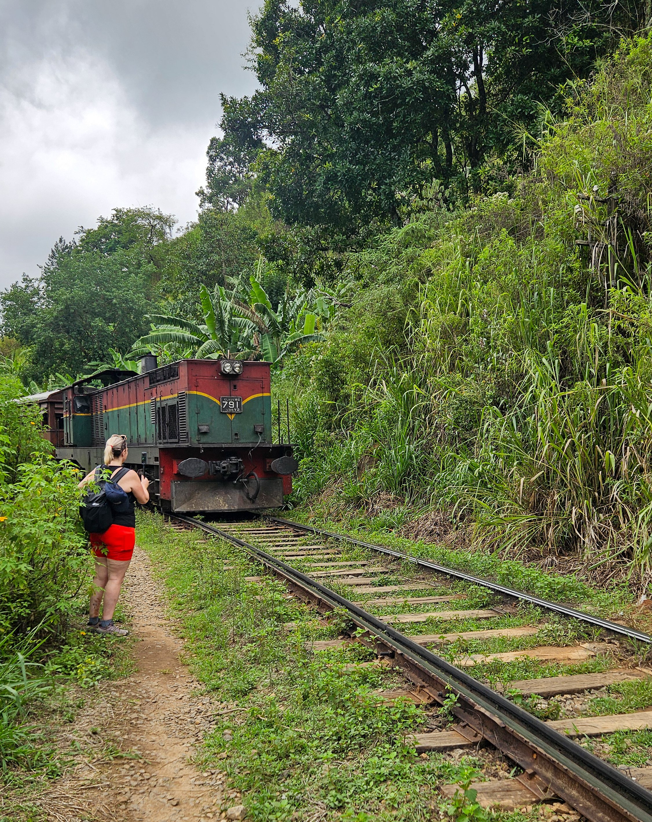
Passing trains
Instead of getting a drive back to Ella town, we decided to walk the extra 5km along the railway tracks which seems crazy for a westerner but is very common and we saw a few other locals doing the same.
It took about 40 minutes but was very hot with limited shade so make sure you keep enough water and sunscreen. All up our trip up Ella Rock took about four and an half hours.
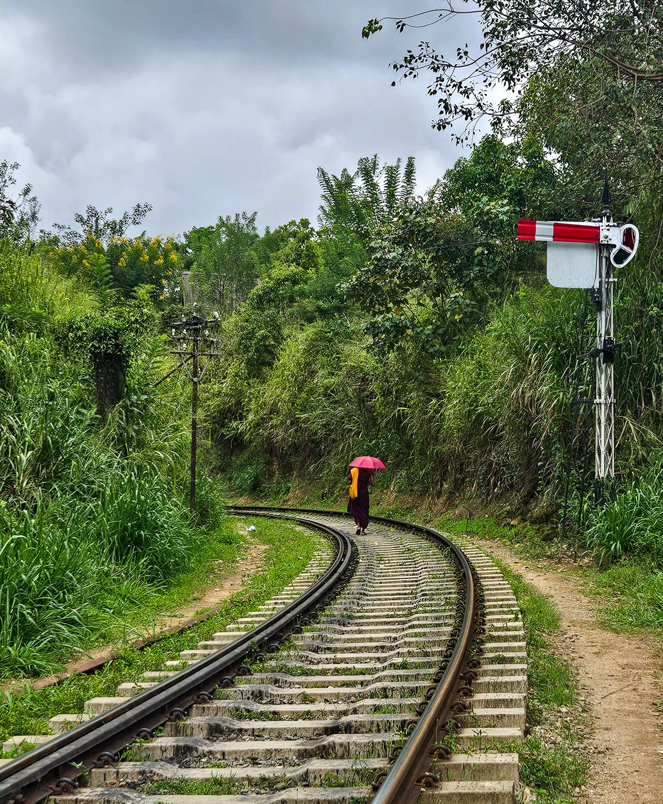
Walking on the tracks
We wandered around town and had a bite to eat before heading to our cooking class at Ella Spice Garden.
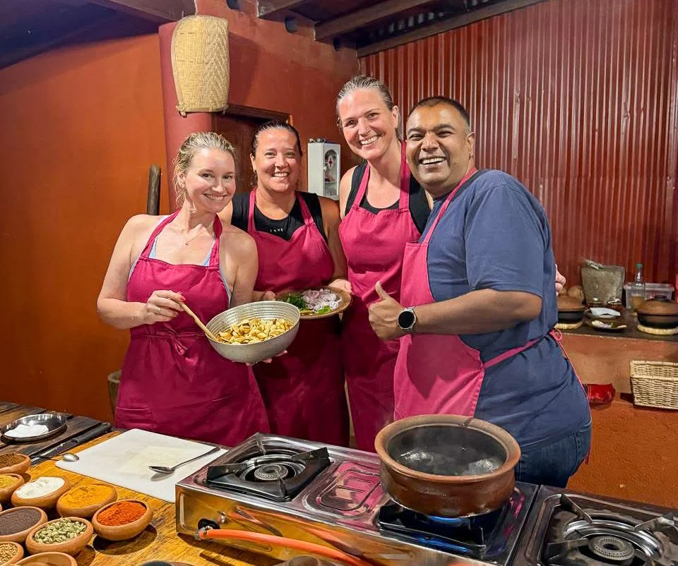
Chefs in the making
This is hands down the best cooking class I have ever done and Theeka is so friendly, personable and funny. Plus, the vegan food we made was amazing.
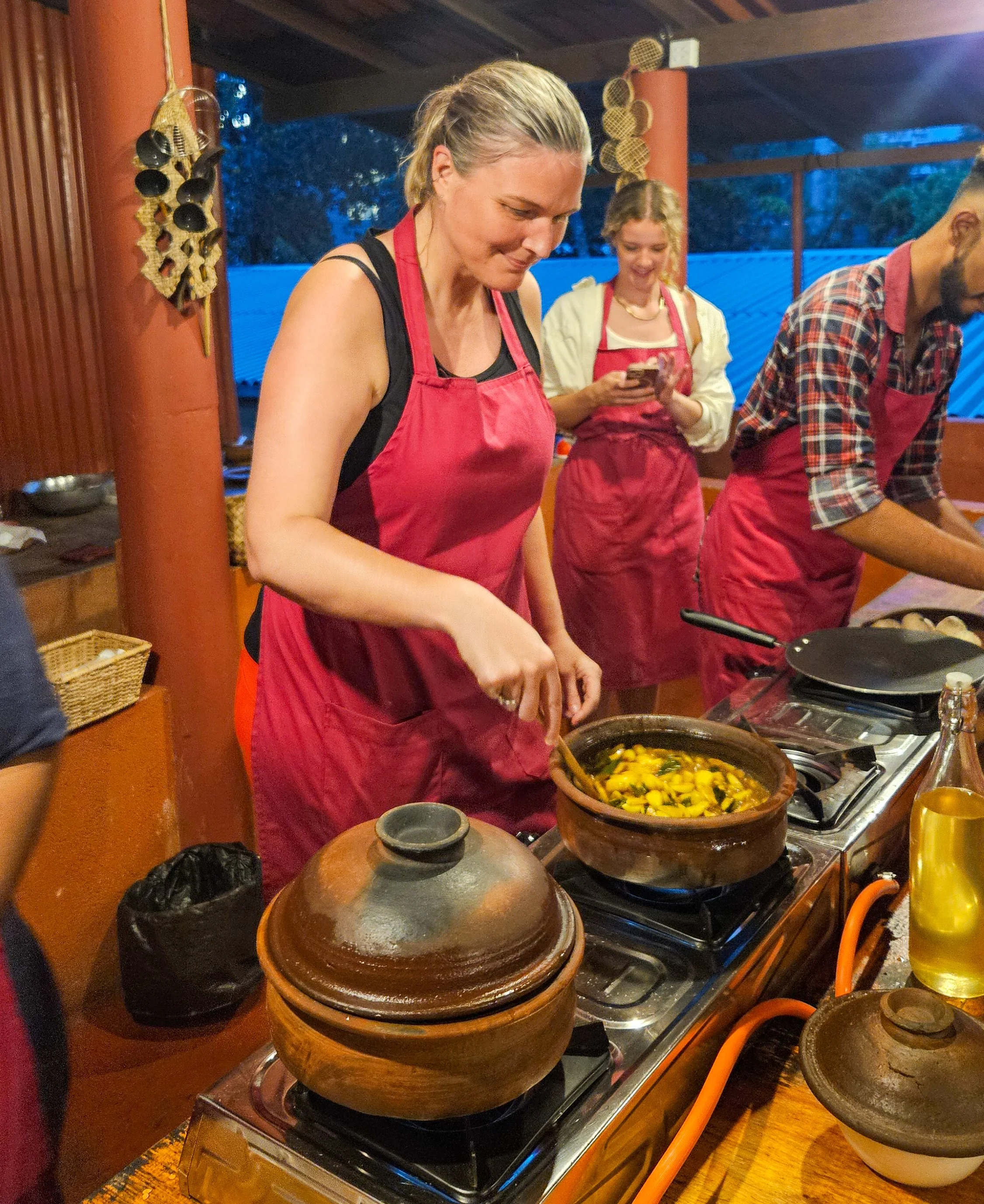
Garlic curry in the making
It starts with a guided tour of the spice garden so you can see all the ingredients you will be cooking with. You then get to make seven dishes that are so layered with flavour that I have tried to re-create it at home.
On our last day in Ella, we started to head up Little Adam’s Peak but it was raining quite heavily and we could see after a couple of kilometres that it was quite touristy and the views from the top would not be any better than those we had at our accommodation.
Views like this are hard to beat
Our final stop on the way out of town was to check out Ravana Waterfall. These epic falls are literally on the side of the road which does make them very busy and surrounded by stalls selling fresh fruit and grilled corn. Perfect for a snack enroute to our next destination.
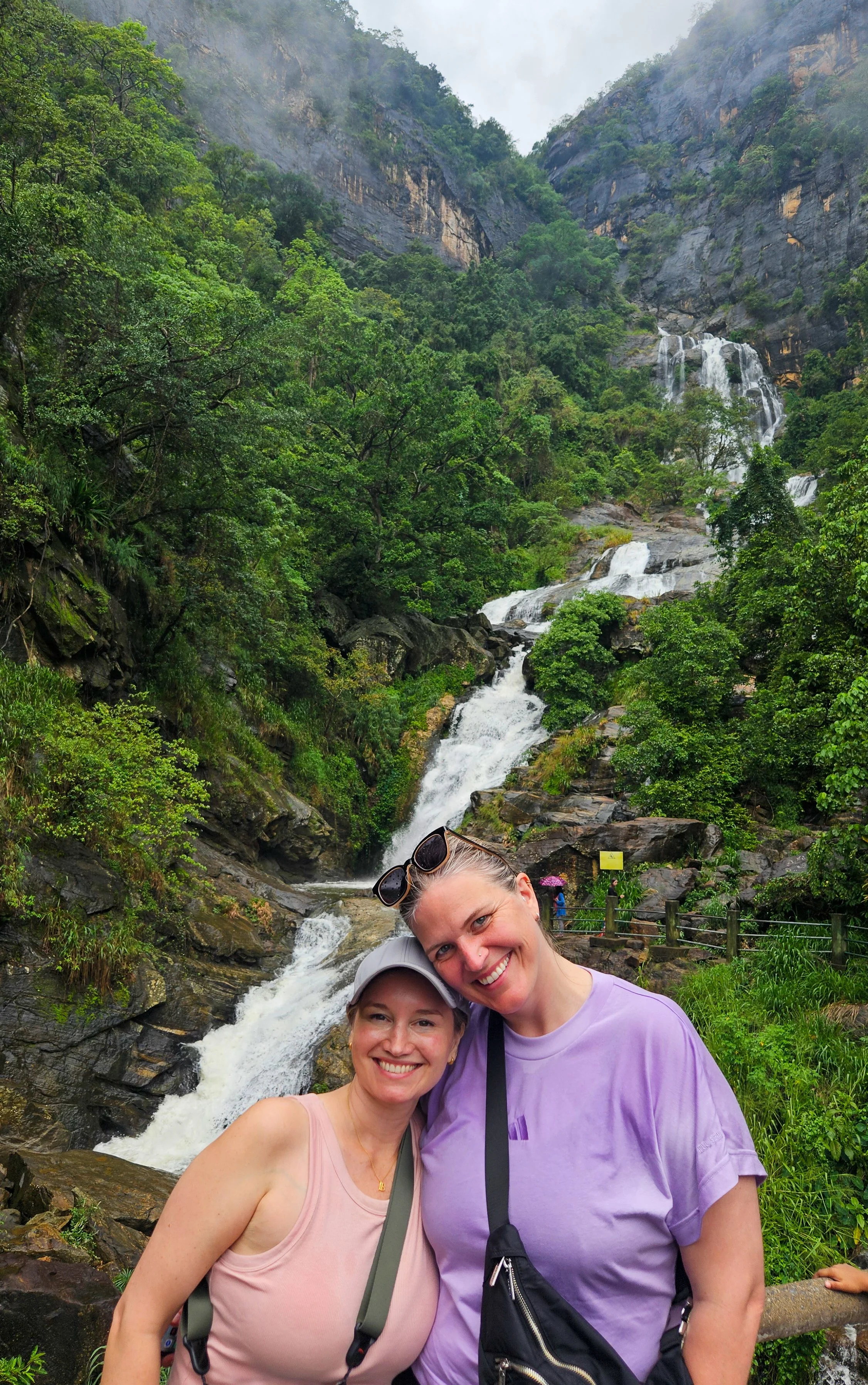
Ravana Falls

Sigiriya, Sri Lanka: Come for the views, stay for the vibe
If you’ve seen photos of Sri Lanka, it is likely you have spied Sigiriya Rock Fortress jutting up, but it is not the only thing worth exploring in this scenic and uncrowded part of Sri Lanka.
First things first, how do you get to Sigiriya?
It’s a small, yet spread out, town without a train station or main bus stops so to get here by public transport, you will need to travel by bus to nearby Dambulla. From there it is an easy Tuk Tuk ride.
However, we found the easiest, and most comfortable, way was with a driver from Colombo for the three of us and our luggage. It was nice to have someone to point out things along the way and we also stopped to visit Dambulla Cave Temple before arriving in Sigiriya – right at our accommodation.
We stayed at 3-star Sigiriya Sunshine Villa and it was lovely and there are so many similar options around the place. I do recommend getting somewhere with a pool though – the days were 35-degrees.
On arrival, it is impossible to miss the towering 200m rock jutting up from a mainly flat landscape, but it wasn’t our first stop!
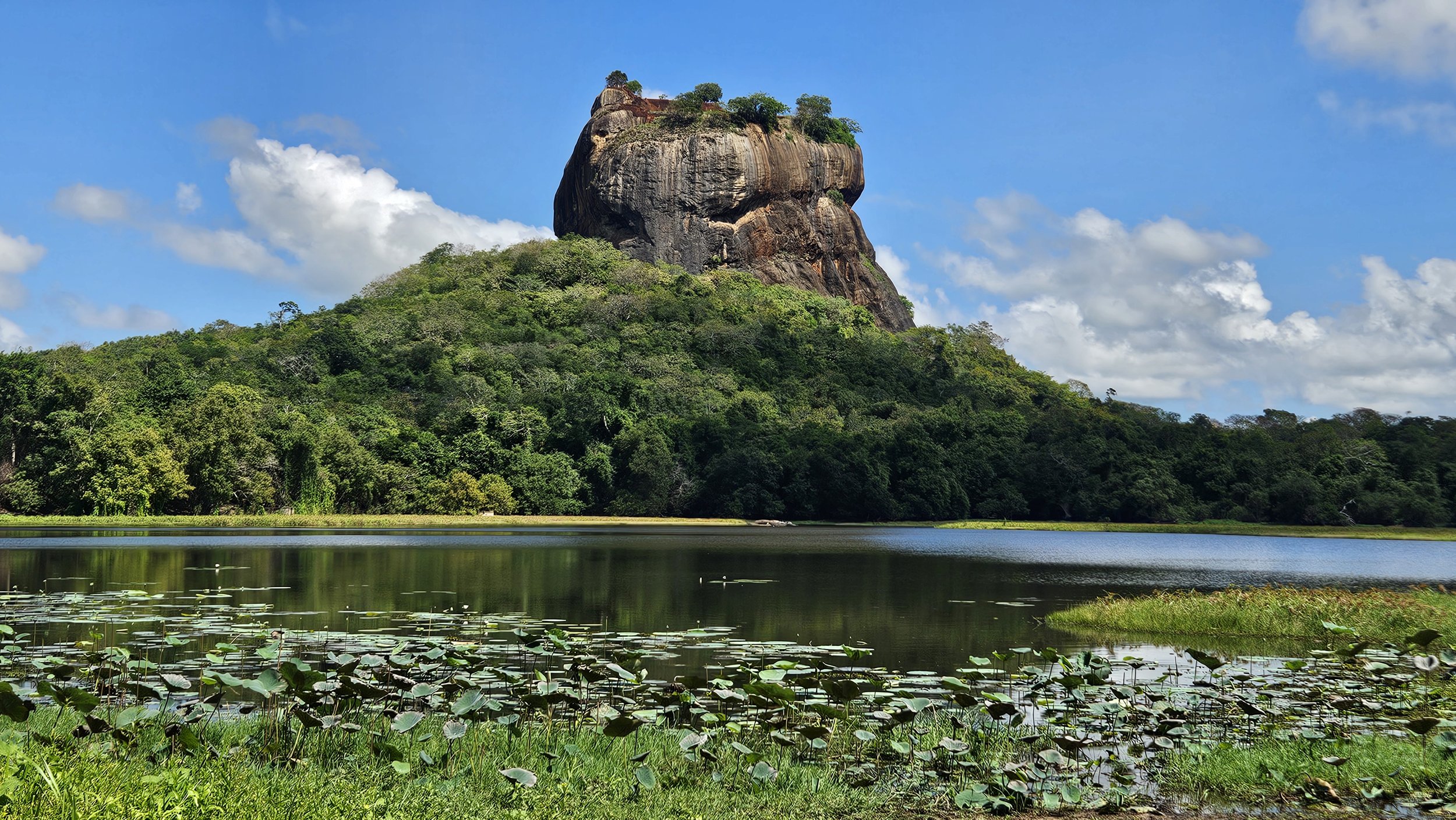
Sigiriya Lion Rock
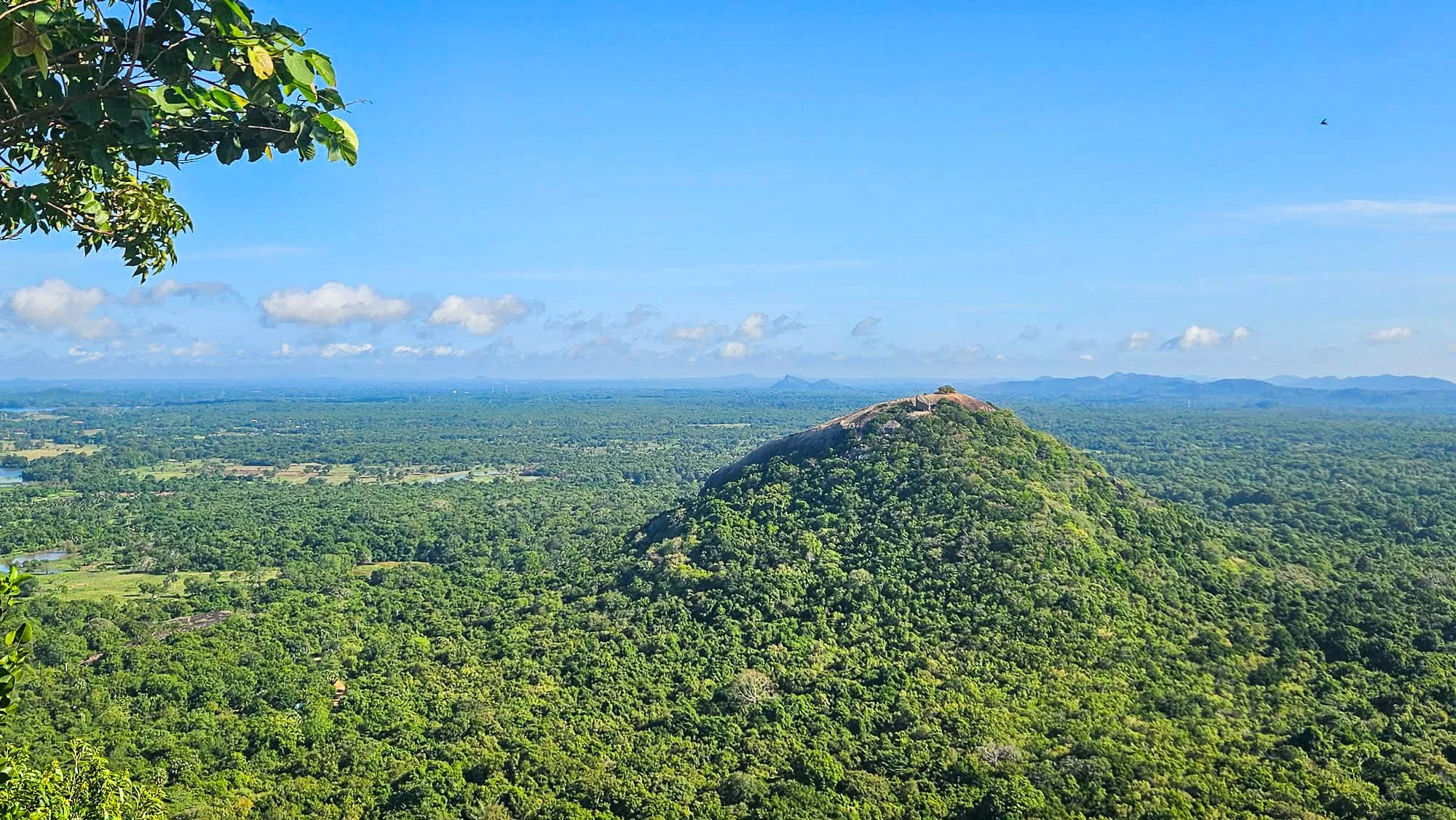
We decided to head up a nearby rock for sunset to give us a panoramic view of Lion Rock (Sigiriya Rock Fortress).
Pidurangala Rock
Pidurangala Rock is a nearby hike (about a kilometre from the ‘town’) that is definitely a popular option for good views. Note that there is a small entrance fee here, but much cheaper than Lion Rock itself.
Before you ascend the hike itself, you have to walk through Pidurangala sacred site, so modest clothing is required - shoulders and knees must be covered. Free sarongs are provided that you can use as you walk through this section, which is great because in October, this was a warm hike.
Pidurangala Rock
To make it to the top is around a 30-45 minute hike which is good to keep in mind if you want to time your arrival with sunrise or sunset. We packed some head torches for the trip down.
The path to the top is well maintained up until you reach the Pidurangala Cave Temple where there is a reclining Buddha. After the cave temple, it becomes more of a scramble and you must find your own path to the top over some large rocks and boulders. At certain points you will have to give way to those making their way down as there is only room for one person at a time.
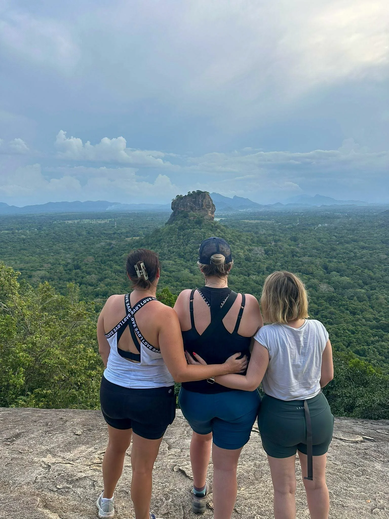
Enjoying the views of Lion Rock
At the top, you can wander around for 360-degree views of the surrounding countryside and an amazing view of Sigiriya Rock.
While there was no amazing sunset for us due to low-lying clouds, we still had an incredible view and spent at least half an hour at the top before making our way back down.
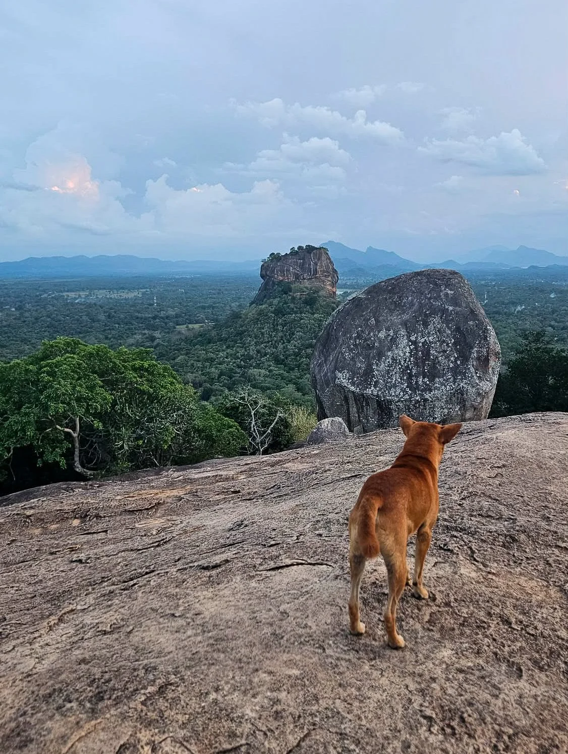
Even locals enjoy the view
Sigiriya Lion Rock
After a relaxing afternoon, we got up early (before sunrise) the next morning to head up the iconic Lion Rock. We were hoping for sunrise but we also wanted to avoid the hottest parts of the day.
It costs US$35 for foreigners to enter Sigiriya which isn’t cheap, but it really is a beautiful place to visit.
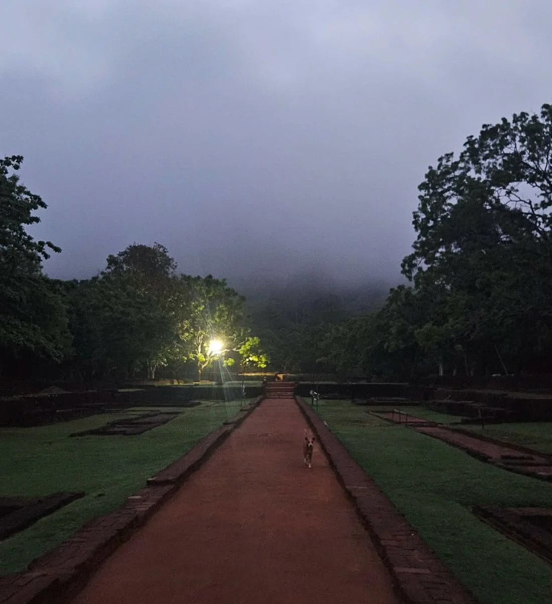
Our walk started before dawn
Sigiriya Fortress is not a temple or a sacred place, so you don’t have to cover your shoulders and knees for this walk.
This incredible site is where King Kassapa I (477-495 CE) built his fortress-palace and definitely worthy it’s UNESCO World Heritage status.
You pass through some of the landscaped royal gardens as you walk towards the giant rock, impressive even in the misty early morning light.
It is a scenic walk to start
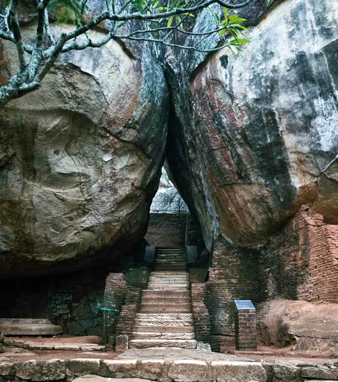
The first set of steps through the rocks will take you up to the famous lion paw staircase, which is how the Lion Rock Fortress got its name.
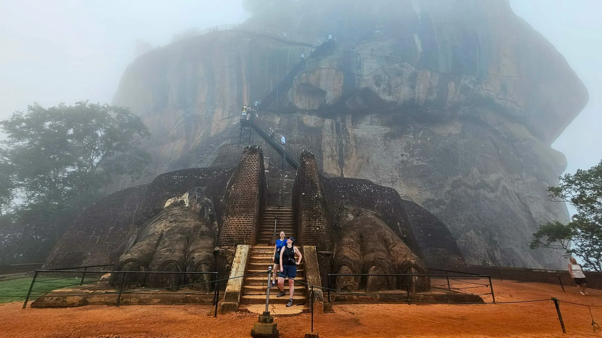
Lion’s Paw
From there, staring up at the narrow metal staircase seems daunting but there are places to rest along the way – even if the stairs seem to be precariously nailed into the side of the rock.
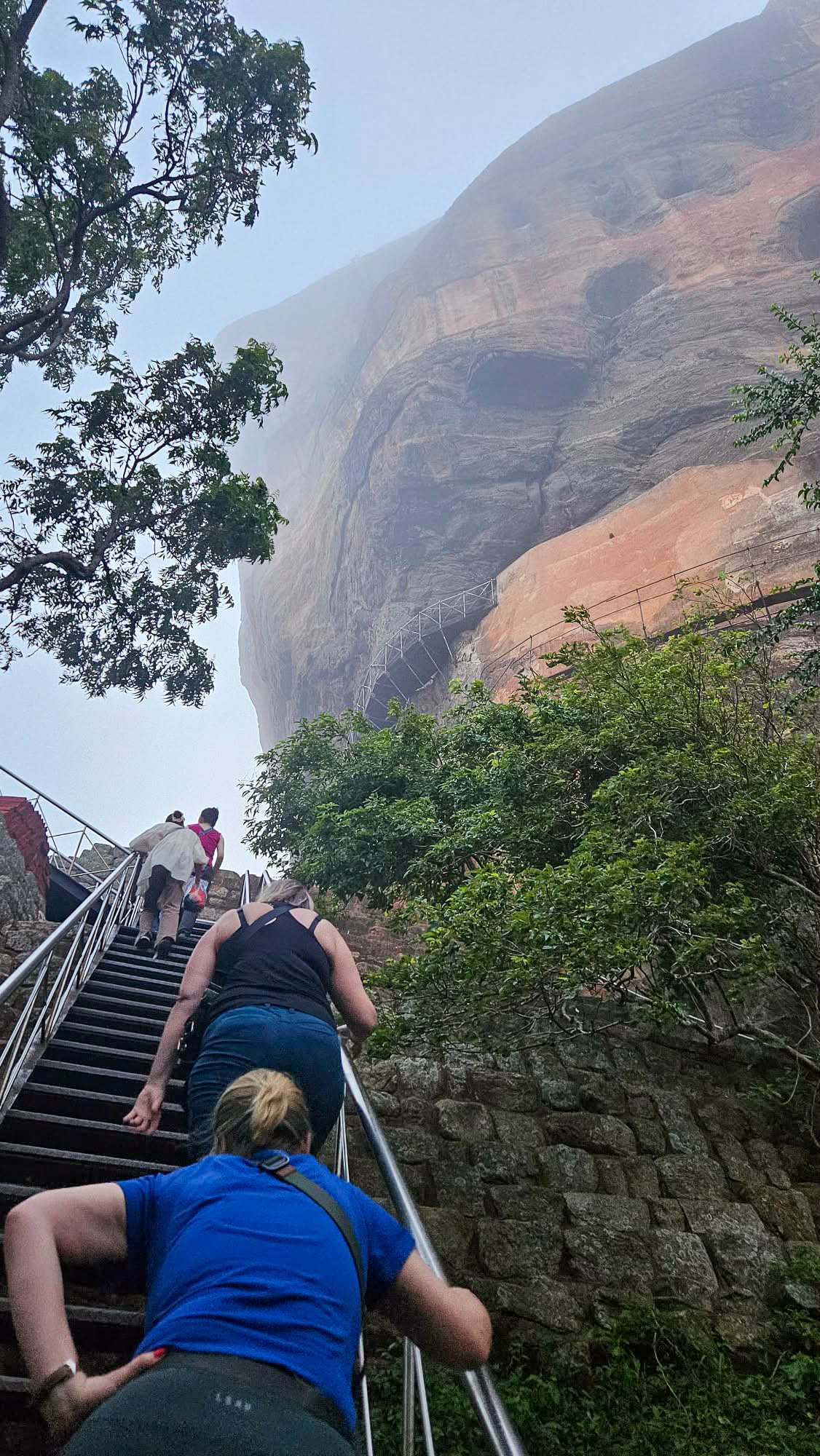
The stairs are steep!
At the top, you can wander around exploring the ruins of the fortified palace and enjoying different vantage points along with some monkey spotting.
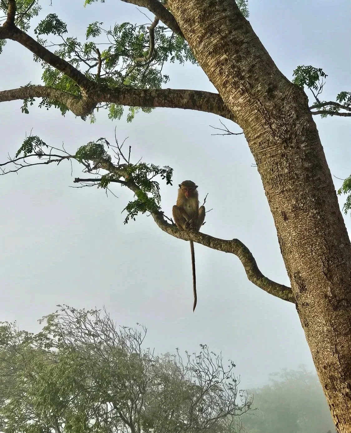
Misty Monkeys
The views from the summit are breathtaking – especially once the clouds clear!
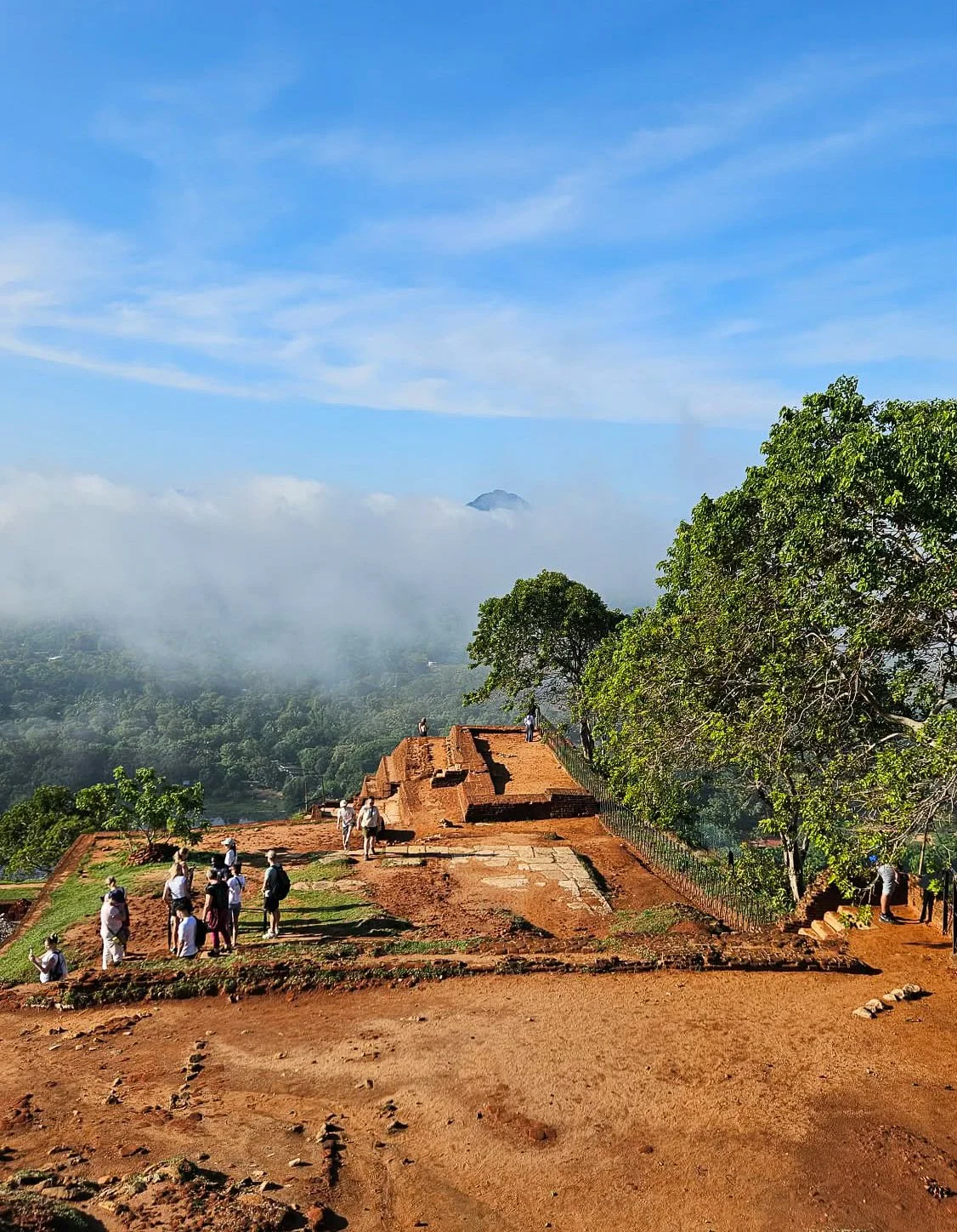
On top of Lion Rock
Kaudulla National Park
On the advice of our driver (shoutout to Amila who also runs guided tours), we also made a spontaneous trip to nearby Kaudulla National Park.
We just booked an afternoon trip through our accommodation and didn’t regret it for a second.
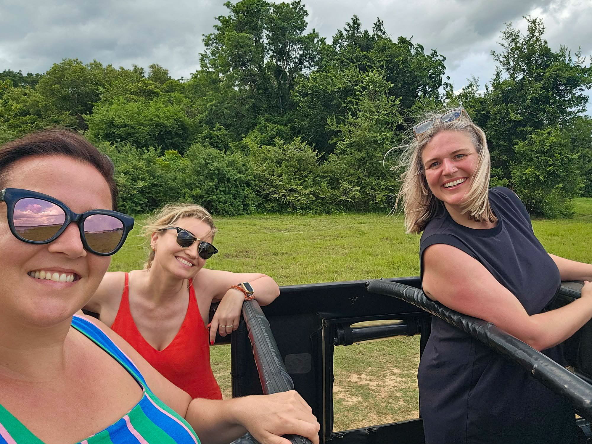
Open-top Jeep ride
This park is known for massive seasonal elephant gatherings around the ancient Kaudulla Reservoir, making it a prime spot for safaris, especially August to December. It is one of 10 parks in Sri Lanka where elephants roam freely.
Within minutes of us entering the park, we spied our first elephants in the distance, hiding in the brush.
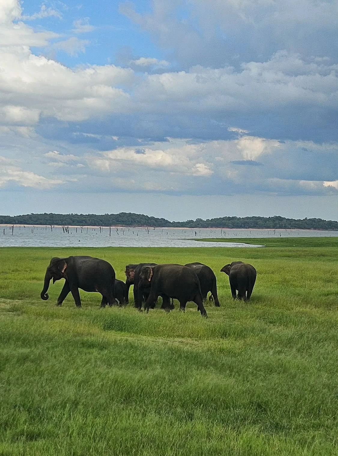
A small herd of elephants
Not long after that we saw a herd swimming, washing and playing in the water. We weren’t close but it was awe-inspiring to see.
We spent several hours admiring these guys at a respectful distance before making our way out of the park, passing bird and Langur monkeys too.

Elephant playing
On our drive back to Sigiriya, we passed several elephants on the side of the road… I guess they don’t know where the national park boundaries are!
In our spare time in Sigiriya in the heat of the day, we lazed by our accommodation pool and found cute spots to eat – some of which like Sigiriya Lion Face have incredible views of the iconic rock while you enjoy your food.
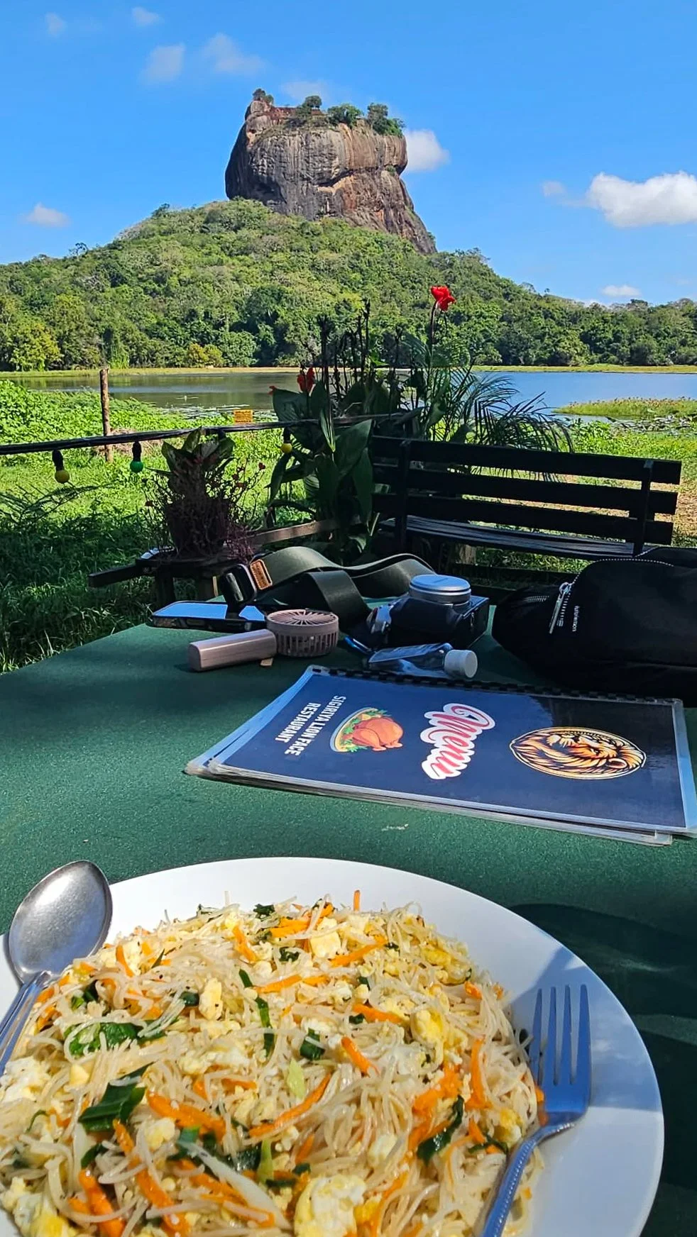
Lunch at Sigiriya Lion Face
Getting around was easy despite the town being so spread out, booking Tuk Tuks through our hotel was a breeze.

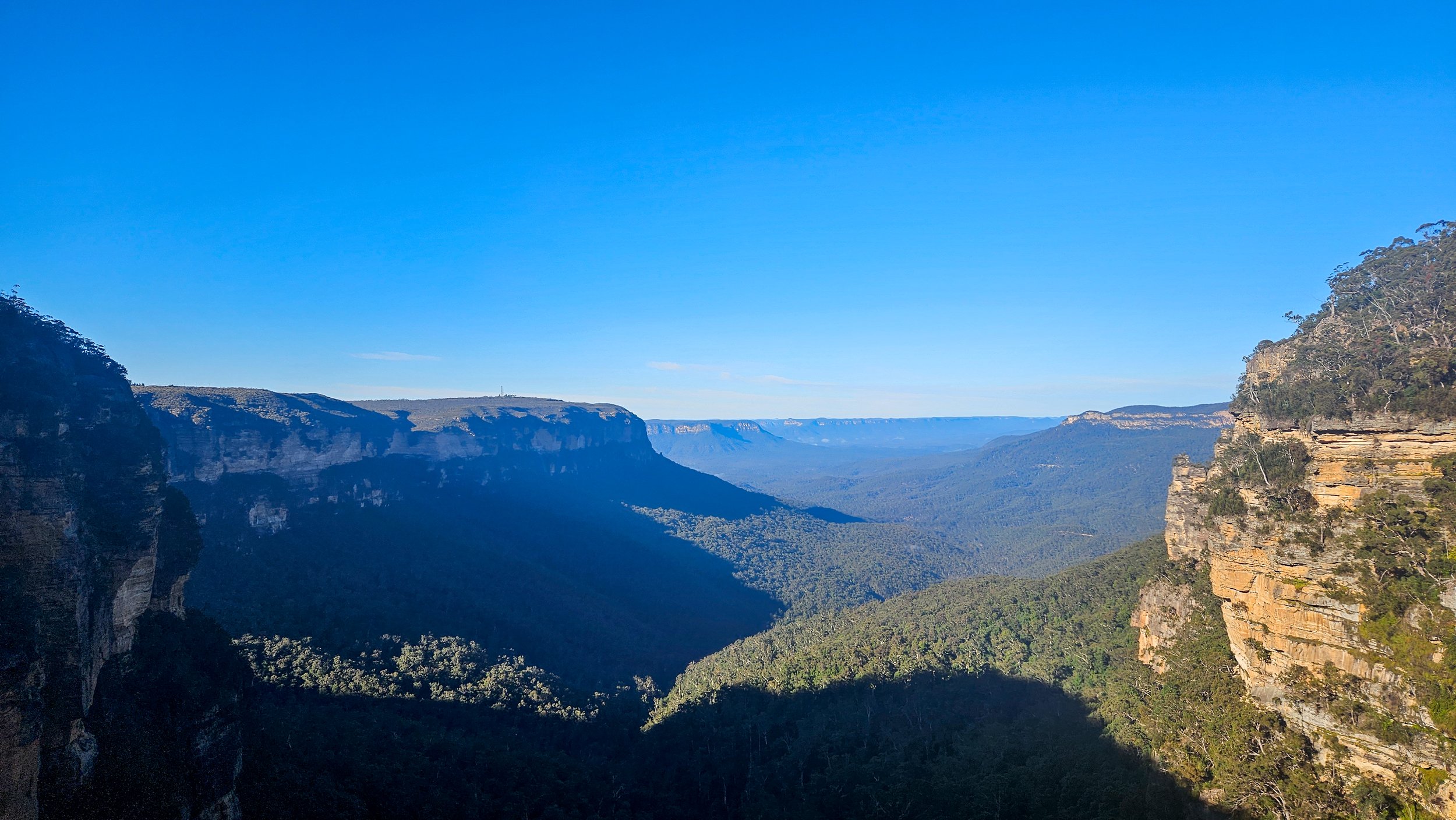
Chasing Waterfalls on the Blue Mountains Nature Track
There are so many walking tracks in the Blue Mountains National Park that it can be sometimes hard to pick one, but my driving force is always finding waterfalls and hidden rock pools.
Having traipsed along the Wentworth Falls trail several times, finding new a trail that offers up a secret swimming pool along the way was a big tick – enter the Nature Track.

Stopping for a selfie at the lookout
We started the circuit walk at the Conservation Hut (which meant we could finish there and enjoy a cup of coffee too).
The whole trail is about 3.5km long but don’t let that fool you, there are plenty of stairs to navigate and even better, some hidden treats just off the track.

Lush sections of the Nature Track
Stray just minutes from the formed path and you’ll find one of the most magical places in all the Blue Mountains: an incredible swimming hole at the foot of a canyon. You’d never know it was there which makes it all the more amazing – more on that later.
This walk has it all – epic views, lush ferns, waterfalls and tranquil pools. Heading out in the middle of July is great to get the blood pumping on a cold winter’s day.
Queen Victoria Lookout
We headed off in a clockwise direction which takes you to Queen Victoria Lookout after about 300m, offering up sweeping views of the Jamison Valley and a nice slow start to warm up the legs.
Not long after that, you will get to Empress Lookout where you will get glimpses of Empress Canyon and Empress Falls – your destination in the valley to see up close later on the walk.
From here, the descent becomes more noticeable and the stairways steeper. You will reach a junction where the Nature Track is signposted to the right, but it is only a 250m detour to the left along the Valley of the Waters Trail to explore Empress Falls.

Empress Falls
Just before you reach the bottom of the falls you’ll get a couple of great views of the top of Empress Falls. You’ll then come out of the forest and head along a path beside the falls, which has a metal handrail in place.
The base of the falls is protected by a handrail and the rocks around here are quite slippery but I imagine quite a few people duck under to have a dip as it is a stunning spot.
After breathing in the waterfall air, it is time to make our way back to the Nature Track and onto Lillian’s Glen and this is where you will find the hidden gem - Asmodeus Pool.

Asmodeus Pool
If you are not looking for this natural pool, you won’t find it and will walk right on by over Lillian’s Bridge.
Asmodeus Pool is a pristine little swimming hole which sits at the bottom of a narrow slot canyon, there’s even a waterfall that runs into it!
It's quite simply a dream destination and it’s nicely hidden away, despite being just moments from a popular walking track. It's not signposted and does require climbing over a boulder to access but then you have this magical spot all to yourself and it feels very private.

A chilly dip in the pool
We did a quick change into swimwear to have a (freezing) wild swimming experience. The pool isn’t deep (enough to dunk your head under) and it is kind of like a sandy beach so you don’t need to worry about rocks.
Our swim didn’t last too long in the roughly 2-degree water before it was back out and into our dry clothes for the hike back out.

Lillian’s Bridge
From Lillian's Glen the trail heads uphill and then you will pass through some impressive overhangs. The next rest stop (we needed it after going up the stairs) is Edinburgh Castle Rock Lookout.
This section of the trail is so different to the lush bush you have come through. It is an unfenced lookout on top of a rock formation, overlooking the northern part of the Valley of the Waters.

Edinburgh Rock
After this the path evens out (read: no more stairs) and you follow a fire trail all the way back to the Conservation Hut.
The walk itself is fairly easy, although of course this being the mountains, there are still quite a few stairs to climb so expect to get your heartrate up!
Stay nearby in Wentworth Falls and enjoy a longer break.

Why the Valley of the Temples should be on your Sicily itinerary
When you think of ruins in Italy, Roman is what springs to mind but tucked away on Sicily are temples that were there to worship the Greek gods!
Just like the Romans left their mark as far as Morocco, various coastal areas of southern Italy were once colonies of the city-states of ancient Greece; collectively, these were known as Great Greece. Culturally and linguistically, they were shaped and reflected the Greeks which is why are there lots of Greek temples in Sicily.

Perched on a hill just outside the Sicilian city of Agrigento, you will find the Valley of the Temples (Valle dei Templi). This UNESCO World Heritage Site is a sprawling archaeological park, spanning a massive 1,300 hectares.
Situated on the dry arid hilltops overlooking the penetrating blues of the Mediterranean Sea, these iconic temples have stood strong in the face of the winds, the invasions, the wars, the eruptions, and the shifting plates and political fortunes of Sicily.
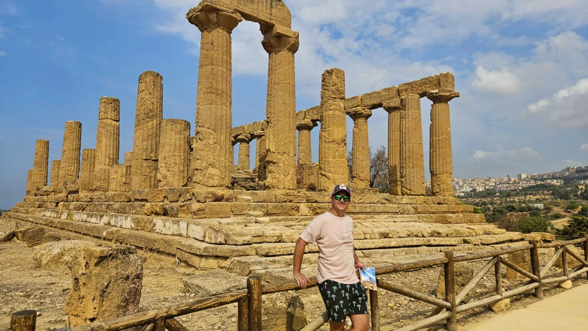
Some of the temples here date back to the 6th and 5th centuries BC and are in incredible condition. They are known as some of the best-preserved examples of this style outside of Greece itself.
The site at Agrigento is not a valley in fact, but a ridge, sitting 230 metres above sea level. The ancient temples stand looking majestically out to sea and the surrounding countryside, and as you drive around the area, you will spot sections of the ruins in the distance as if they are watching over you.

So, how do you get here to explore them? The good news is you don’t have to stay in Agrigento as the area is accessible. We stayed nearby at Maddalusa Beach just outside town so we could wake up to the sounds of the sea.
We hired a car as we were travelling around Sicily for about a week so access was easy, but you can also go by bus, train or tour from major cities like Palermo or Catania as a day trip.
Tickets are around $30 per person (€17).
The archaeological park consists of eight temples and various other relics, including the Temple of Hera, the Temple of Concordia, the Temple of Heracles, the Temple of Olympian Zeus, the Temple of Castor and Pollux, the Temple of Hephaestus and the Temple of Demeter.
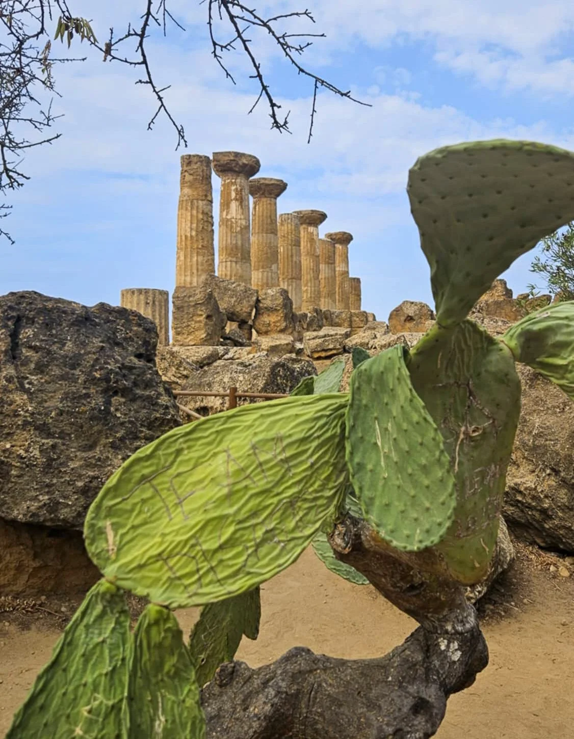
While we there, they were setting up to film a movie of some sort, so we couldn’t see the massive bronze statue of Icarus laying on the ground in front of the Temple of Concordia up close unfortunately.
All up, we spent around two hours exploring and walking around five kilometres. Reading information on the ruins as we went after deciding to self-guide following recent guided tours in both Rome and Pompeii.

The route along the dusty path to all the temples and ruins is obvious, and quite well sign-posted so it would be quite difficult to get lost.
Opening hours are from 8.30am (early by Sicilian standards!) Closing time varies as it is extended during peak summer periods.

We were there in the middle of September and do not recommend visiting in the middle of the day as there is very little shade as you wander around. No matter the season, take plenty of water with you – a refillable bottle is a good idea. In the park, they have a number of drinking water fountains, so you can easily fill up as you explore and stay hydrated!

A taste of Etna’s legacy: Volcanic wines at Barone di Villagrande
Nestled on the eastern slopes of Mount Etna, where ancient vines cling to volcanic soil and clouds dance with smoke from the crater above, you will find one of the oldest vineyards in the volcanic area of Sicily - Barone di Villagrande.

The laid back arrival at Barone di Villagrande
This historic winery is a family-run estate with centuries of winemaking tradition. The vineyard was officially founded in 1727 when the current owner’s ancestor, Don Carmelo Nicolosi was given the title of Baron of Villagrande. The vineyards have been cultivated by the same family ever since.
After arriving through the winding roads up the mountain, ash piled up where it has floated down from the famous volcano above, the views at Barone di Villagrande take your breath away. You can see the Ionian Sea shimmering in the distance, framed by the dark, fertile slopes of Etna. The vineyards cascade down the hillsides, orderly yet wild.

Acres of vines
There are two options to taste wine here and in typical Sicilian style, neither of them are fast!
You can indulge in a full four-course lunch with your tastings, or as we did, opt for finger foods to match the wines.
Both are guided tastings starting with a visit to the ancient cellars on the estate and include the opportunity to try the dishes of the Etnean kitchen paired with the wines. Menus are entirely seasonal, but they do cater to dietaries.

Tasty morsels
Our host, charming and unhurried, began the tasting with a full glass of the Salina Bianco and left us to enjoy it. We sipped slowly, enjoying sitting in the warm outdoors and the light breeze on a hot summer day.
The wines that followed were the Etna Bianco (my favourite), the Etna Rosso, made from Nerello Mascalese. Pale garnet in color, it looked almost too delicate for its earthy aroma.

Enjoying the Etna Bianco
The finish we had a sweet wine, the Malvasia which matched our snacks perfectly.
All in all we spent at least two hours enjoying one of the oldest vineyards on an active (very active) volcano. We spent a little time in the shop on our way out, buying a couple of bottles of the Etna Bianco and some olive oil to enjoy on our travels.

Little pieces of history everywhere
Barone di Villagrande isn’t just a winery. It’s a quiet slice of paradise where history and love of good food and wine come together. It’s worth a visit.
If you wanted to linger a little longer, you can stay right here on the estate – there is even and outdoor pool overlooking the mountain vines.

Finding the quiet heart of the Amalfi Coast at Domus Claudia
When most people think of the Amalfi Coast, their minds jump straight to Positano or Amalfi. But let me let you in on a little secret: Atrani is where the real magic happens. One of Italy’s smallest villages is tucked between dramatic cliffs and the glittering Tyrrhenian Sea, this tiny town is the quiet gem of the Amalfi Coast - and I found my own slice of heaven at Domus Claudia Airbnb.

The view from our window
I fell in love with Atrani before I even unpacked my suitcase, despite the stairs to get to our room. And honestly? I think it had a lot to do with how wonderfully, blissfully quiet it is. While Positano dazzles with her glam and Amalfi buzzes with boats and gelato-chasing crowds, Atrani feels like the calm, sun-drenched little sister - leaning back against the cliffs, totally unbothered, sipping a spritz in the shade.
And nestled right into this serene slice of the Amalfi Coast is where we stayed: Domus Claudia.

King sea view room at Domus Claudia
We booked the King Room with a sea view, and let me tell you, those views did NOT disappoint. From the moment we opened the shutters, we were met with a watercolour-worthy scene of deep blue ocean boats and cliffs. Mornings here? A salty breeze with the hint of espresso. Nights? Moonlight dancing on the water, the whole town hushed like it’s sharing a secret.

Atrani by night
The room here was massive in size and decorated in beautiful cool tiles, and you get your own private bathroom too. The owner even provided a chilled beer on arrival which was amazing after lugging our bags up the stairs.
But there’s even more to enjoy: the rooftop terrace which is where we enjoyed our cold beers. I swear it’s one of the best-kept secrets on the coast. A magical little perch above it all - ideal for morning yoga (if you're that kind of person), golden hour Aperol spritzes (if you're my kind of person), or just pretending you’re in a movie.

Domus Claudia rooftop terrace
Now, if you’ve ever been to the Amalfi Coast in peak season (or just seen some photos of those packed beaches), you know the drill - crowds, lines, narrow roads full of scooters and honking cars. Atrani? It’s like stepping into a postcard that forgot to invite the tourists. You can stroll from the quiet beach to the piazza in 30 seconds, and if you time it right, you’ll find yourself the only one wandering those quiet cobbled alleys. We loved our quiet mornings here swimming before breakfast and an espresso.

Views in another direction from our room at Domus Claudia
We used Atrani as our home base for four nights and walked to Amalfi in about 10 minutes (yes, really). There is a pedestrian tunnel that connects the two towns, meaning ferries to other parts of the Amalfi Coast are super accessible.

The well-lit pedestrian tunnel
After exploring Amalfi or hiking the Path of the Gods, we’d return to Domus Claudia, slip off our shoes, and exhale into that sweet, salty quiet.
If you’re looking for the perfect blend of sun, sea, and serenity, skip the crowds and stay in Atrani. And if you want a place that feels like your very own Amalfi fairytale - Domus Claudia is it. Just don’t tell too many people. Let’s keep this little dream between us, okay?