

Epic views and wild roads: an adventure in Ella’s mountains
A trip to the mountainous centre of Sri Lanka in Ella is always going to dish up epic views – but sometimes they don’t come without a little effort!
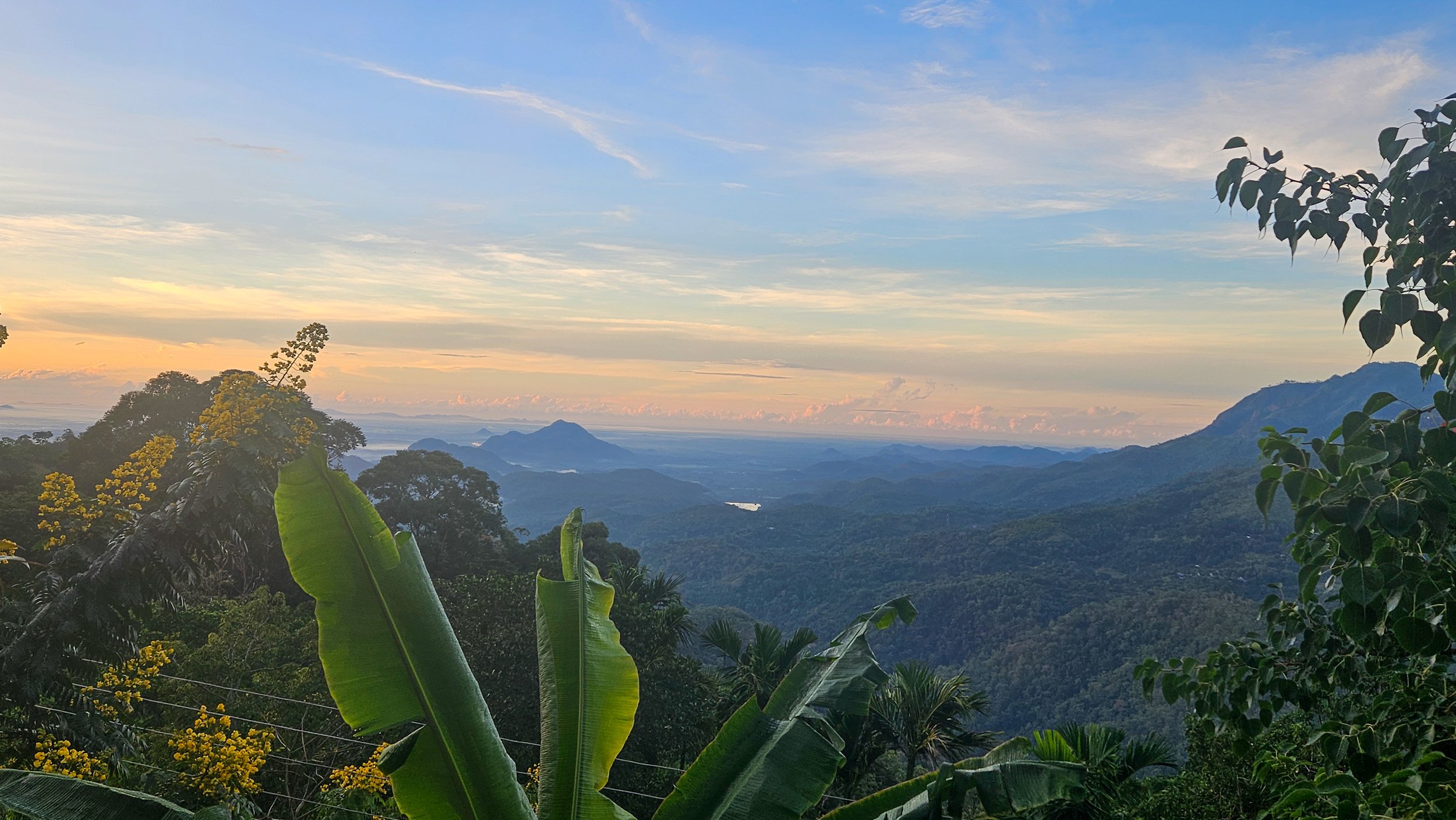
We arrived on the iconic train from Nuwara Eliya as the light was starting to fade, unprepared for the chaos of drivers touting for our business. In hindsight, we should have booked a transfer to our accommodation, but we didn’t realise what the roads in these mountains were like and everything looks much closer on a map…
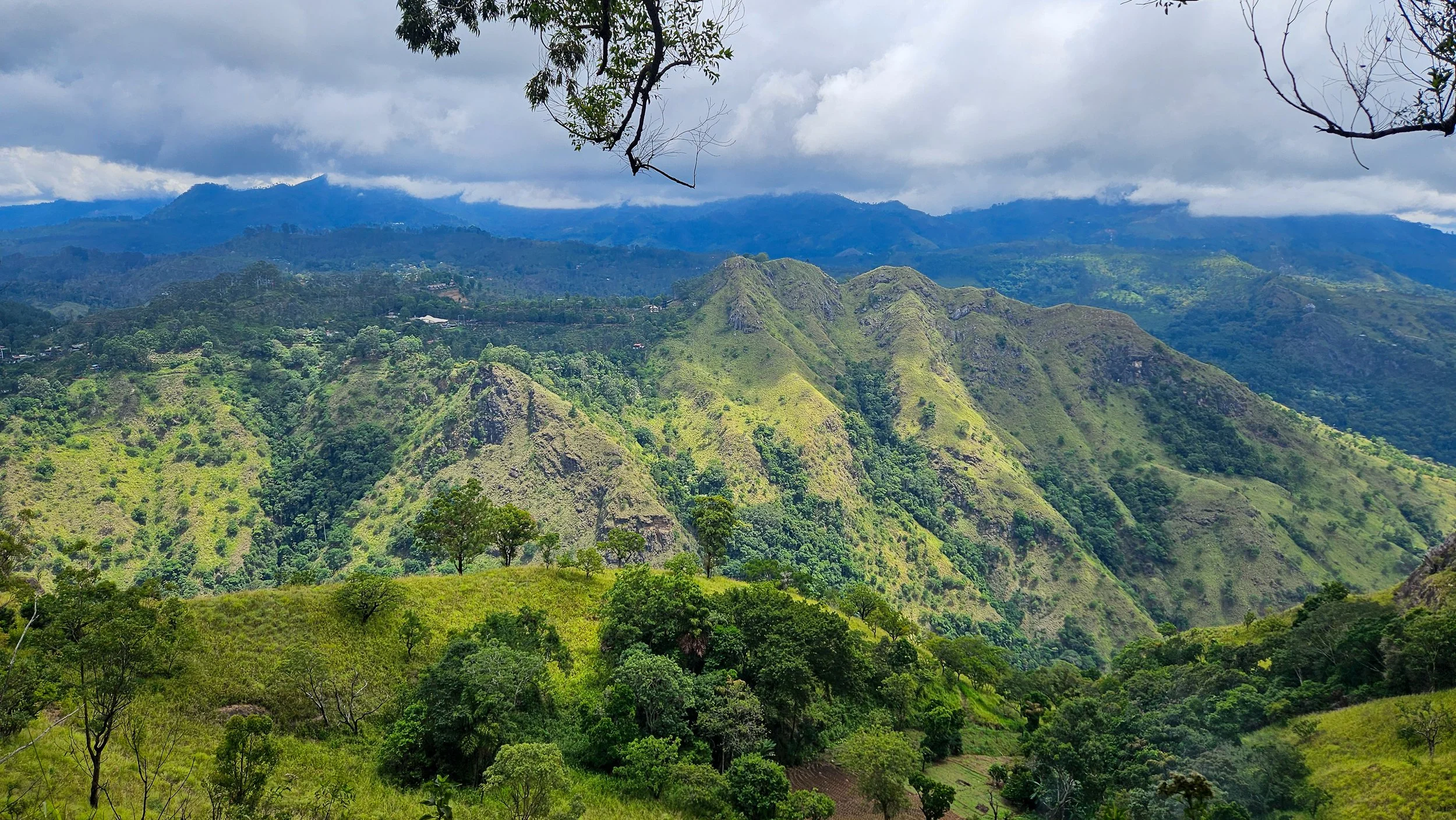
A view from above the clouds
We booked a driver through the popular Pick Me app that could fit three people and our luggage, and it all started well as we climbed higher in the mountains. As we got closer to Awesome Place (our accommodation), the road became dirt, full of potholes, and quite literally on the edge of a cliff.
Our driver was naturally cautious and after he got out to check the size of some of the holes in the dark, I am pretty sure my eyes were closed for the last, very bouncy section of our trip.
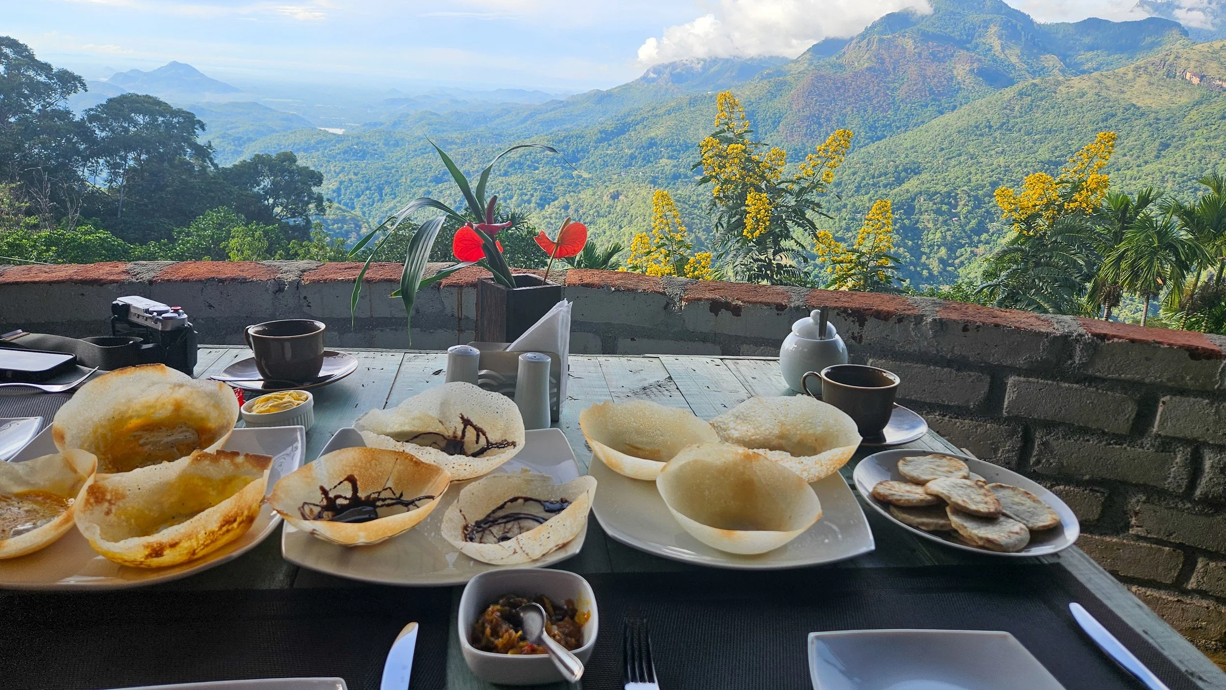
Breakfast with a view
It was all worth it and for all remaining trips to and from Awesome Place, we used drivers from the villa!
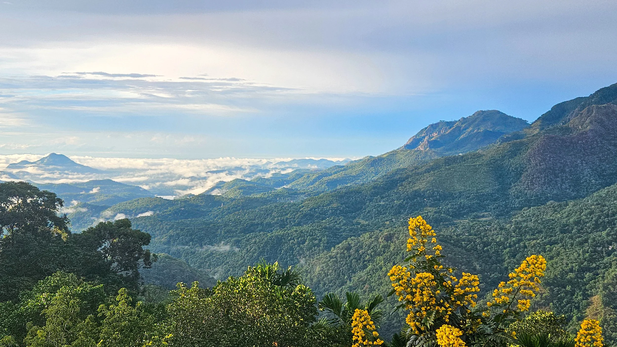
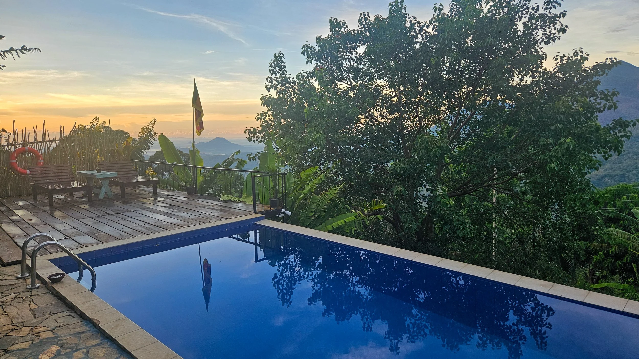
Awesome Place may only be 10km from the train station, but it can take about 40 minutes to travel the distance. The pay off is, the views from this 3-villa boutique stay are epic, and the staff could not be more accommodating. With only three rooms, it also never felt busy and we always got the best spot to enjoy coffee with the sunrise.
It was an incredible place to start your day with coffee and breakfast overlooking lush mountains and finish it with a swim or a drink by the pool that looks like it is sitting on the edge of the world.
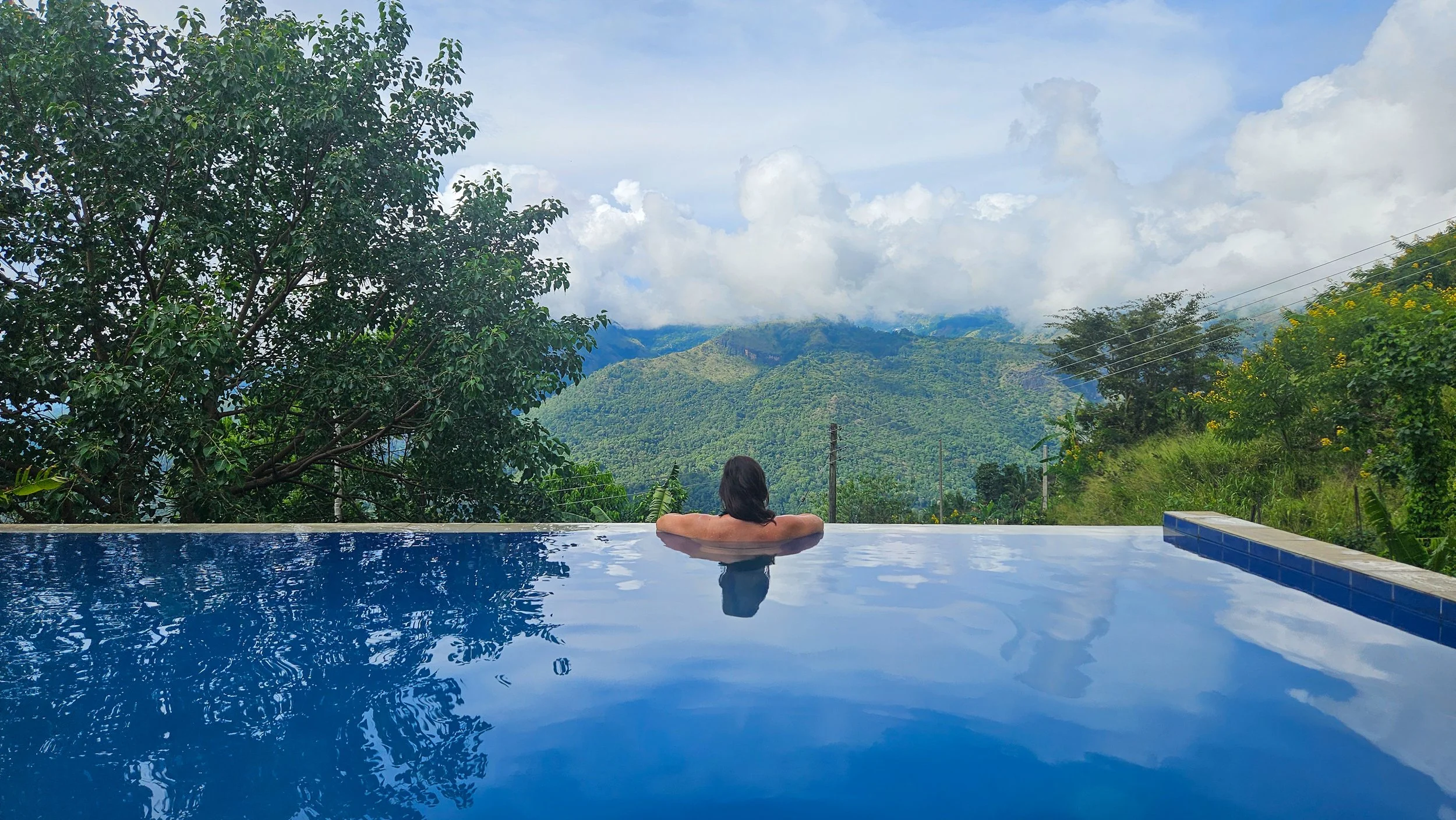
A pool on the edge
Being in the mountains always makes me want to climb to the top of them, so that is exactly what we did. We could see Ella Rock from our pool so started early one morning with a drive down to the starting point at Kithaella Railway Station.
From the station, you cross the train tracks and then head across a small creek before actually getting to the official trail head. We attempted to make our way up on our own from there with instructions from blogs but the paths around here can be a bit confusing and there is definitely more than one way up!
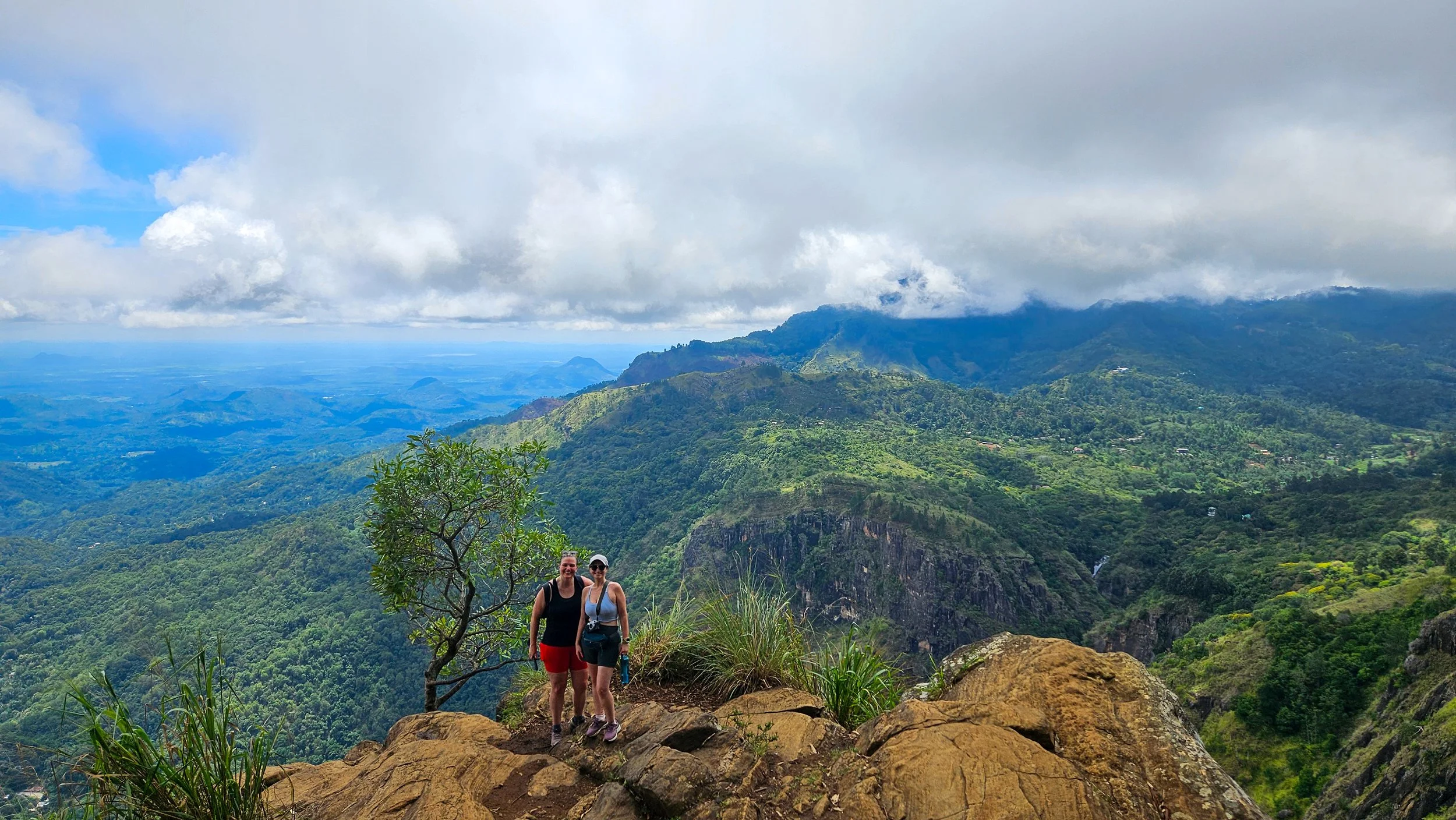
A the top of Ella Rock
We took a few wrong turns, ended up on someone’s backyard but managed to gain a guide to lead us all the way to the top from here.
The trail starts easily enough through some tea plantations but before long, I felt like I was hiking at home through eucalypts! It is through here that the path gets a little steeper (and sweatier).
Coming out of the bush, you will reach a clearing at the top of Ella Rock. Here, you will see a small hut, with wooden fencing around it. This is where you will need to pay a small fee to access the viewpoint above. It is totally worth it.
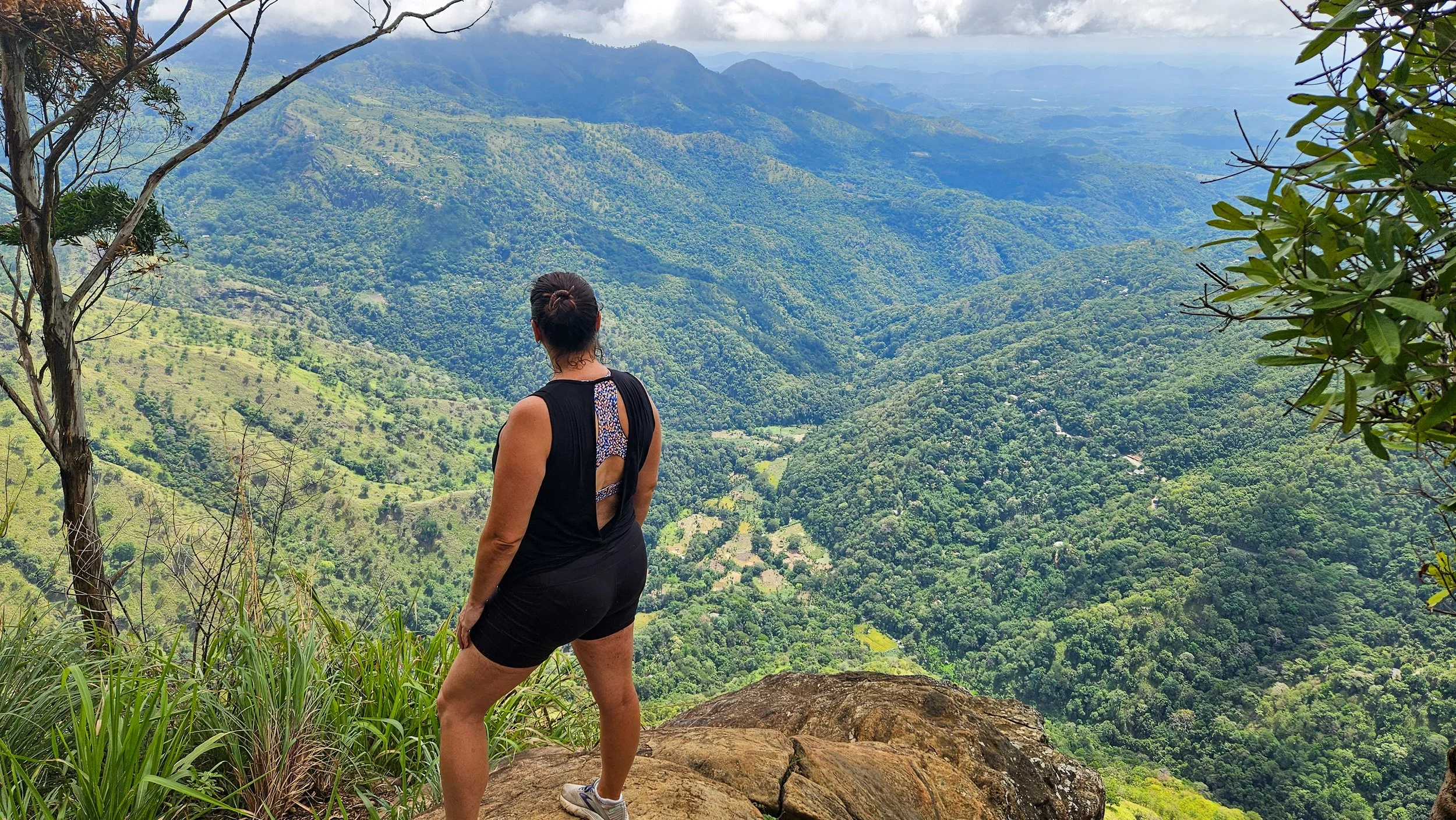
Looking down at the valley
A little perspective
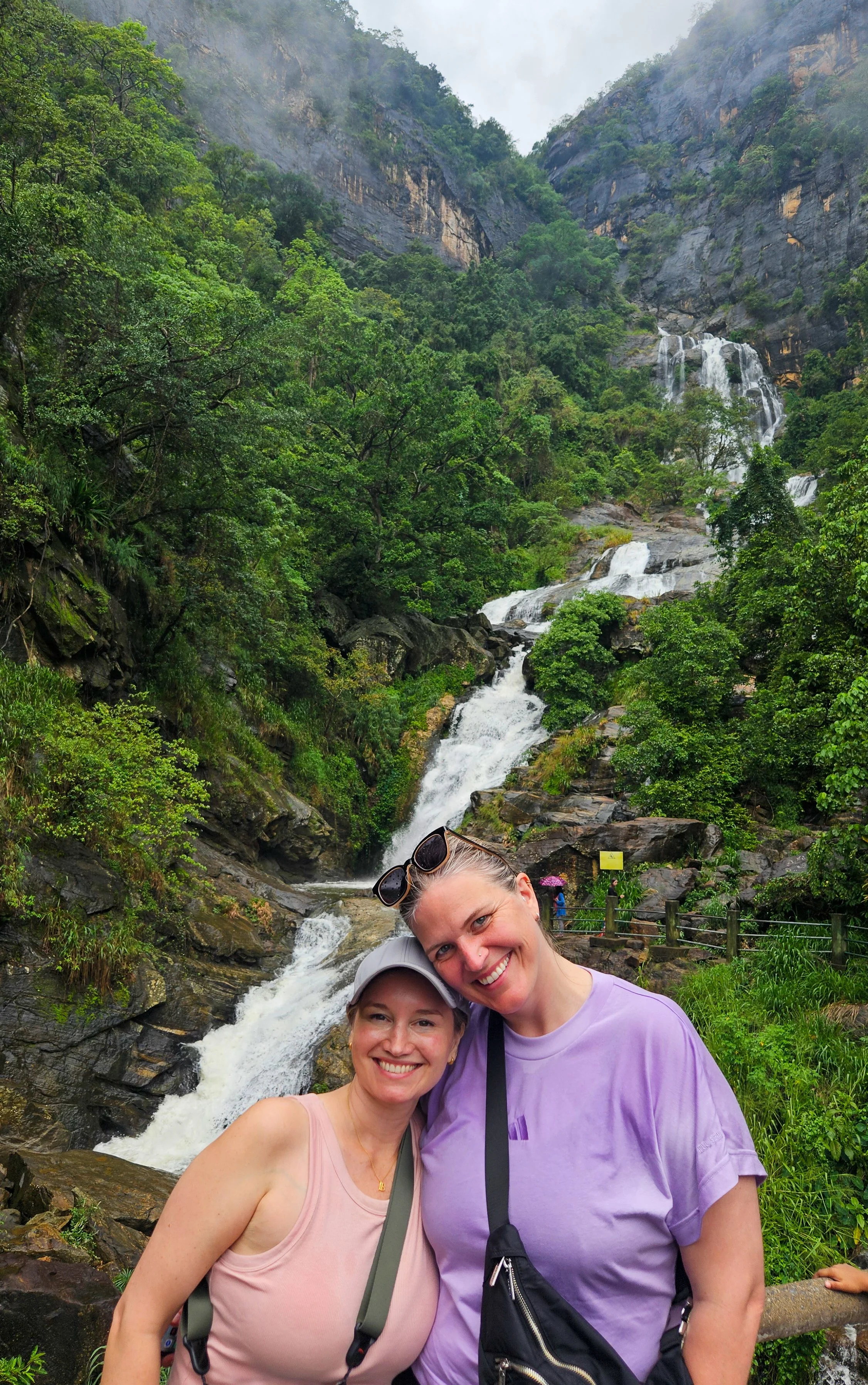
There are two viewpoints from the top. The first looks out over Ella and the railway, the second is about 10 minutes around and you can see incredible waterfalls from here. We probably spent close to an hour just enjoying the views (and catching our breath) before heading back down.
On the way back down, I managed to pick a few leeches on the way trying to get into my shoes through my shoelace holes. Thankfully, they were quite easy to flick off but something to look out for!
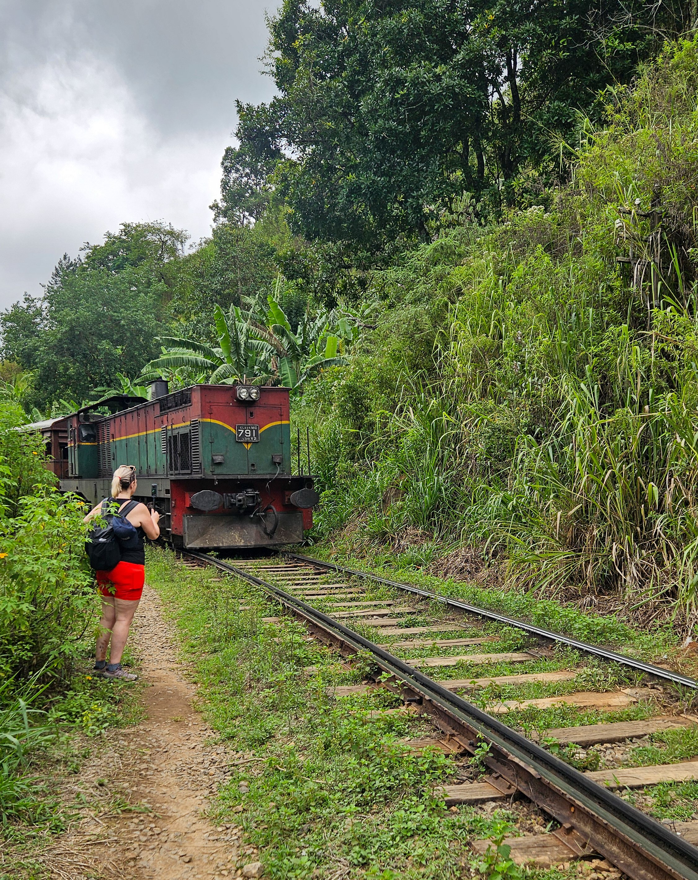
Passing trains
Instead of getting a drive back to Ella town, we decided to walk the extra 5km along the railway tracks which seems crazy for a westerner but is very common and we saw a few other locals doing the same.
It took about 40 minutes but was very hot with limited shade so make sure you keep enough water and sunscreen. All up our trip up Ella Rock took about four and an half hours.
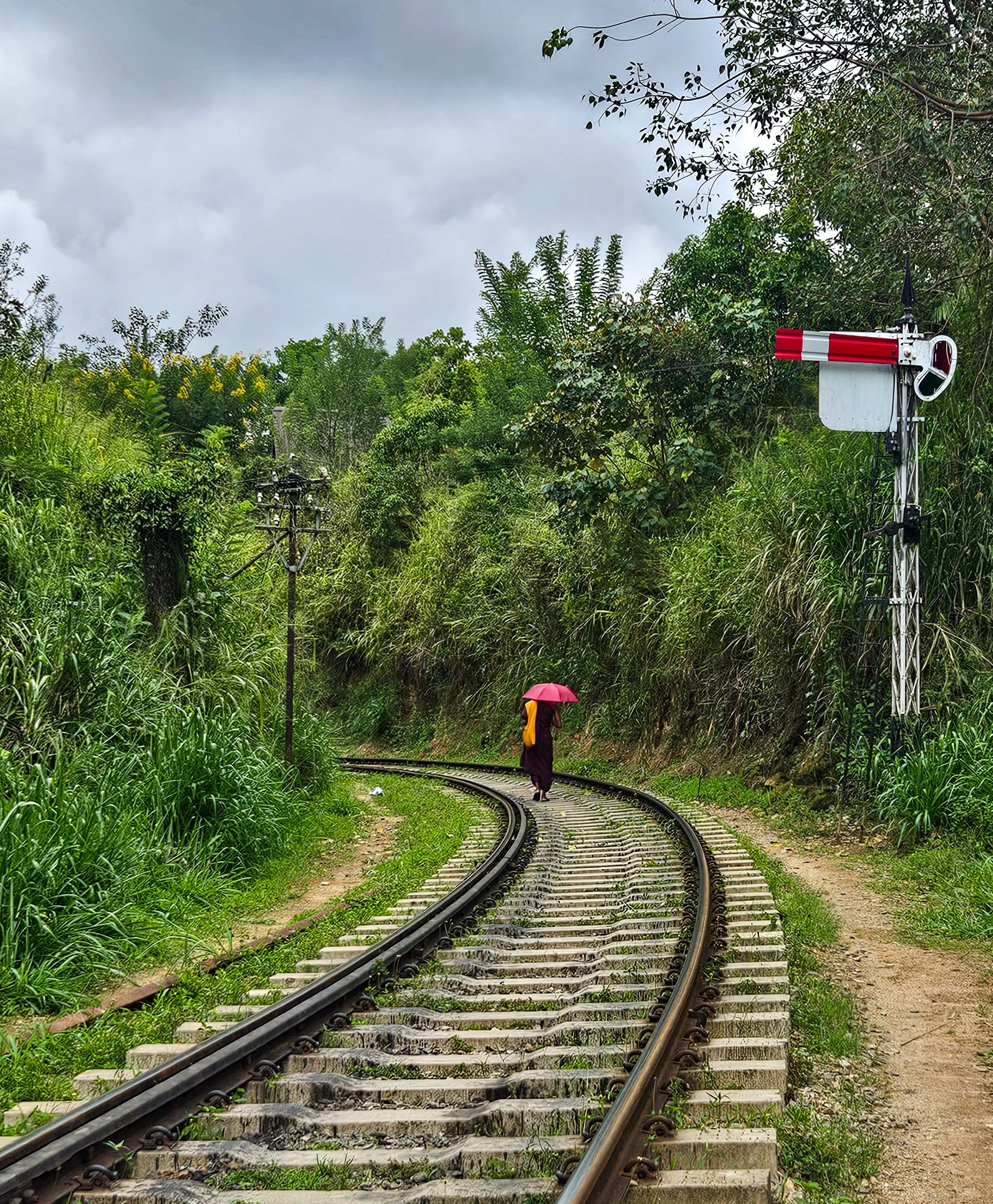
Walking on the tracks
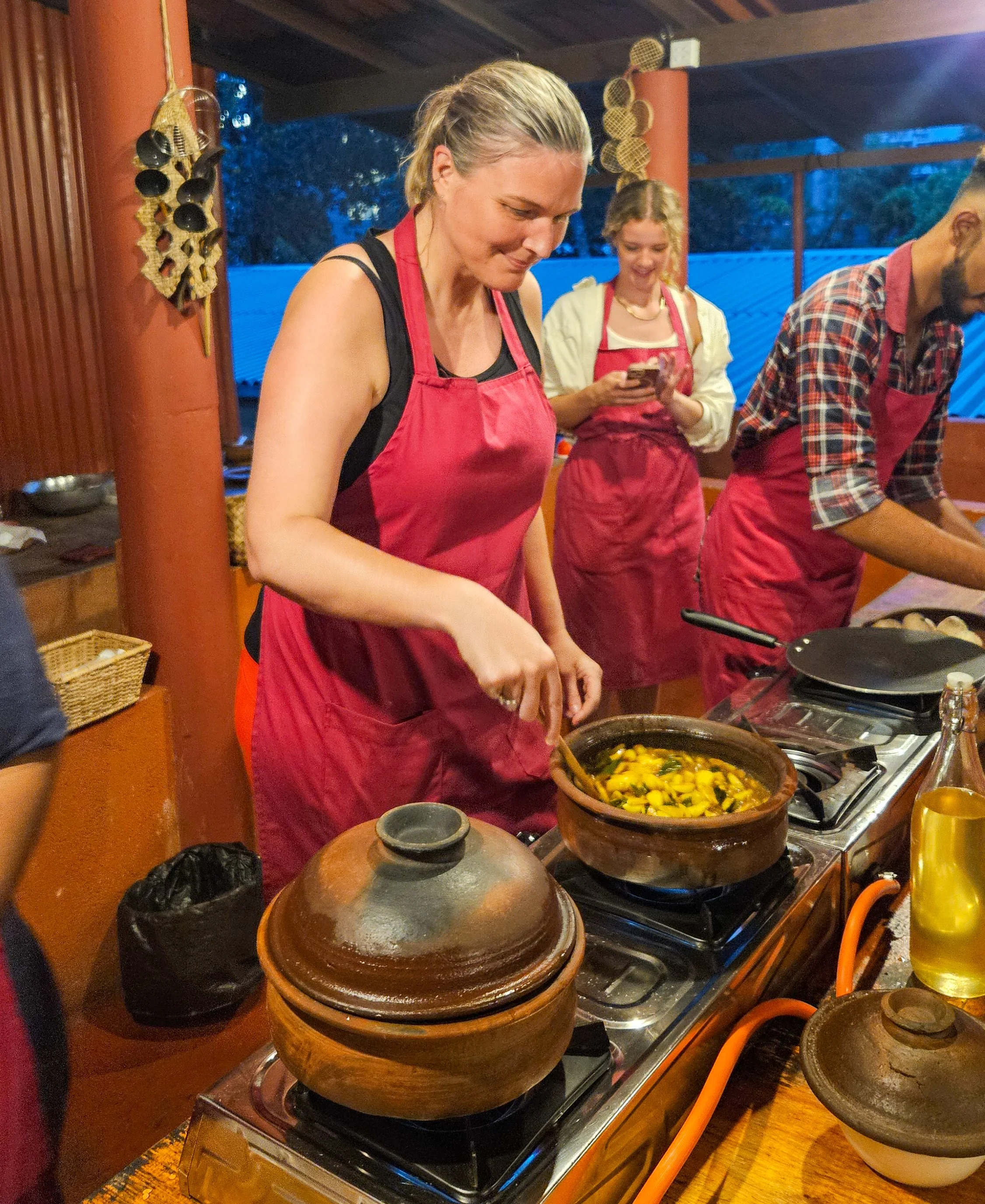
We wandered around town and had a bite to eat before heading to our cooking class at Ella Spice Garden.
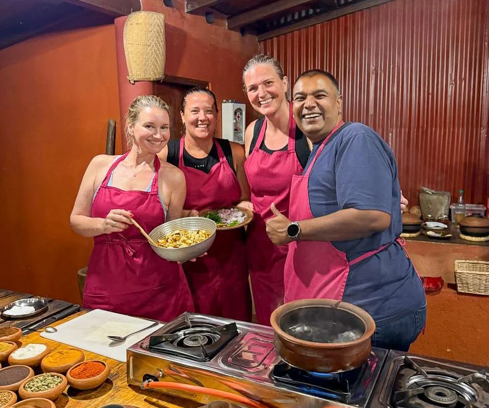
Chefs in the making
This is hands down the best cooking class I have ever done and Theeka is so friendly, personable and funny. Plus, the vegan food we made was amazing.
Garlic curry in the making
It starts with a guided tour of the spice garden so you can see all the ingredients you will be cooking with. You then get to make seven dishes that are so layered with flavour that I have tried to re-create it at home.
On our last day in Ella, we started to head up Little Adam’s Peak but it was raining quite heavily and we could see after a couple of kilometres that it was quite touristy and the views from the top would not be any better than those we had at our accommodation.
Views like this are hard to beat
Our final stop on the way out of town was to check out Ravana Waterfall. These epic falls are literally on the side of the road which does make them very busy and surrounded by stalls selling fresh fruit and grilled corn. Perfect for a snack enroute to our next destination.
Ravana Falls

Sigiriya, Sri Lanka: Come for the views, stay for the vibe
If you’ve seen photos of Sri Lanka, it is likely you have spied Sigiriya Rock Fortress jutting up, but it is not the only thing worth exploring in this scenic and uncrowded part of Sri Lanka.
First things first, how do you get to Sigiriya?
It’s a small, yet spread out, town without a train station or main bus stops so to get here by public transport, you will need to travel by bus to nearby Dambulla. From there it is an easy Tuk Tuk ride.
However, we found the easiest, and most comfortable, way was with a driver from Colombo for the three of us and our luggage. It was nice to have someone to point out things along the way and we also stopped to visit Dambulla Cave Temple before arriving in Sigiriya – right at our accommodation.
We stayed at 3-star Sigiriya Sunshine Villa and it was lovely and there are so many similar options around the place. I do recommend getting somewhere with a pool though – the days were 35-degrees.
On arrival, it is impossible to miss the towering 200m rock jutting up from a mainly flat landscape, but it wasn’t our first stop!
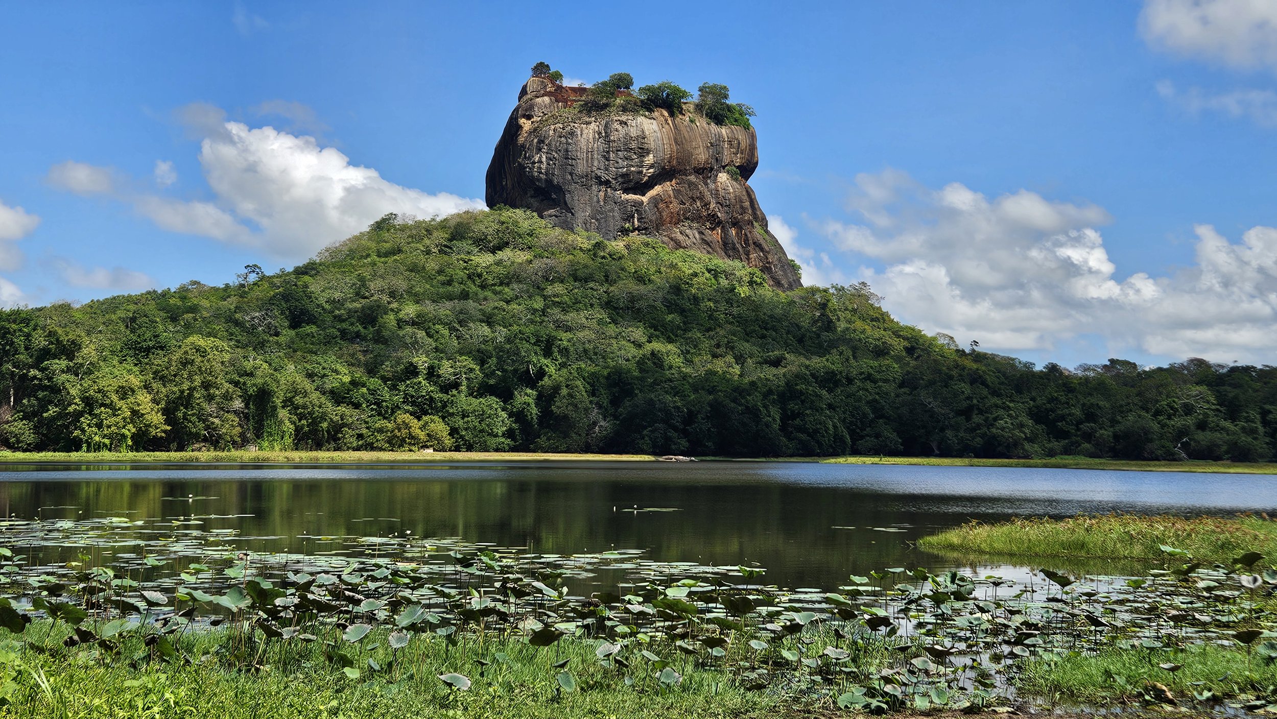
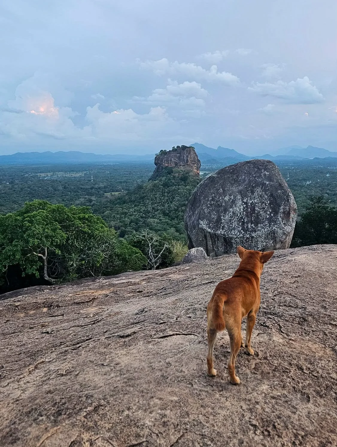
Sigiriya Lion Rock
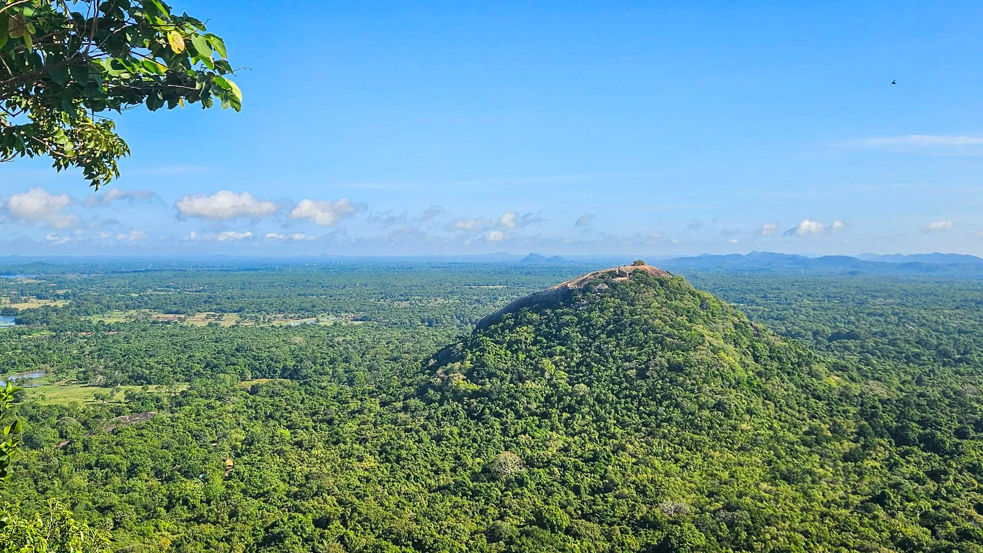
We decided to head up a nearby rock for sunset to give us a panoramic view of Lion Rock (Sigiriya Rock Fortress).
Pidurangala Rock
Pidurangala Rock is a nearby hike (about a kilometre from the ‘town’) that is definitely a popular option for good views. Note that there is a small entrance fee here, but much cheaper than Lion Rock itself.
Before you ascend the hike itself, you have to walk through Pidurangala sacred site, so modest clothing is required - shoulders and knees must be covered. Free sarongs are provided that you can use as you walk through this section, which is great because in October, this was a warm hike.
Pidurangala Rock
To make it to the top is around a 30-45 minute hike which is good to keep in mind if you want to time your arrival with sunrise or sunset. We packed some head torches for the trip down.
The path to the top is well maintained up until you reach the Pidurangala Cave Temple where there is a reclining Buddha. After the cave temple, it becomes more of a scramble and you must find your own path to the top over some large rocks and boulders. At certain points you will have to give way to those making their way down as there is only room for one person at a time.
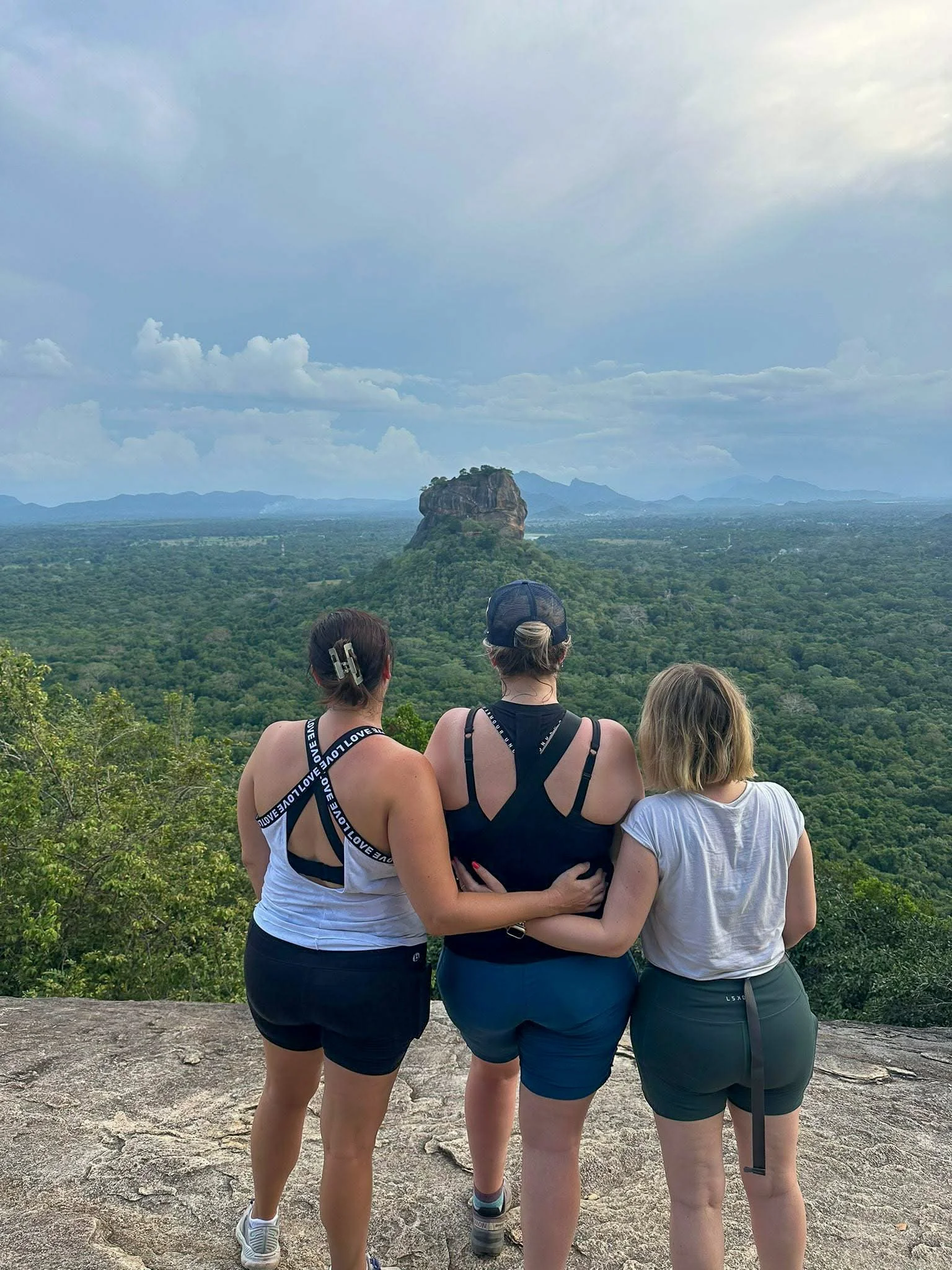
Enjoying the views of Lion Rock
At the top, you can wander around for 360-degree views of the surrounding countryside and an amazing view of Sigiriya Rock.
While there was no amazing sunset for us due to low-lying clouds, we still had an incredible view and spent at least half an hour at the top before making our way back down.
Even locals enjoy the view
Sigiriya Lion Rock
After a relaxing afternoon, we got up early (before sunrise) the next morning to head up the iconic Lion Rock. We were hoping for sunrise but we also wanted to avoid the hottest parts of the day.
It costs US$35 for foreigners to enter Sigiriya which isn’t cheap, but it really is a beautiful place to visit.
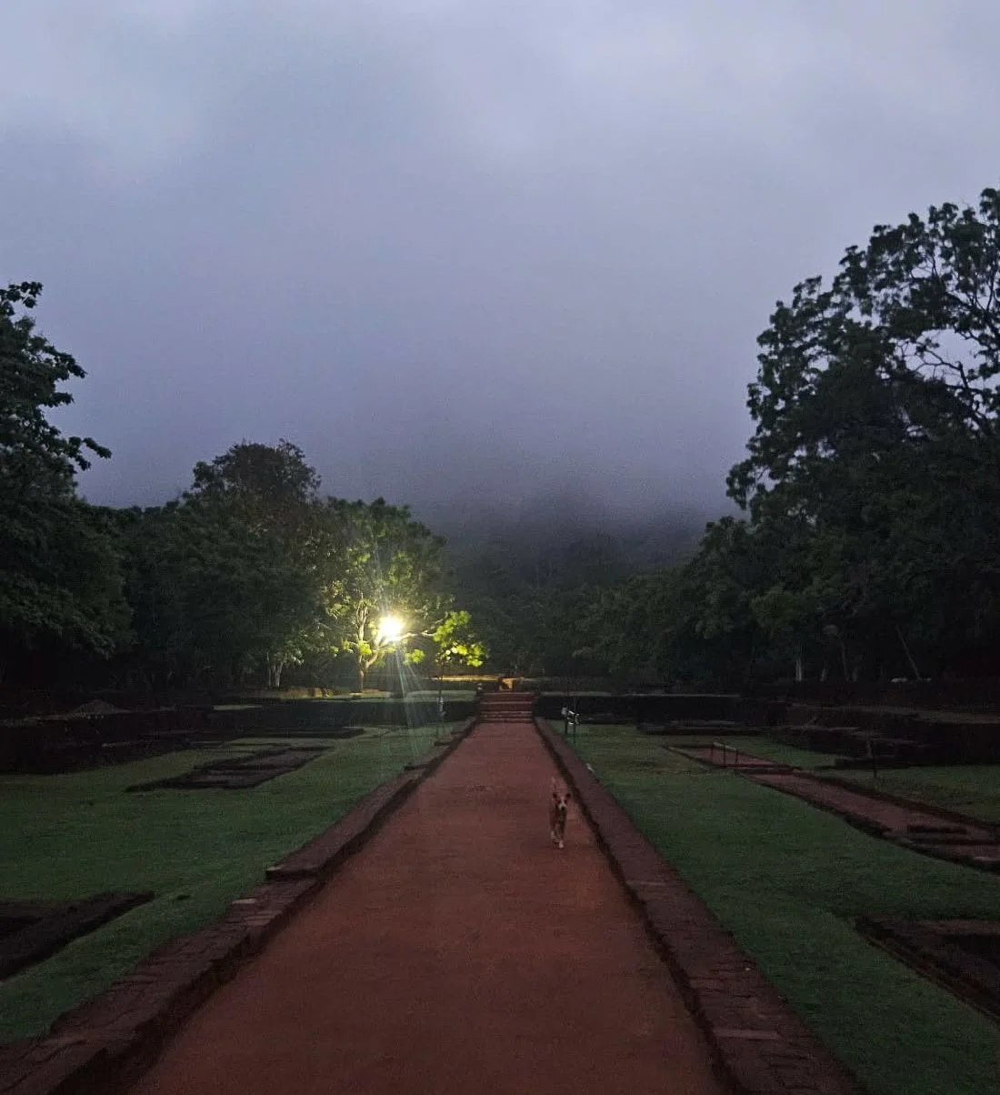
Our walk started before dawn
Sigiriya Fortress is not a temple or a sacred place, so you don’t have to cover your shoulders and knees for this walk.
This incredible site is where King Kassapa I (477-495 CE) built his fortress-palace and definitely worthy it’s UNESCO World Heritage status.
You pass through some of the landscaped royal gardens as you walk towards the giant rock, impressive even in the misty early morning light.
It is a scenic walk to start
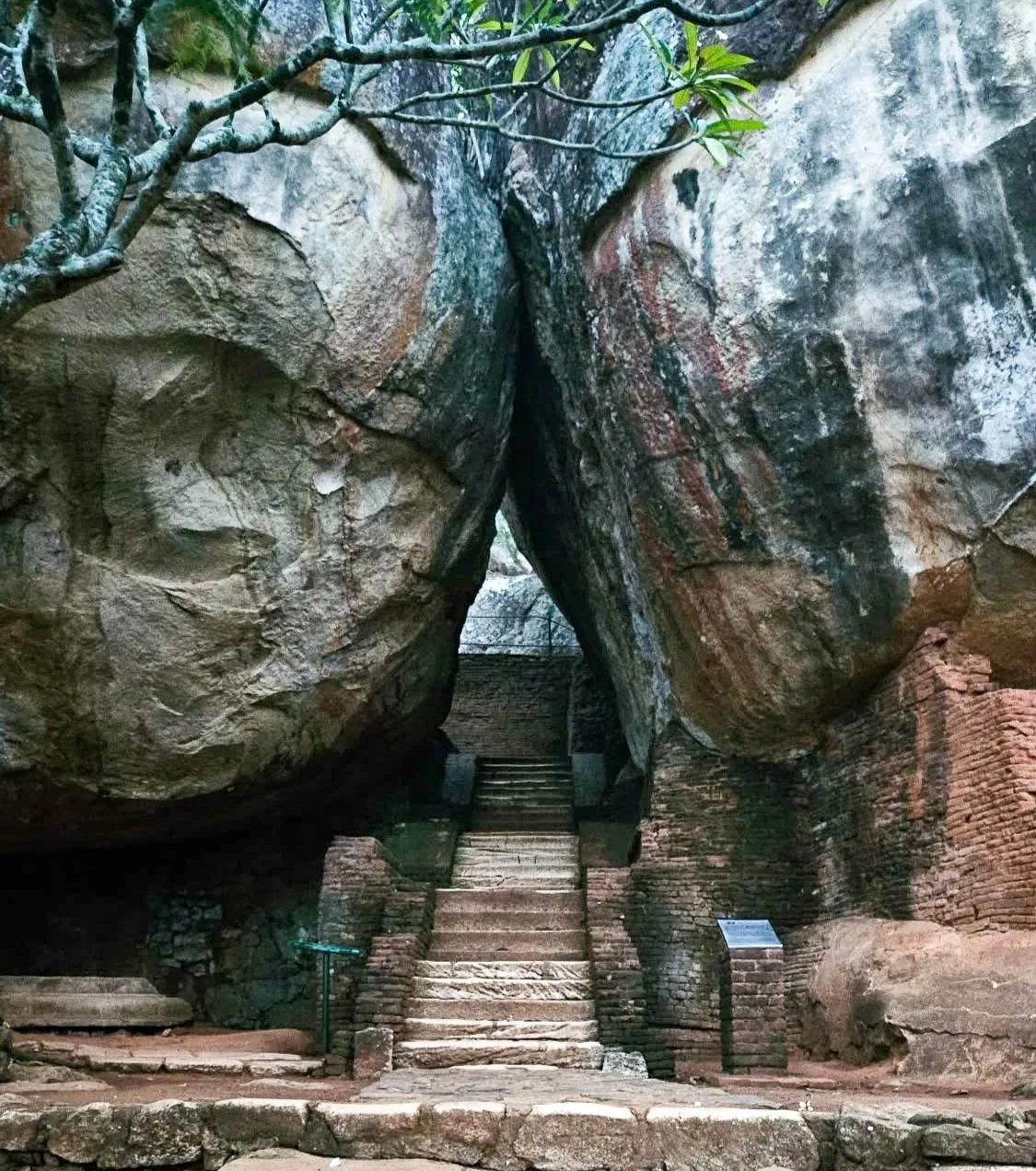
The first set of steps through the rocks will take you up to the famous lion paw staircase, which is how the Lion Rock Fortress got its name.
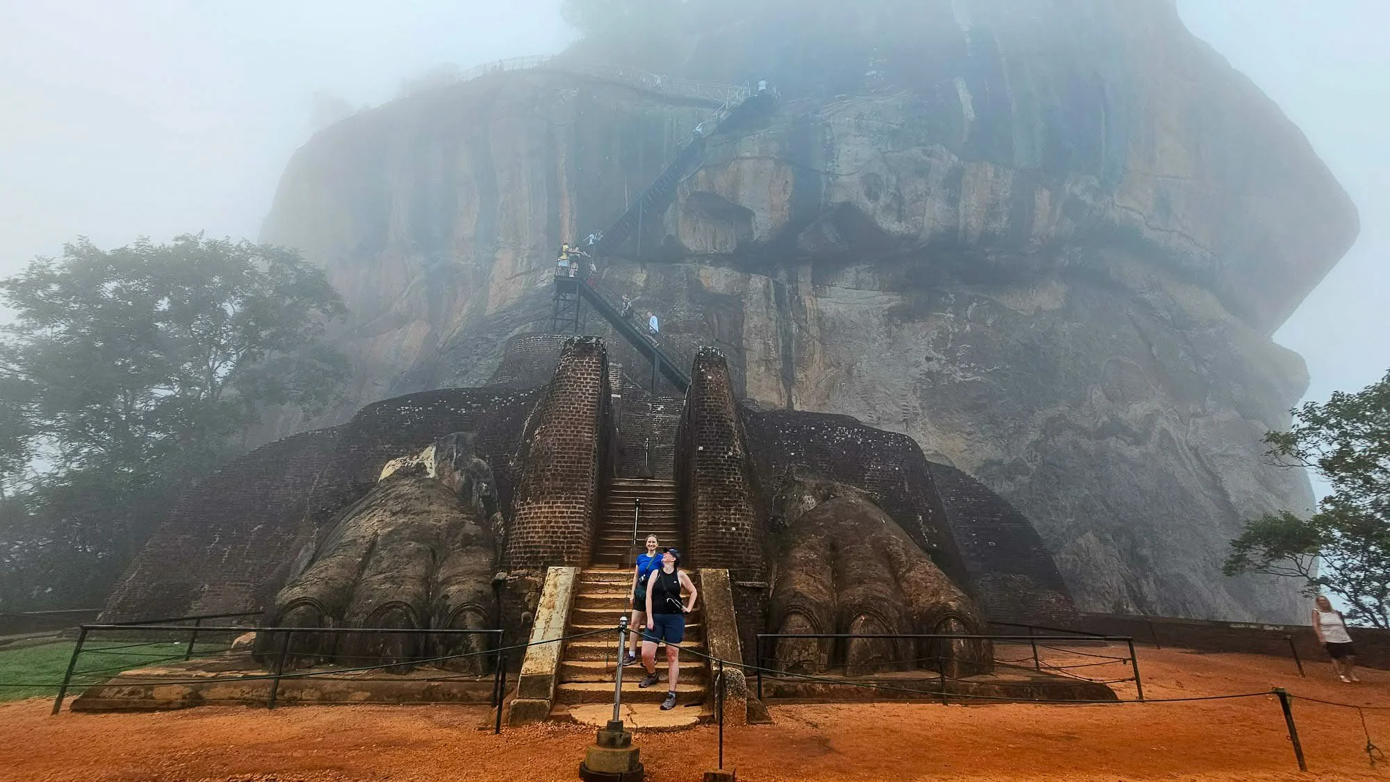
Lion’s Paw
From there, staring up at the narrow metal staircase seems daunting but there are places to rest along the way – even if the stairs seem to be precariously nailed into the side of the rock.
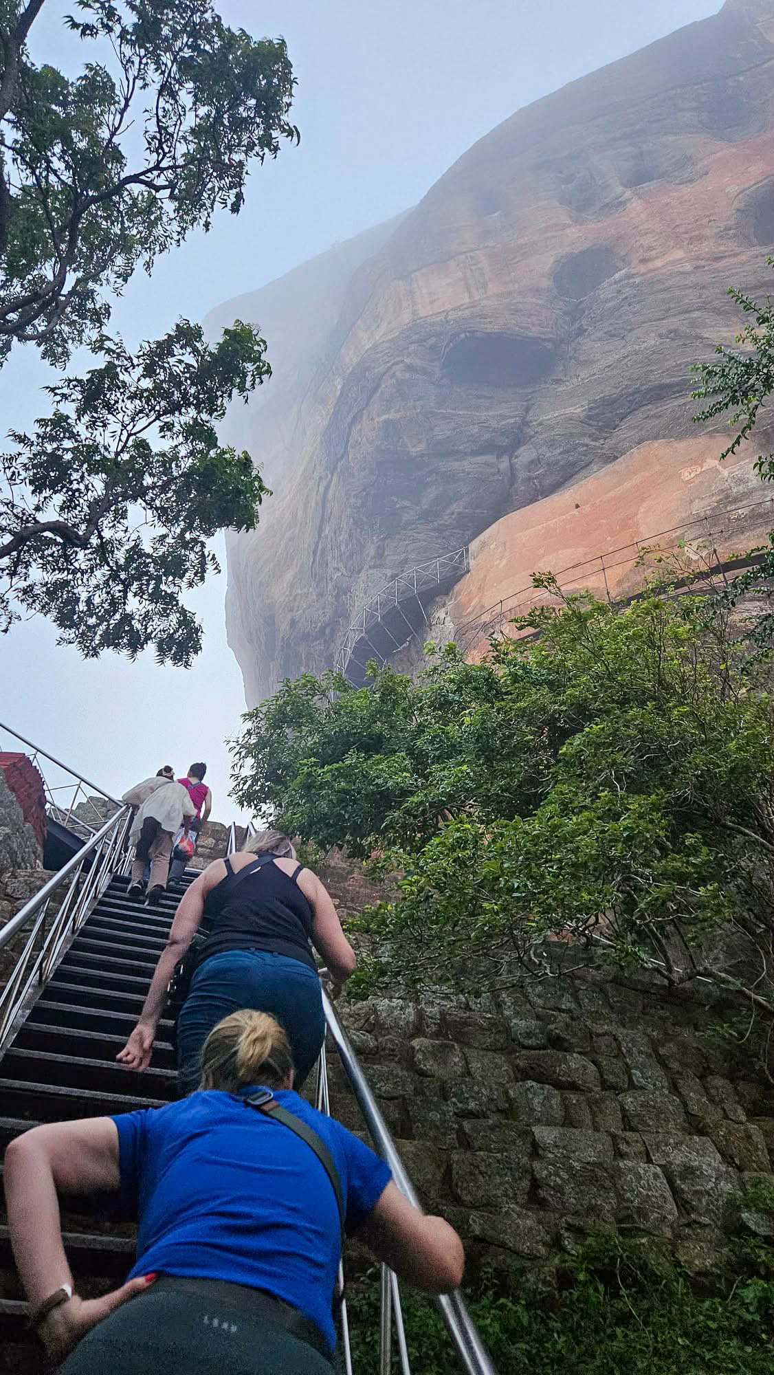
The stairs are steep!
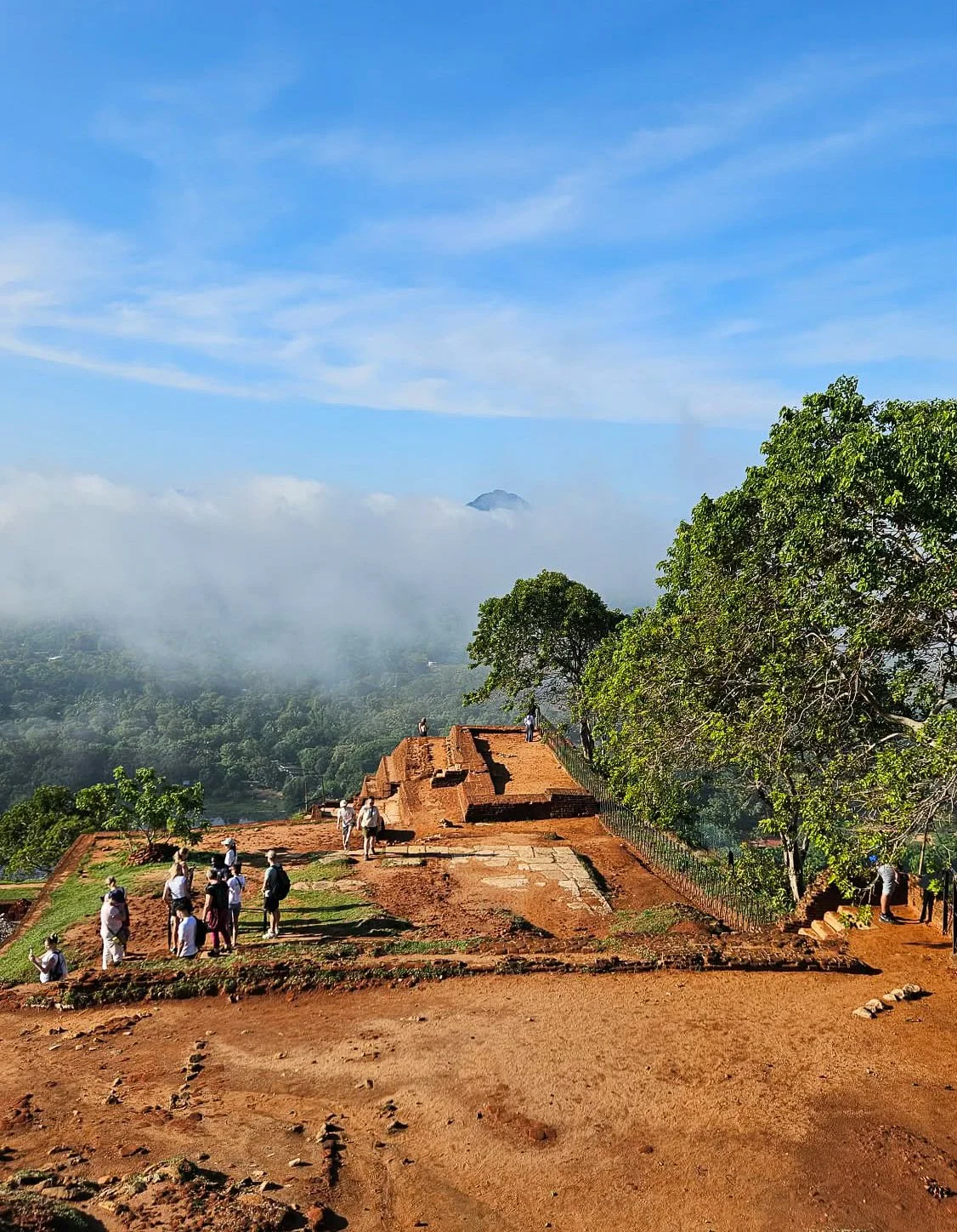
At the top, you can wander around exploring the ruins of the fortified palace and enjoying different vantage points along with some monkey spotting.
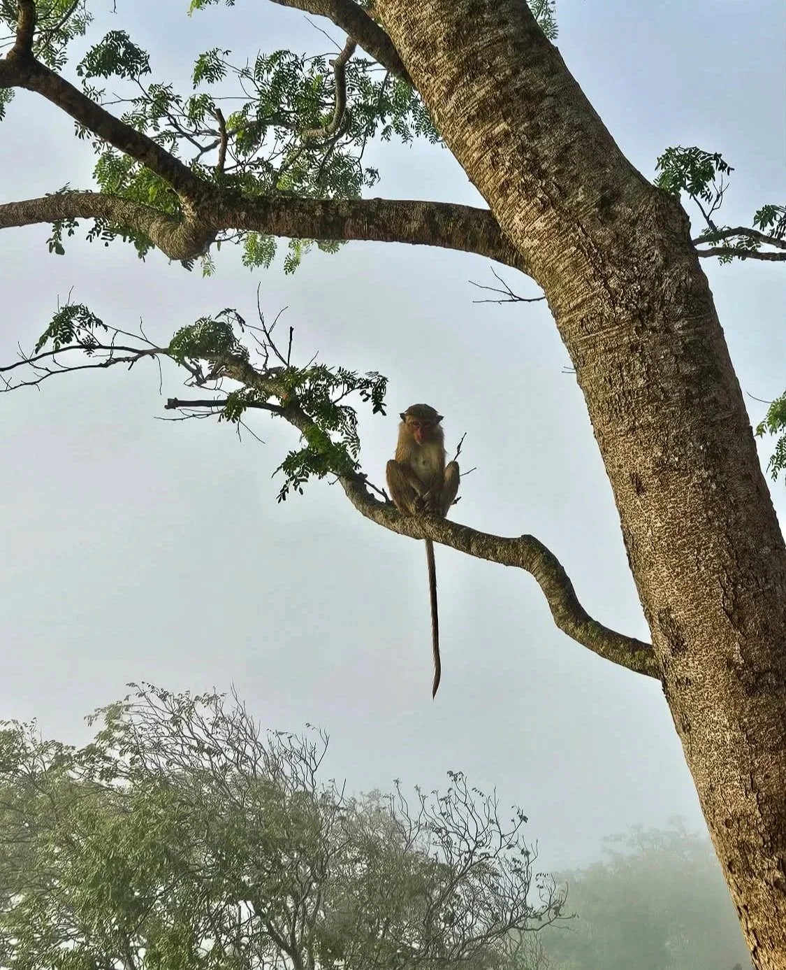
Misty Monkeys
The views from the summit are breathtaking – especially once the clouds clear!
On top of Lion Rock
Kaudulla National Park
On the advice of our driver (shoutout to Amila who also runs guided tours), we also made a spontaneous trip to nearby Kaudulla National Park.
We just booked an afternoon trip through our accommodation and didn’t regret it for a second.
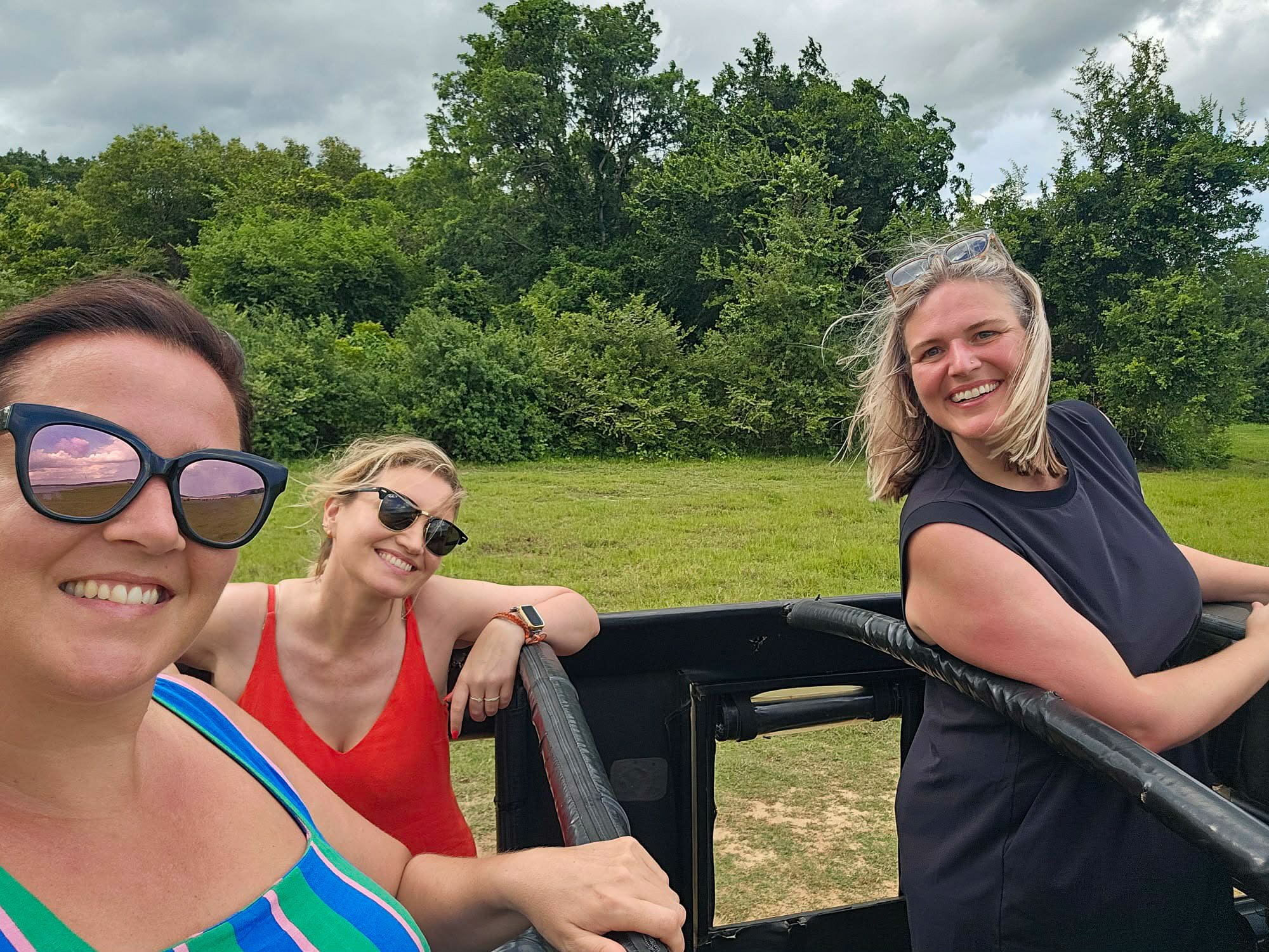
Open-top Jeep ride
This park is known for massive seasonal elephant gatherings around the ancient Kaudulla Reservoir, making it a prime spot for safaris, especially August to December. It is one of 10 parks in Sri Lanka where elephants roam freely.
Within minutes of us entering the park, we spied our first elephants in the distance, hiding in the brush.
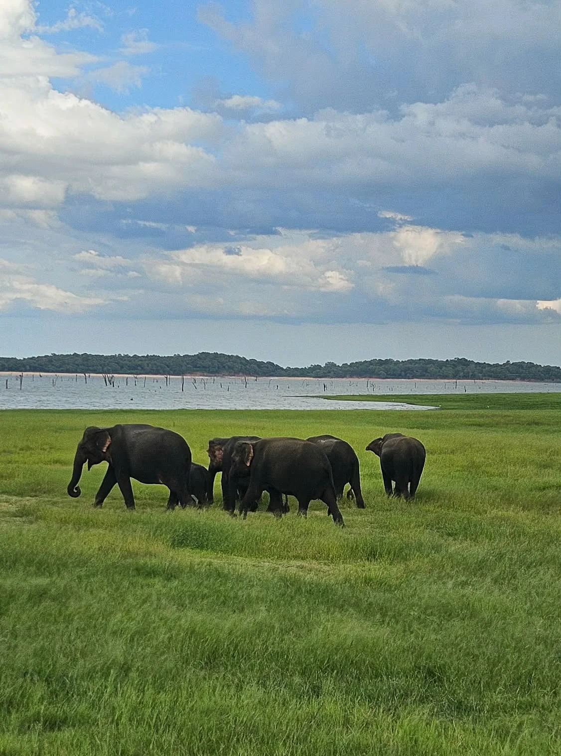
A small herd of elephants
Not long after that we saw a herd swimming, washing and playing in the water. We weren’t close but it was awe-inspiring to see.
We spent several hours admiring these guys at a respectful distance before making our way out of the park, passing bird and Langur monkeys too.

Elephant playing
On our drive back to Sigiriya, we passed several elephants on the side of the road… I guess they don’t know where the national park boundaries are!
In our spare time in Sigiriya in the heat of the day, we lazed by our accommodation pool and found cute spots to eat – some of which like Sigiriya Lion Face have incredible views of the iconic rock while you enjoy your food.
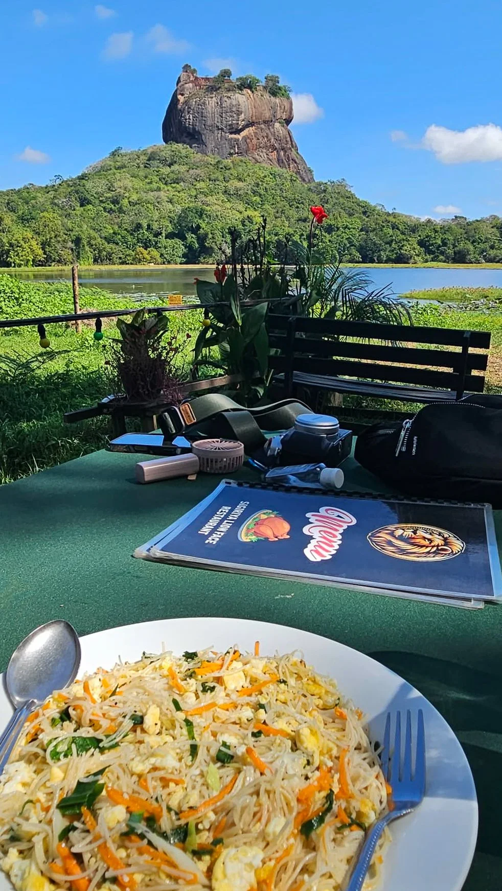
Lunch at Sigiriya Lion Face
Getting around was easy despite the town being so spread out, booking Tuk Tuks through our hotel was a breeze.

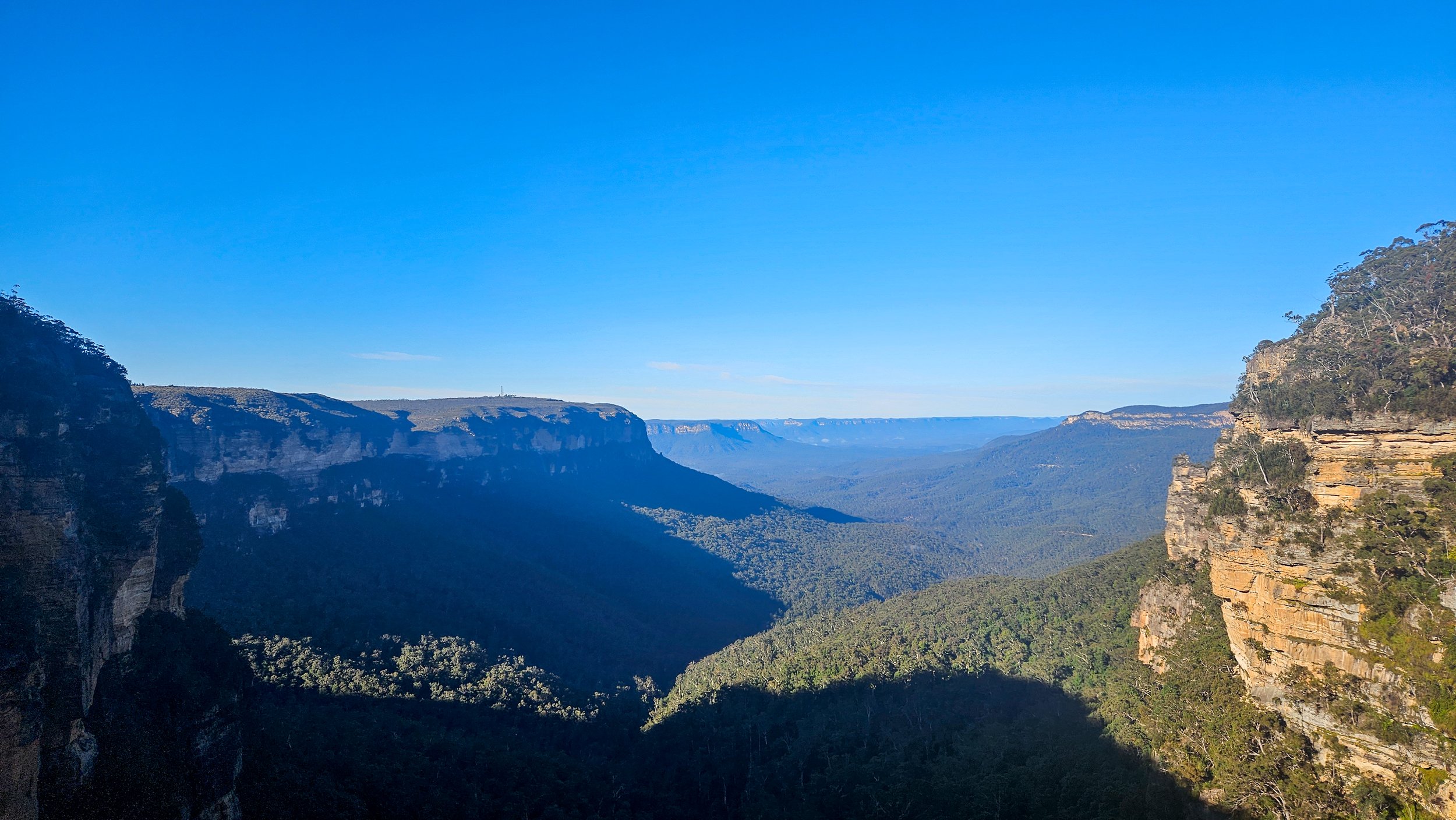
Chasing Waterfalls on the Blue Mountains Nature Track
There are so many walking tracks in the Blue Mountains National Park that it can be sometimes hard to pick one, but my driving force is always finding waterfalls and hidden rock pools.
Having traipsed along the Wentworth Falls trail several times, finding new a trail that offers up a secret swimming pool along the way was a big tick – enter the Nature Track.

Stopping for a selfie at the lookout
We started the circuit walk at the Conservation Hut (which meant we could finish there and enjoy a cup of coffee too).
The whole trail is about 3.5km long but don’t let that fool you, there are plenty of stairs to navigate and even better, some hidden treats just off the track.

Lush sections of the Nature Track
Stray just minutes from the formed path and you’ll find one of the most magical places in all the Blue Mountains: an incredible swimming hole at the foot of a canyon. You’d never know it was there which makes it all the more amazing – more on that later.
This walk has it all – epic views, lush ferns, waterfalls and tranquil pools. Heading out in the middle of July is great to get the blood pumping on a cold winter’s day.
Queen Victoria Lookout
We headed off in a clockwise direction which takes you to Queen Victoria Lookout after about 300m, offering up sweeping views of the Jamison Valley and a nice slow start to warm up the legs.
Not long after that, you will get to Empress Lookout where you will get glimpses of Empress Canyon and Empress Falls – your destination in the valley to see up close later on the walk.
From here, the descent becomes more noticeable and the stairways steeper. You will reach a junction where the Nature Track is signposted to the right, but it is only a 250m detour to the left along the Valley of the Waters Trail to explore Empress Falls.

Empress Falls
Just before you reach the bottom of the falls you’ll get a couple of great views of the top of Empress Falls. You’ll then come out of the forest and head along a path beside the falls, which has a metal handrail in place.
The base of the falls is protected by a handrail and the rocks around here are quite slippery but I imagine quite a few people duck under to have a dip as it is a stunning spot.
After breathing in the waterfall air, it is time to make our way back to the Nature Track and onto Lillian’s Glen and this is where you will find the hidden gem - Asmodeus Pool.

Asmodeus Pool
If you are not looking for this natural pool, you won’t find it and will walk right on by over Lillian’s Bridge.
Asmodeus Pool is a pristine little swimming hole which sits at the bottom of a narrow slot canyon, there’s even a waterfall that runs into it!
It's quite simply a dream destination and it’s nicely hidden away, despite being just moments from a popular walking track. It's not signposted and does require climbing over a boulder to access but then you have this magical spot all to yourself and it feels very private.

A chilly dip in the pool
We did a quick change into swimwear to have a (freezing) wild swimming experience. The pool isn’t deep (enough to dunk your head under) and it is kind of like a sandy beach so you don’t need to worry about rocks.
Our swim didn’t last too long in the roughly 2-degree water before it was back out and into our dry clothes for the hike back out.

Lillian’s Bridge
From Lillian's Glen the trail heads uphill and then you will pass through some impressive overhangs. The next rest stop (we needed it after going up the stairs) is Edinburgh Castle Rock Lookout.
This section of the trail is so different to the lush bush you have come through. It is an unfenced lookout on top of a rock formation, overlooking the northern part of the Valley of the Waters.

Edinburgh Rock
After this the path evens out (read: no more stairs) and you follow a fire trail all the way back to the Conservation Hut.
The walk itself is fairly easy, although of course this being the mountains, there are still quite a few stairs to climb so expect to get your heartrate up!
Stay nearby in Wentworth Falls and enjoy a longer break.

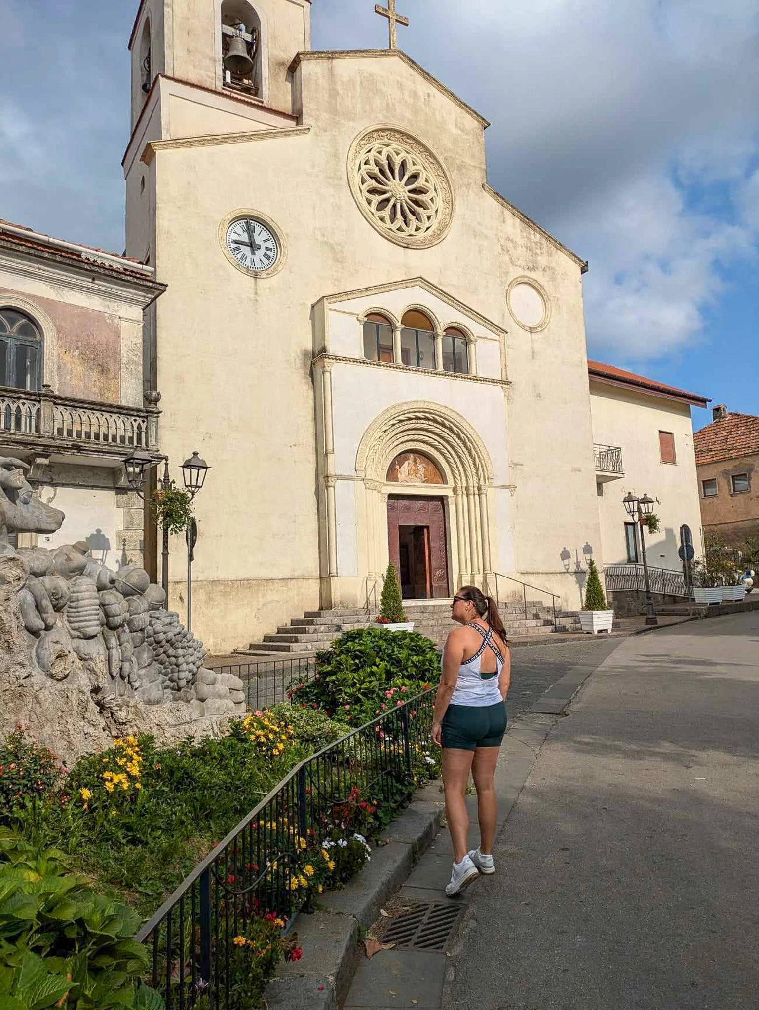
Why the Valley of the Temples should be on your Sicily itinerary
When you think of ruins in Italy, Roman is what springs to mind but tucked away on Sicily are temples that were there to worship the Greek gods!
Just like the Romans left their mark as far as Morocco, various coastal areas of southern Italy were once colonies of the city-states of ancient Greece; collectively, these were known as Great Greece. Culturally and linguistically, they were shaped and reflected the Greeks which is why are there lots of Greek temples in Sicily.

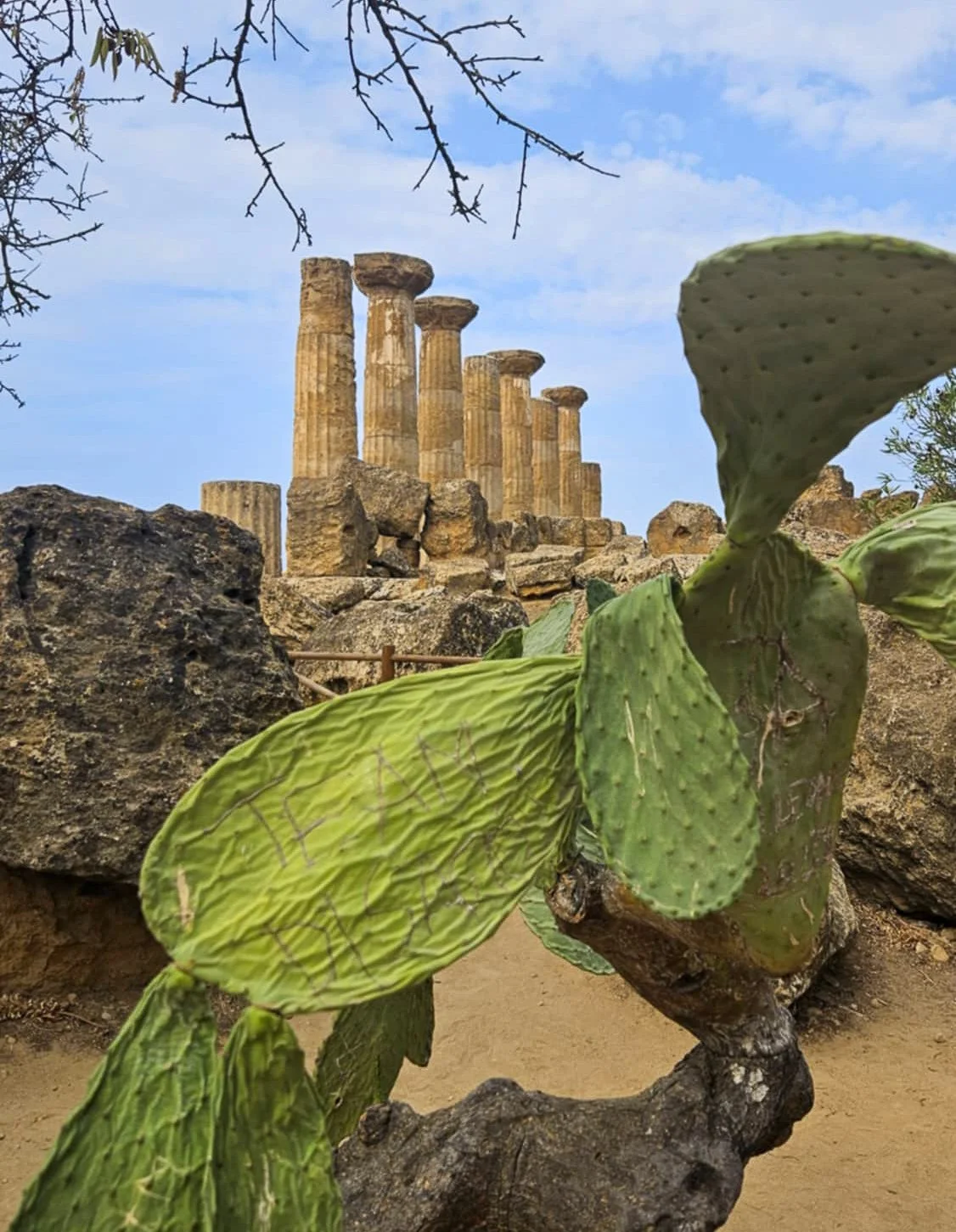
Perched on a hill just outside the Sicilian city of Agrigento, you will find the Valley of the Temples (Valle dei Templi). This UNESCO World Heritage Site is a sprawling archaeological park, spanning a massive 1,300 hectares.
Situated on the dry arid hilltops overlooking the penetrating blues of the Mediterranean Sea, these iconic temples have stood strong in the face of the winds, the invasions, the wars, the eruptions, and the shifting plates and political fortunes of Sicily.
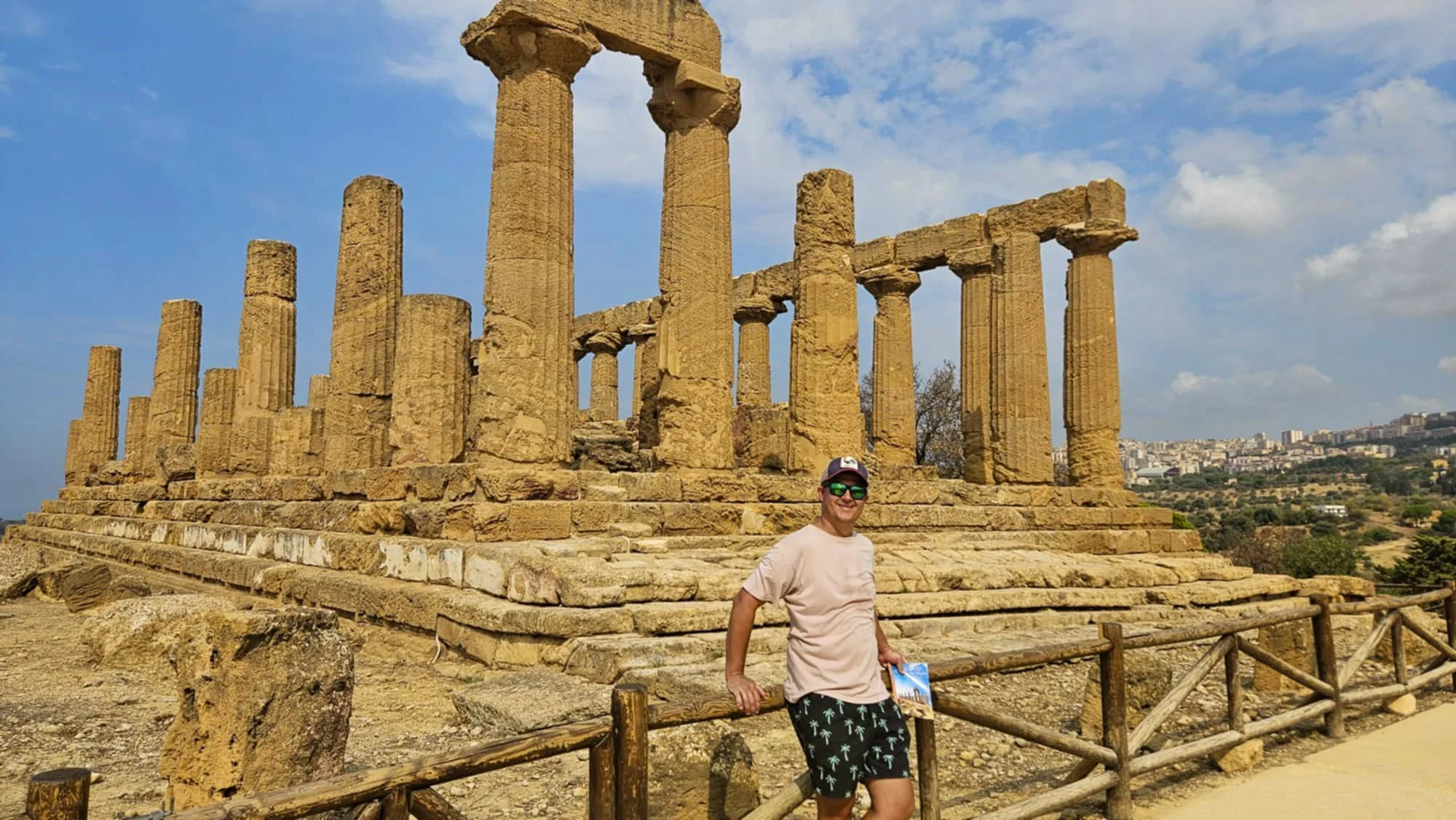
Some of the temples here date back to the 6th and 5th centuries BC and are in incredible condition. They are known as some of the best-preserved examples of this style outside of Greece itself.
The site at Agrigento is not a valley in fact, but a ridge, sitting 230 metres above sea level. The ancient temples stand looking majestically out to sea and the surrounding countryside, and as you drive around the area, you will spot sections of the ruins in the distance as if they are watching over you.

So, how do you get here to explore them? The good news is you don’t have to stay in Agrigento as the area is accessible. We stayed nearby at Maddalusa Beach just outside town so we could wake up to the sounds of the sea.
We hired a car as we were travelling around Sicily for about a week so access was easy, but you can also go by bus, train or tour from major cities like Palermo or Catania as a day trip.
Tickets are around $30 per person (€17).
The archaeological park consists of eight temples and various other relics, including the Temple of Hera, the Temple of Concordia, the Temple of Heracles, the Temple of Olympian Zeus, the Temple of Castor and Pollux, the Temple of Hephaestus and the Temple of Demeter.
While we there, they were setting up to film a movie of some sort, so we couldn’t see the massive bronze statue of Icarus laying on the ground in front of the Temple of Concordia up close unfortunately.
All up, we spent around two hours exploring and walking around five kilometres. Reading information on the ruins as we went after deciding to self-guide following recent guided tours in both Rome and Pompeii.

The route along the dusty path to all the temples and ruins is obvious, and quite well sign-posted so it would be quite difficult to get lost.
Opening hours are from 8.30am (early by Sicilian standards!) Closing time varies as it is extended during peak summer periods.

We were there in the middle of September and do not recommend visiting in the middle of the day as there is very little shade as you wander around. No matter the season, take plenty of water with you – a refillable bottle is a good idea. In the park, they have a number of drinking water fountains, so you can easily fill up as you explore and stay hydrated!

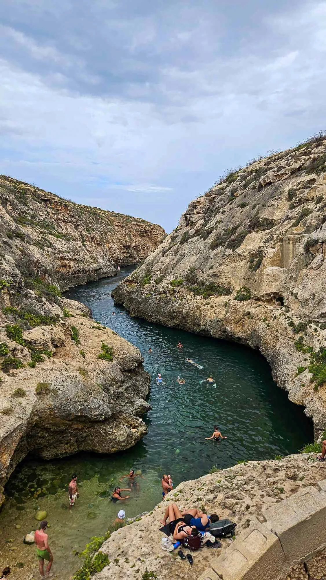
A day trip to Comino Island
Chances are, you have seen a picture or two of the Blue Lagoon.
This idyllic lagoon is found on Comino, a little gem of an island belonging to the Maltese archipelago, situated between Malta and Gozo.
It may be small, but it sure is mighty. Think stunning nature, crystal-clear turquoise water and hiking trails with breathtaking views.

Swimming at the Blue Lagoon
We took a day trip there while staying on nearby Gozo. A ferry trip will take you about 15 to 20 minutes and then the day is yours.
My advice is to go early. We just walked down to the ferry terminal in Mgarr Harbour and bought a ticket for the next boat over. Don’t lose your card for the return trip – they are colour-coded based on who you booked through and some of the ferries go back to different parts of Malta.

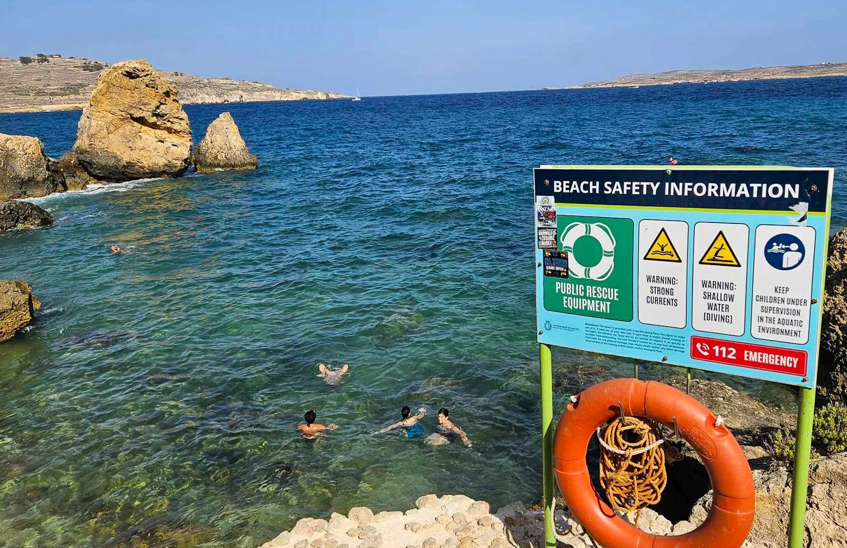
As soon as you get off the boat, you can’t help but notice this incredibly vibrant blue stretch of water – that’s the Blue Lagoon and it can be tempting to stay here all day but that would be a mistake!
We had packed plenty of water and a sense of adventure and decided to spend our day walking around the island exploring – we could then spend as much time as wanted at the lagoon before heading back to Gozo.

Looking down at the Crystal Lagoon
There are no cars on Comino, but also not really any signposts, so we just followed the paths in the direction we wanted.
The one downside of walking on Comino is that in summer, it was pretty warm and there is no shade on this wild and wonderful island, so we definitely got pretty hot.

Walking in the heat on Comino
Our first stop was the Crystal Lagoon – just a 15 minute stroll around the cliff. Much less visited as most people only come by boat, this lagoon is surrounded by dramatic cliffs, hidden caves and tunnels.
You need to be wearing proper shoes and scramble down the rocks a bit. We did some light snorkelling and explored some caves and tunnels before taking to the cliffs for a couple of rock jumps. I was a bit scared to go from the higher points but Aiden did it in style.

Jumping in style
From here we walked along the dramatic cliff edges towards the Santa Marja Tower. We could only admire this from a distance as it is currently closed.
This tower was built in 1618 to defend the island. It is visible from Gozo island and the ferry. Interestingly, in the 17th century, Comino served as a place of imprisonment or exile for errant knights.

Santa Marja Tower
From here we definitely wanted to explore some more and started to head along the coast towards Elephant Rock. About half way there, we realized it was too hot and we weren’t going to enjoy it so changed course and cut through the middle of island and made Santa Maria Bay our next stop.
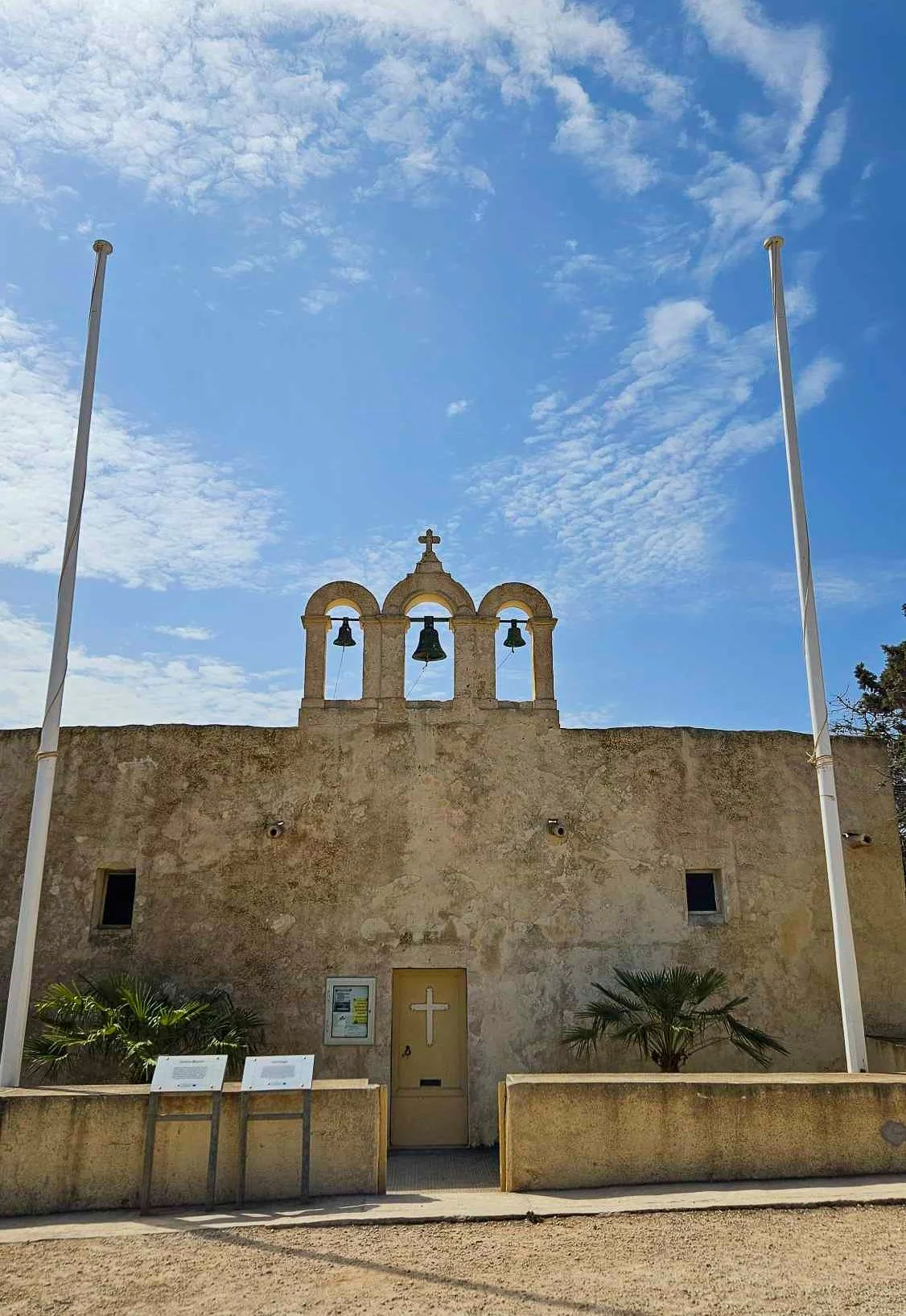
The chapel
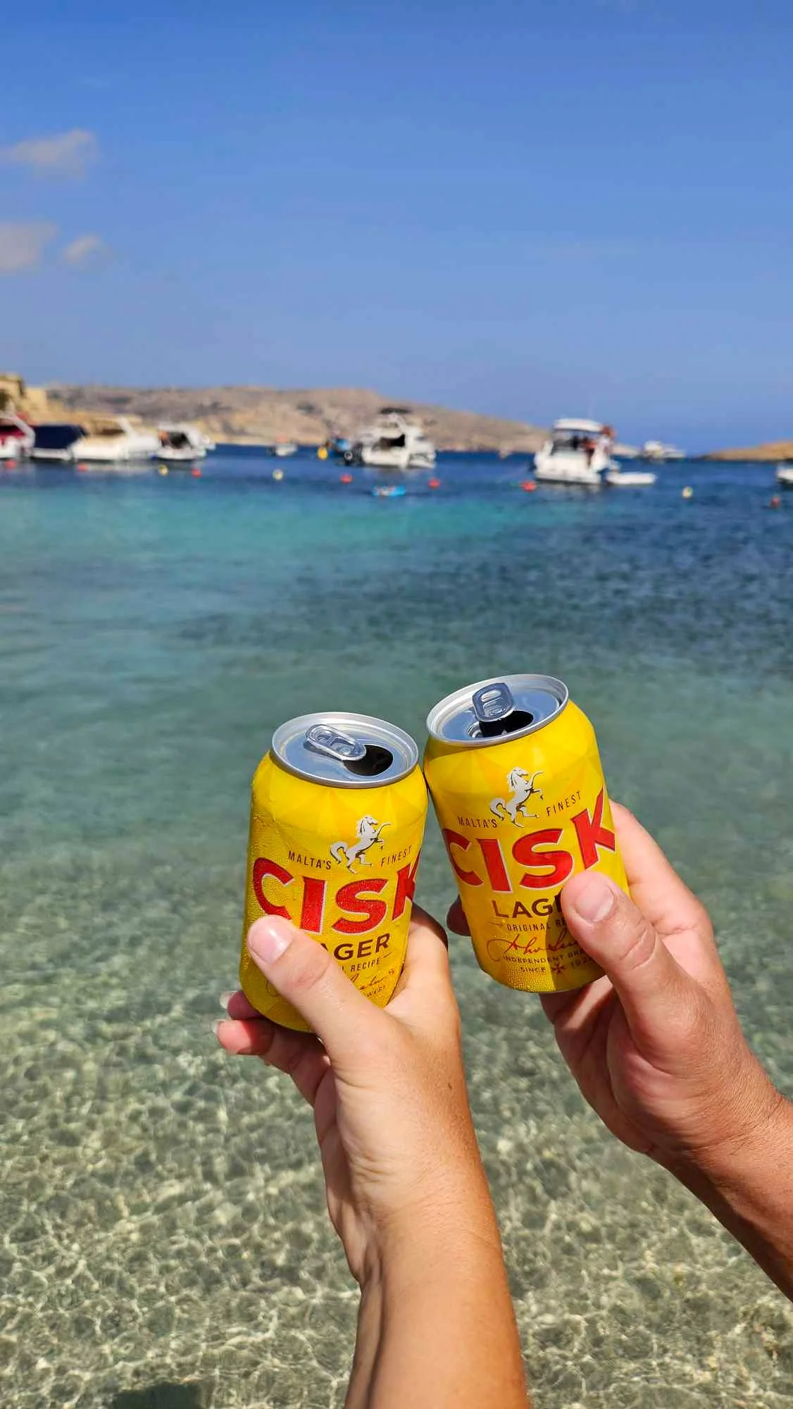
Passing by a chapel, we emerged to a gorgeous, protected bay for a beer and a swim.
After a refreshing break here, it was time to go back to the start.
Refreshing at Santa Maria Bay
We followed the coastline back and I am pretty sure this isn’t a path and would have been more direct to go back inland but it is an adventure after all!. It would be hard to get lost here but there is an abandoned resort that is fenced off and we had to walk our way inland around that but we made it.

Island views
As we walked back down towards the Blue Lagoon, there are loads of food trucks lining the hill. We picked one for a kebab and a beer and had lunch overlooking the bay.
You can hire chairs and umbrellas on the rocks from the attendants on the beach but that really isn’t our style so we ate perched on a rock – there is no beach here.
The long narrow bay of bright blue water is surrounded by a rocky landscape, but the smooth sand at the bottom of the water make you almost feel like you’re swimming in a pool – albeit a crowded one.

Heading back to the Blue Lagoon
We spied some rocky cave across the lagoon and went to swim for it. The current across the middle of the lagoon was actually kind of intense and then understood the need for the lifeguards.
The cave was cool – riding the swell in and out for a while and then we swam back. At this point, I was starting to feel a little crispy and it was nearly 4pm so we decided to grab the next boat back to Gozo.

Cave swims!
This was not as simple as it sounds! The tiny jetty handles all the boats and ferries heading to and from various parts of Malta and there is no way of knowing which boat is yours until it arrives and someone yells out which colour is to board. Our boat only fit around 10 passengers but it was still so hectic and there were people shoving and pushing – mostly trying to escape the scorching sun. To make matters worse, there is a swimming area there with limited access so that adds another couple of dozen humans to the mix.
Once back on our boat, we had an added 10 minutes of driving around some caves on Comino before zooming across to Gozo. They call this a ‘caves tour’ but there is no commentary from the Capitan and you have no idea where you are, but it was pretty to see from the water what we had seen from the cliffs above.

Rugged island views

Malta’s Gems: Exploring Gozo
Tucked away between Sicily and the North African coast, Malta is the ultimate Mediterranean escape and while small, the country is made up of more than one island.
The islands of Gozo and Comino to the north are hidden gems just waiting to be discovered.
We started our adventure with our bags on board a fast ferry taking us from Valetta to Gozo, docking in Mġarr – this is where we were basing ourselves for the next couple of days.

Elevated pool at Grand Hotel Gozo
The port in Mġarr looks small but busy and charming and I was glad to see some restaurants around, meaning we wouldn’t have to travel for our evening meals.
Having spent a couple of days exploring the cities on the main island of Malta, we didn’t want to be landlocked and felt this was a good base and checked into the Grand Hotel Gozo with views across the harbour.
After arriving, we immediately wanted to get out and explore so we headed for a coastal walk from the port along the cliffs to Gorgun Beach.
Gorgun Beach
I am not sure the word ‘beach’ really applies here but the walk was scenic and hot so there was no way we weren’t swimming.
Shoes are recommended as you make your way down some stairs and across some large and slippery rocks to make your way into the water. The day we were there, there was a bit of swell so had to be super careful getting back out.
The next day was the day to explore further afield. We had booked some a buggy through Gozo Quad Hire for the whole day. We self-drove but you can join a tour as well.
The guys came and picked us up from our hotel first thing in the morning and after a quick briefing, we were on our way.

Our ride for the day
The first stop was Grech’s bakery for a sweet donut and an espresso to fuel us for the day.
We had decided to do a lap of the island starting on the eastern side and heading north. This took us to Hondoq ir-Rummien where we stopped for a look around and enjoyed the view. We were there very early with not many people around and offering crystal clear water, but we were quite ready for a swim yet.

A moody morning at at Hondoq ir-Rummien
Next up, we headed down a winding road to Daħlet Qorrot Beach. I almost don’t want to share this spot because it was magical, and we could have spent all day here.
There were no other tourists, just locals out for their morning walk and swim and a few people learning how to dive.

The most inviting water at Daħlet Qorrot
The word hidden gem gets thrown around a lot, but this beach truly lived up to the phrase. The pebbly cove is surrounded by lush countryside and bordered by carved cliffs resulting in the perfect sheltered bay for swimming and snorkelling. The peace and the quiet here without shops or buildings is unmatched in the Mediterranean.

Rocky views at Daħlet Qorrot
After dragging ourselves out of the sea and on our way, knowing that our buggy maxed out at 50km/h and while small, we wouldn’t make it around the whole island if we dallied too long, we headed for Ramla Beach.
Passing a vineyard on our left and stalls on our right, we headed down a straight, flat road – such a novelty for the island and ended on rich red sand.

The red sand of Rambla Bay
This beach was much more developed and busier than where we had just left so we felt we didn’t need a swim (plus the sand was scorching hot) so walked down for a look and then headed back for a refreshing beer overlooking the calm ocean in front.
By now, I was getting a little hungry, so we pulled up in Marsalforn for some lunch. We opted to find a spot away from the restaurants lining the bay and tucked into some incredible Thai food a couple of streets back.
Long before visiting Malta, I had seen images of Xwejni Bay and the salt pans but nothing prepares you for seeing it in real life.

Selfie at the salt pans
The Xwejni salt pans stretch three kilometres along the coast and have been used for more than 350 years. A salt pan is a shallow reservoir dug out of limestone rock to collect seawater. As the water evaporates, white salt crystals remain. The crystals are then dried and packed into salt pouches – collected about once a month in summer and it is incredible to see it in action.

Salt pans
After exploring here (from a distance as you cannot walk on the pans themselves), we headed to another spot I absolutely had to see for myself - Wied il-Għasri.
Driving down a dirt road and parking wherever we could find a spot out of the way, we headed in the direction of the sea. Before you make it, you can see a fissure in the land ahead.
Wied il-Għasri
Wied il-Għasri resembles a canyon and stretches 300 metres inland to a tiny pebble beach. To get down, you walk down about 100 steps carved into the porous walls of the sandstone.
Like most, we have to stop in awe as the winding bay appears before us on the way down. Towel down and slow stumble to the water’s edge across the soft pebbles (we had no water shoes) and into the clear bay we float.
Over the years, the swirling sea has carved out the sides of the gorge, creating caves and pockets beneath the water's surface. We swim almost to the mouth of the gorge but, feeling the pull of the current on our toes, stay safely away from the wide-open ocean.
After a relaxing swim (although it was quite busy when we visited in peak summer), it was on to what would be our last stop for the day.

Swimming near Dwerja
If you google Gozo, you will probably see images of a rock arch over the sea. Unfortunately, the 28m tall Azure Window collapsed into the ocean in 2017 but this part of the coastline is still spectacular and worth a visit.
In addition to the Inland Sea – a natural sea pool connected to the sea by an 80-m long tunnel – this exposed part of the north-western coastline is dramatic and wild. It was also a filming location for season 1 of Game of Thrones!

Inland sea and cave entrance
We wanted to make a stop at Xlendi Beach and Victoria on the way back to our hotel but we had run out of time needed to return the buggy! We drove slowly through Victoria to get a sense of the city and got back just on closing time and the guys dropped us back to Mġarr so we could refresh and have a cocktail while we relived the day’s highlights.
It is crazy that you can fit so much to see on one tiny island and we didn’t even get to explore it all!

Dinner views in Mġarr

Traversing the breathtaking Path of the Gods
The Amalfi Coast in Italy is stunning from any angle but hiking along the clifftops of the Sentiero degli Dei (the Path of the Gods) offers up unbeatable views.
The official path runs from the small mountain-top town of Bomerano and finishes in Nocelle but you can continue (as we did) down the 1700+ stairs to end up 500 metres below in bustling Positano. Just prepare your legs for that finish!
It is recommended to do the hike in this direction to make the most of the views but also as this way has less uphill so is a little easier on the legs.
Appreciating Bomerano
This has to be one of the most beautiful walks but honestly, it is probably not for the faint of heart in the Italian summer heat and there is some up and down as you hike along.

Spectacular views along the way
We did this hike in August 2024, and it was HOT. We caught one of the first morning buses from Amalfi town to take us the 40 minutes up the winding mountain roads to do as much of the hike before it got too hot.
The only catch with this early bus is that we did have to hunt to find a place that sold bus tickets at that time, we ended up finding a café in Amalfi that sold them but only if we grabbed an espresso as well – cash only too for those that are wondering.
The bus dropped us near the main piazza of Bomerano and we grabbed a mozzarella roll and another espresso to fuel us for the walk ahead.

Breakfast in Bomerano
You walk out of town a little to the official start of the trail. From there, the trail is easy to follow—look out for the red and white lines that mark it along the way. Follow signs for Sentiero degli Dei, trail #327 and after about 800m you will be at the official entry to the hike.

The official start of the Path of the Gods
We had a day of bright sunshine and there isn’t too much shade along the way. I was grateful we had packed loads of water and sunscreen with us for the morning out.
The trail itself is a mix of graded dirt and gravel trails, up and down large stone steps, and over rockier, uneven trails – we were passed by a herd of goats that are clearly more accustomed to this kind of terrain!

The path is right on the edge
About two kilometres in, there is a fork in the road, an option for those that are truly afraid of heights to take a slightly different path to Nocelle. The main cliff path with the spectacular scenery is #327, and #327a will take you on a less exposed path.

Epic views
This is where the trail really delivers the views. We really took our time over the next couple of kilometres, soaking up the Amalfi Coast vistas. The dramatic peninsula seems to stretch forever in the distance.
Alongside the breathtaking clifftop, we passed by terraced farms, lush vineyards, and fields of wheat.
Along the way, there are a couple of water points and picnic benches were excellent places to stop for a breather and enjoy the views. We actually stopped at what felt like just after half way for a frozen lemon drink at what looked like a shack on the edge of the cliff. I later discovered that this eclectic construction is called Ulisee’s House and was perfect for cooling off a little in the shade.

Inviting us in for a cold drink…
As we got close to Nocelle, we could even see the Island of Capri in the distance.
Nocelle is a tiny village but we stopped at a little restaurant/bar as we entered the town that offered incredible views. A couple of cold beers at Il Chiosco del Sentiero Degli Dei were just what we needed before tackling all the stairs to Positano.

A beer with a view in Nocelle
Thankfully the views on the way down are worth the burning quads but I did have to stop a few times to take a little break.

Directions are easy to find
Once you reach the bottom of the stairs, you actually have to walk along a part of the winding road to get to Positano. I probably found this the most stressful as there is no footpath and the road seems barely wide enough for one car!

Some of the stairs down to Positano
After a day of seeing very few people, the teeming masses as we encountered as we walked in to Positano was a little overwhelming. We stopped at a restaurant along the way to grab a bite to eat and another cold drink. I couldn’t even tell you the name.
We wandered around for a little bit before deciding we needed to head back to our quieter side of the coast. This meant again braving masses of people to find the right ferry to take us back to Amalfi town where we jumped in for a swim before walking back through the pedestrian tunnel to Atrani.

Positano
In my opinion, the Path of the Gods is definitely worth hiking. It’s a beautiful trail that gives you a different perspective on the stunning Amalfi coastline, and if you start early, it’s also a peaceful escape from the crowds that seem to be everywhere in the busy summer season.
The stats:
From Bomerano to Nocelle, it is about 6.5km and should take about two to three hours.
If you are adding the steps down to Positano, allow at least an extra half an hour to an hour as the elevation drops from 450m to 80m.
Total Ascent: 235 metres
Total Descent: 780 metres
Highest Elevation: 650 metres
Lowest Elevation: 80 metres

Cruising Atherton’s Waterfall Way
About an hour out of Cairns, there is a tropical wonderland that has nothing to do with the Great Barrier Reef. And no, I am not talking about the Daintree Rainforest – amazing as that is.
I have been to Cairns many times but never explored the Atherton Tablelands – specifically what is known as the waterfall circuit.
This area is a natural playground of tropical forests, volcanic crater lakes, and rivers rushing towards the coast to create a wonderland of incredible waterfalls and I couldn’t wait to explore them.
We started our day trip after a coffee by heading to probably one of the most Instagrammed waterfalls in the area - Millaa Millaa Falls.

Arriving at Millaa Milla Falls
We got there early and managed to almost have this spot to ourselves to admire the 18-metre drop. It’s not too much of a swimming spot as the water is very shallow until right near the falls but it is awe-inspiring to soak in the majesty of nature.
Access is pretty easy from the top carpark down a short stone walk or if you have mobility issues, you can get to the viewing platform from the bottom carpark.

The Instagram-worthy Millaa Millaa Falls
Our next stop was just down the road at Zillie Falls where we were a little disappointed with the views from the platform.
Access to the platform is pretty easy, across the road from the carpark (but with no crossing so be careful!)
The view is quite restricted, not really looking down at it, but not looking across it either, it’s yet another view that doesn’t allow you to take in the waterfall’s full beauty.
We weren’t able to uncover any sort of official track down to the base of Zillie Falls and given we were there smack bang in the middle of wet season, it didn’t seem like a good idea to try and scramble down the rocks.

Ellinjaa Falls
Our final waterfall on the ‘official’ circuit was Ellinjaa Falls, and it was probably my favourite.
A short zig-zag walk from the carpark brings you out to a beautiful view of the falls. To get in the water for a swim, you do have to carefully walk over the shallow rocks to get to a space deep enough to swim.
We ended up having this beautiful waterfall all to ourselves, laughing and squealing as we swam through the powerful falls to discover a private cavern behind, unable to hold a conversation because of the thunderous noise of water crashing down from 12 metres above.

Playing behind the falls at Ellinjaa
On our drive back to Cairns, we detoured to check out Josephine Falls. The walk to see this incredible feat of nature is a bit longer – around 1.2km – but it isn’t strenuous and the surrounds are lush and rainforesty.
Josephine Falls is a popular tourist spot with a natural waterslide drawing people in.
Unfortunately for us, there would be no swimming (or sliding) down these falls for us as the water levels were dangerously high after crazy rainfalls the week before we arrived.

Powerful Josephine Falls
Nationals Parks have even installed an alert system here with closeable gates and coloured lights to indicate when water levels aren’t safe –people have lost their lives. With too much rain it becomes dangerous to swim but the tradeoff comes in the ferocious views, the loud screaming torrent and the furious deluge you are able to witness.
Deciding we needed one last swim before retiring from chasing waterfalls for the day, we drove just down the road to Babina Boulders and the Devil’s Pool.
The Devil's Pool walk is a 1.3km return walk along Babinda Creek downstream from the Babinda Boulders picnic area and carpark. The walk isn’t difficult, slightly undulating along a rough bitumen track, the walk leads through the rainforest to two viewing platforms where the creek cascades down a series of spectacular waterfalls, granite boulders and washpools.

Frolicking at Babinda Boulders
There is no swimming down this end of the creek, despite how tempting the deep pools amongst the boulders look. There’s a barrier on the lookout point and warning signs about the dangers of swimming here.
After walking back, take a different turn from the carpark and you will find one of the calmest and most beautiful swimming spots. I could spend a whole day here.
Imagine a beautiful creek with crystal clear water that weaves around huge boulders. Even during the hottest days in summer, the water here is still quite cool and perfect for a refreshing swim.
We found a rushing current we could jump into and float along before getting back out and doing it all again like the big kids that we are.
While we didn’t visit on that same day, the day we were flying out, we made an effort to see one last waterfall.
Crystal Cascades is a series of water holes and waterfalls along Freshwater Creek in the Baron Gorge National Park, 17 kilometres from Cairns.
An easy 1.5-kilometre walk along the creek will bring you to several cascading waterfalls and a large swimming hole and the morning we went, we had the place to ourselves!

Crystal Cascades
We didn’t swim at the top end of the falls with the rushing water looking a bit too intense but jumped in for a dip at one of the swimming holes we had passed on our way up to the lookout to cool off from the March humidity.
If you are looking for a unique waterfall experience in the area, Emerald Creek Falls is amazing!