


Riad Utopia Suites & Spa, Marrakech
Marrakech is a bustling, busy city surrounded by desert and the snow-capped Atlas Mountains.
After a day exploring the Medina, haggling for lamps, rugs and jewellery, and admiring the live thatre that unfolds daily in the Djemaa El Fna square, there is nothing quite like a quiet space to retreat to and relax in. This is where Riad Utopia Suites & Spa, Marrakech steps in.
A riad is a traditional Moroccan house, generally speaking built around an internal courtyard or garden. Ssome – like Riad Utopia – even feature an internal plunge or swimming pool.

Riad Utopia definitely lives up to the name and is a true oasis hidden within the centre of Medina – though it may take a little extra effort to find it!
On arrival, mint tea and biscuits are served by the pool while you check in which is so nice after carrying our bags down a narrow alley to get to the entrance.
The interior design is a mix of traditional Morocco style and modern elements with plenty of bright white spaces that are so soothing after the hectic life in the Medina.

With only nine rooms, life at the Riad is never very busy but if you really want some extra solitude, with incredible views, the rooftop terrace is huge and filled with lounges. You can admire the Atlas Mountains off in the distance or just relax with a book. You will even find some privacy curtains around the lounges to make it even more secluded. There isn’t a lot of shade on the roof through and our visit was in August so long stays were avoided due to the searing heat!

Each room has a name instead of a number which is a nice touch and they are all designed slightly differently. Our room was Clair de Musc, filled with a queen bed and an ensuite. Not huge but perfect for our needs as we spent most of our time out exploring Marrakech.

Clair de Musc suite
The locks on the doors are massive with antique style keys which are quirky but not super convenient to carry around. Luckily, you can leave them at reception to lighten your purse.

The water in the shower was a little cold but given it was over 40 degrees outside most day, it was kind of refreshing!
There is also a spa onsite but we didn’t try it. We did eat the simple breakfast including fresh orange juice and yoghurt along with the various breads that seemed to be served with every meal in Morocco.
Riad Utopia feels a world away, but this tranquil stay is less than a 15-minute walk from the square and the souks. If I even make it back to Morocco, I wouldn’t hesitate about booking myself a couple of nights back in this oasis.


Robinson Falls: Nambour’s secret waterfall
I have spent the last couple of years exploring my new home here on the Sunshine Coast, but it wasn’t until recently that I discovered that Nambour was actually home to a waterfall of its very own.
Tucked away not too far from the hospital is a small area of bushland in suburbia – Cilento Park. The park itself is found at the end of Waterfall Road – a hint of what you might find if you explore a little further.
At the entrance, you will find a large open parkland, picnic tables, BBQ facilities and play equipment – perfect for that post-waterfall picnic.
On either side of the park and you'll see tracks that lead to a bush backdrop, rocks, streams and a waterfall.

The track is actually a short loop – less than 1km – and after rains you will probably have to hop over the creek at the bottom to complete the loop.
On my first visit, we opted to take the track to the right of the park which heads down the hill and crosses over Tuckers Creek at the bottom of the falls, before winding our way up to the top of the waterfalls and back to the park.

On top of the falls
The rocks at the bottom can be a little slippery in the rainforest-like conditions, so watch your step.
It’s a relatively easy and short bushwalk and dogs are welcome on a lead.

At the base of the falls the surrounding bush is quite lush, with a sub-tropical feel. We felt like we had the place all to ourselves.
The waterfall is officially called Robinson Falls and was named in honour of early settlers and brothers Edmund Alfred and Arthur Campbell Robinson.
It was amazing to feel so far away from civilisation but to be so close to Nambour!

Looking for more waterfalls? The Sunshine Coast has plenty. Check out Gardners Falls, Mapleton Falls, or Gheerulla Falls!
Find your next Sunshine Coast stay here!

Finding Sunrise
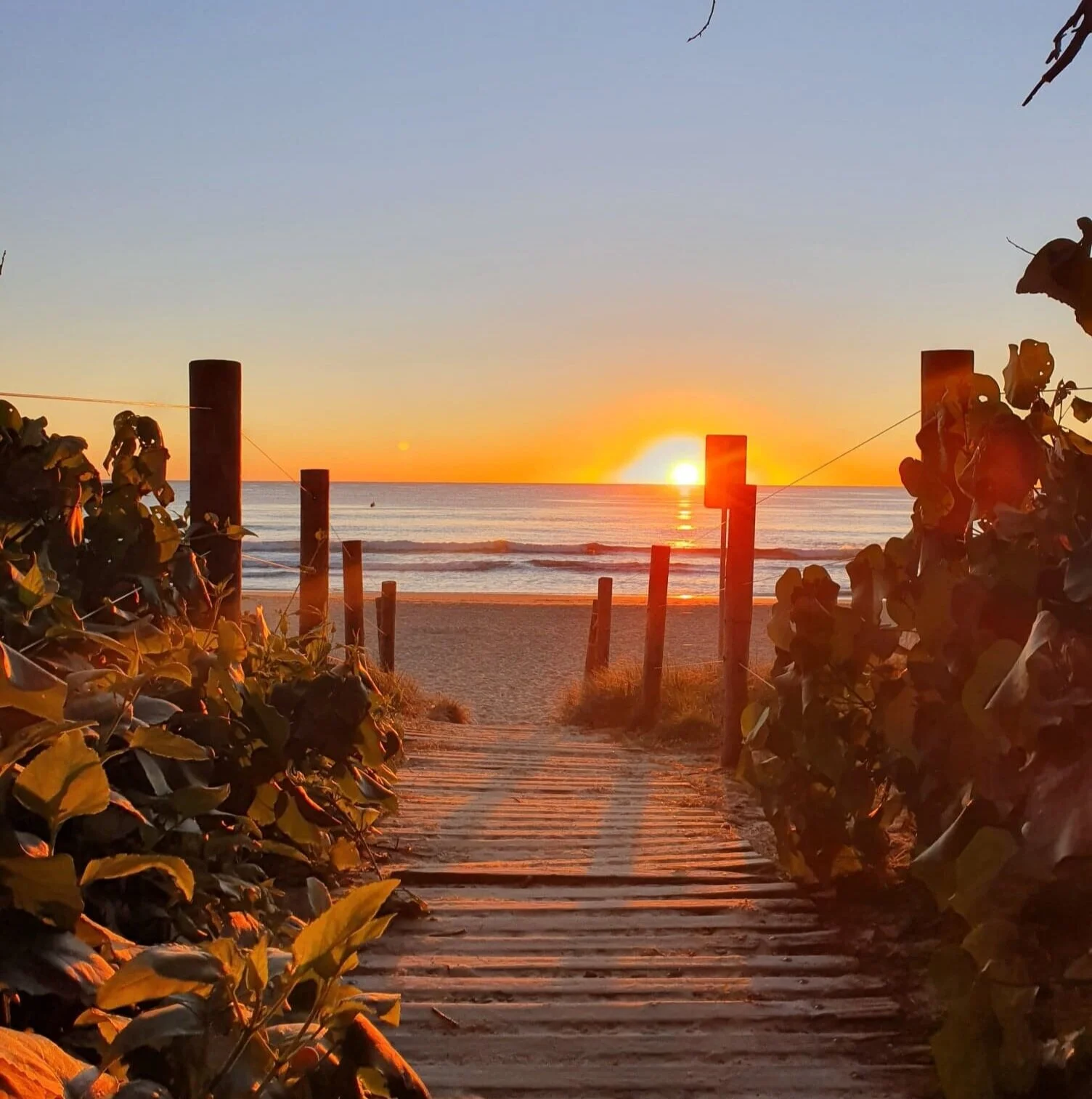
Being on the east coast, the Sunshine Coast gets way better sunrises than sunsets – unless you find a nice spot at Noosa Main Beach in autumn or summit one of the Glass House Mountains for a bird’s eye view.
Luckily, I am a bit of a morning person so getting up to spot sunrise is something I relish – albeit not during Queensland summer when the sun gets up around 4am!

Here on the Sunshine Coast, we are lucky to have some of the world’s best-kept beaches where you can enjoy that small window of time each day where dark becomes light.
The best bit is that generally you only have to share the view with a few other early risers unless it is Anzac Day!
Here are a few of my favourite sunrise spots:
Mudjimba
Watching the sun rise above the horizon and over Old Woman Island is one of my favourite ways to start the day!

Grab a coffee from High Tide or the Island and watch the surfers catch waves as the sky changes colours. The most dramatic colours are usually just before the sun actually comes up, and I love walking down the beach and soaking it all in as the waves lick at my feet.
Maroochy River
One of my regular morning running spots is along the Maroochy River from Fishermans Rd to Chambers Island.
During autumn and winter, the still river water reflects the colours of sunrise in the most beautiful way that I inevitably stop and take photos at different points along the way – quite often using my dog as a model.

One of the best spots to stop is near the quaint boathouse jetties jutting out over the river or standing on the bridge over to Chambers Island watching the kayakers and SUP-ers paddling in the changing light.

Mooloolaba
Every morning without fail, the Beach Bums take to the calm waters at Mooloolaba for an ocean swim. I enjoy getting there a bit earlier and watching the sun rise over the lighthouse at Pt Cartwright in the distance before jumping in the water.

The stretch of sand can get a bit busy here - even before 6am – so I tend to walk further down towards the point to enjoy the scenery on my own.
Sunrise Beach
It should come as no surprise that a beach named after the event is a good spot to see sunrise!
Jutting up against the Noosa National Park, Sunrise Beach’s endless stretch of white sand and pristine rolling waves make it the perfect spot to soak up the earliest rays of sunshine. Take a picnic blanket and get cosy on the hill and watch the show.
Mt Coolum
Start the little day with a hike up Mount Coolum and you’ll be rewarded with a great vista to watch the day start out, with views extending from Noosa National Park to Caloundra, as well as the cane fields and Maroochy River.
Early morning is one of the best times to climb Mt Coolum, before the heat of the day and before the crowds turn up. To catch the sunrise from the summit, you’ll want to start pretty early and take a torch.
Where is your favourite spot?

Ewen Maddock Dam
Nestled in among 200 hectares of lush state forest at the foothills of the Sunshine Coast Hinterland is Ewen Maddock Dam.

The dam itself is about three kilometres from Landsborough and not hard to get to by car.
Along with fishing and swimming, there are shared trails for mountain biking, walking and even horse riding.
Fishing from the water’s edge is a popular pastime with the dam stocked with Australian Bass, Yellowbelly, Mary River Cod, Saratoga, Tandans, Spangled Perch and Eels.
At the starting (and finishing) point there is a small carpark where you will find playground facilities for the kids, picnic tables, shelters, free BBQ's and even a swimming area with a sandy beach are all there for you to take advantage of.
In total there are nine kilometres of trails in one direction and the path is generally pretty shady and can be muddy after rain and I would recommend taking some water with you.
We started out on a long walk - around 12km return for us – partially circumnavigating the dam.

The first part of the track starts with a wooden boardwalk and follows the edge of the lake before heading inland along what feels a bit like a fire trail. You pass through tall stands of Eucalypts and other forest trees as well as groves of palms and paperbark trees in wetlands that are buzzing with vibrant blue and burnt red dragonflies.
After a rainy period, I would probably prepare with some bug spray too.
The path itself undulates little but there aren’t too many big inclines making this is a pretty chilled out walk. With no powerboats allowed on the lake it’s a quiet, peaceful stroll and not too busy, especially the further you go.
There is plenty of bird life both on the dam and in the woodland, we spent some time admiring the small birds flitting through the trees.
There are a few tracks that branch and loop off the main route, but it is all well signposted and I think you would struggle to get lost.

I have also taken my niece and nephew for a bike ride here, there are a couple more hills at the beginning on bikes as you can’t head out on the board walk but then it evens out. The roped-off swimming spot was a great way to cool off after working up a sweat on the bikes.
As it is not a National Park, animals are allowed! We have taken our pup here for long walks on several occasions. Dogs have to be on-leash, but he did meet his very first horse along the shared trails.


The Blue Holes of Vanuatu
The islands of Vanuatu are full of amazing and picturesque places to swim, but the Blue Holes hidden on Espiritu Santo are next level.
Close your eyes and imagine a natural pool, enclosed by jungle and filled with crystal-clear, pure water so blue you will think it came out of a bottle and that is what you will find.
Some of the holes are the product of freshwater springs trickling from the belly of the islands’ mountains, while some oscillate with the tide, filling with fish that dart in their crystal depths like wondrous, native aquariums.

Nanda Blue Hole
We visited two of the three main Blue Holes on our trip to Santo and I wish we had more time to experience them.
If you are planning a visit of your own, don’t forget to take some cash with you, there’s often an entrance fee that helps cover the amenities provided by the local owners.
Nanda Blue Hole
Our first experience of the stunning Blue Holes was at Nanda – also known as Jackie’s Blue Hole. We exited off the main road heading north out of Luganville and we could have been anywhere!
After paying the entrance fee, we walked a few metres from the carpark and the blue of the water in front was almost overwhelming.
We were lucky enough to have the place to ourselves, and our driver Tusty grabbed some stale bread from the car to show us the size of the fish swimming in this hole. They swam to us as if from nowhere.

Fish coming for a feed
Looking into the water from the convenient boardwalk, you could be forgiven for thinking it isn’t very deep, but the pool is actually 13 metres at its deepest point, and you can see all the way to the bottom.
We had our snorkels with us and spent a good half-hour exploring and cooling off in the clearest blue hole on Santo.
Matevulu Blue Hole
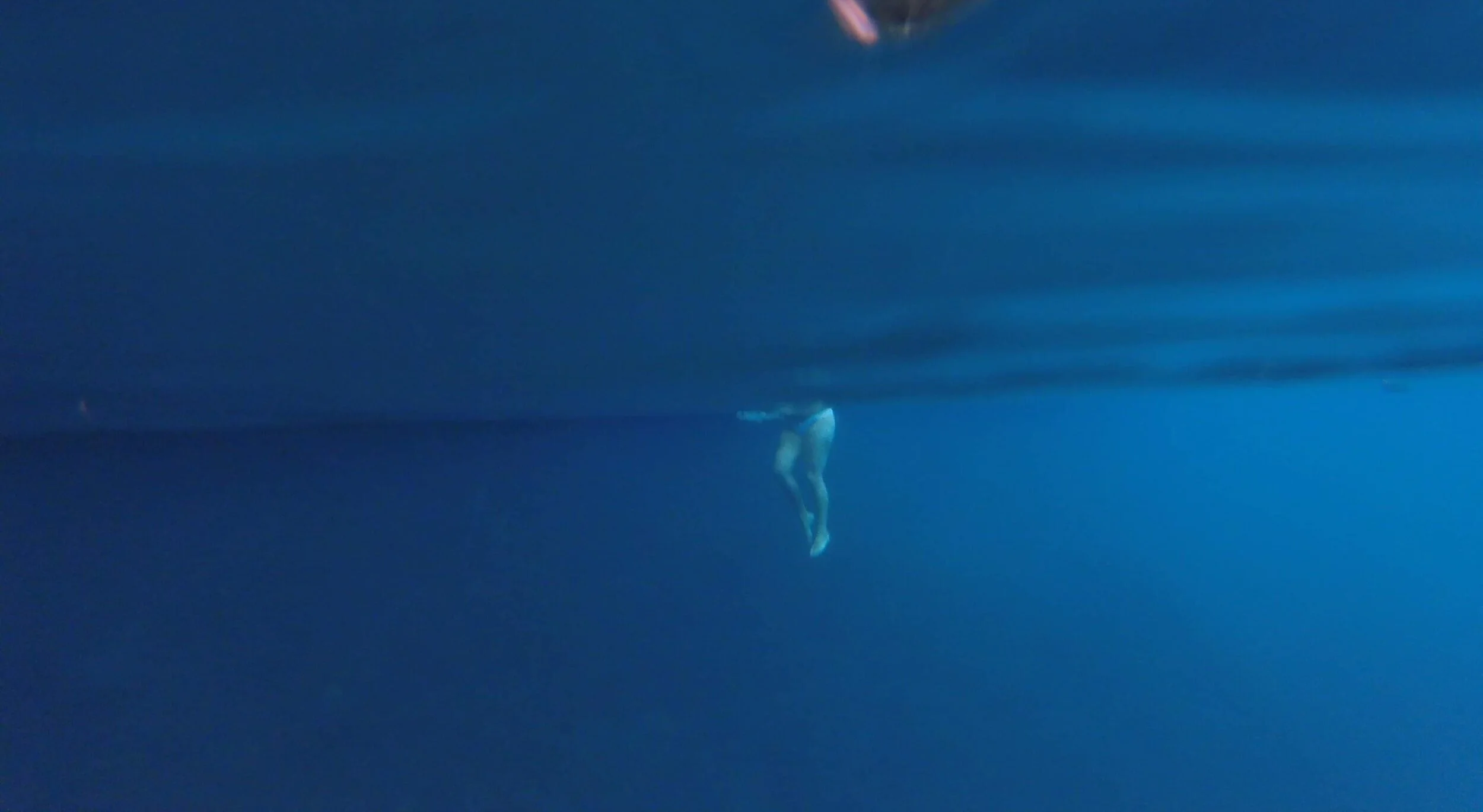
There are a couple of ways to get to Matevulu, by car or by kayak from the river mouth. As we could hire kayaks from our lodge, we opted to paddle for an hour to check out this stunning spot – the largest of the blue holes on the island.

Kayaking to Matevulu
Once we actually managed to get to the river mouth (a lot of hard paddling into the wind), the paddle was actually half the fun of this day, watching the water change from salty to fresh along the 3.5km crystal river. On the paddle in we didn’t see anyone else on the water – such a peaceful experience.
The water at this hole isn’t as blue as at Nanda, but it does have some other things working in its favour.
Underwater at Matevulu
In addition to the clear water and freshwater fish, there are two rope swings for a bit of an adrenalin rush. One is hanging from a massive Banyan tree with a wooden ladder to access it, and the other hangs out from a wooden platform.

Rope swing at Matevulu
We did share this visit with a load of cruise ship passengers so it pays to be aware of when these are docking as it does impact the experience a bit.
Riri Blue Hole
We didn’t visit Riri Blue Hole on our visit given all the other things we wanted to do on the trip. We opted out as this is the closest one to Luganville and a further paddle from our lodge.
The Riri Blue Hole is less developed than the Nanda Blue Hole. A small concrete walkway only surrounds one edge, while the rest is a dense tropical jungle. There is also a diving deck and rope swing here as well.
Although they're the most well-known, Matevulu, Nanda and Ri Ri blue holes aren't the extent of the Vanuatu phenomenon. For those prepared to explore, there are blue holes where few other visitors have ever dared to tread. None of these are signposted, and most are on private land, so special permission may be required and additional fees paid.
I am pretty sure any Blue Hole you visit in Vanuatu is bound to be an amazing experience.

Rope swing fun!

Millennium Cave Trek, Vanuatu
Espiritu Santo may be the largest island in Vanuatu but it is definitely still off the beaten track.
Hidden up behind the town of Luganville and away from the aquamarine blue water along the coast are small villages in the hills. This is where we will be heading on our Millennium Cave tour.
You can’t do this trek without the local guides but we saw this as a good thing.

Walking into Vunaspef village
We met Sam at the ‘office’ in Luganville before setting off on our big adventure. His dad is the chief of the village that owns the land the cave is on, and the money goes directly back into their community. Already it has funded schools and training for the locals.
The day starts will a slow drive up to Nambel village, along a wide, pothole-filled dirt track that was once the biggest air strip on the island, built by the Americans during WWII. While you may have to brace yourself for some bumps, this will probably be one of the easiest parts of the day!
For the rest of the day we will be trekking, caving, canyoning and swimming.

Crossing a bamboo bridge.
Aiden and I were lucky enough to be travelling on our own with two local guides who know this land really well. The first ‘trek’ is a 20-minute stroll through the lush green jungle to Vunaspef village where you will be briefed by your tour guide and given a life jacket – not the most comfortable accessory to have in the humidity, but a necessary piece of equipment.
If you have anything you want to keep dry, leave it here to collect on your return! We had a dry bag with us for the essentials and our lunch.
From here on out, this trek is no walk in the park and you will need some degree of fitness to make it out. The ground was muddy and slippery even though it hadn’t rained in days, and soon the grooves in my water shoes designed to provide grip were soon caked with mud. The core was definitely engaged.
We walked along narrow tracks, across bamboo bridges and up and down ladders with slippery handles until we got to a rest point before the descent to the river. Along the way, our guides pointed out different plants and had interesting stories to tell.

The different lines symbolise different elements in nature.
At a clearing, we paused for a symbolic ritual: clay paste applied to our faces to mark our respect for nature and ensure safe passage. The next section involved steep ladders so I hope you aren’t afraid if heights, because you have to look down to make sure you don’t miss a step.

The entrance to the Millennium Cave
Eventually you look up and see the entrance to the cave itself – which is immense.
The cave has a high ceiling and is home to many nesting swallows and some bats, which you see by torchlight as you walk through. The river runs the entire way through the cave and is cool and refreshing as you climb over rocks and wade through the cavern.
The size of the cave means that for most of the trip through, it is pitch black. We stopped at a waterfall in the middle and all turned our torches off to truly experience the extreme darkness.

The exit to the cave in sight!
It takes at least 30 minutes to get through the cave, especially slow going when the ground is a riverbed, covered in rocks of different sizes and flowing water sometimes up to my thighs. I will admit I stumbled twice on this section of the trek but with no injuries other than a slightly bruised knee and ego.

A scenic and secluded lunch spot
You can see the natural light from a distance but the exit to the cave is much smaller than the entry. The final stretch from the cave is to cross the river with the aid of a rope as it is quite deep and fast flowing in the centre. After all that effort, the bank of the Sarakata River is a rest stop for lunch and you definitely have it all to yourself.
From here is was the canyoning portion of the day – although not in the true sense. There were no harnesses and no helmets. Just a few J-bars secured to the rocks to help you up, down and over.
Some sections had a strong current as the river was near some small waterfalls so indeed there was no shortage of hazards here. In fact, I would say this section of the tour was perhaps the most treacherous part, and we really had to pay attention to our guides as well as concentrate on where we were placing our hands and feet. The whole body was getting a workout on this adventure.
I was excited for the next step – the most relaxing and the obvious reason for our life jackets. We spent the next 20-30 minutes floating down the river, past some epic waterfalls, looking up the overhanging rock faces.
Unfortunately, what goes down must go back up, so there is some hard work to do to make it back to the villages.
We climbed up a small, slow-flowing water that seemed tailor-made with hand and footholds before finding some more of those almost vertical ladders to take us higher. It is about 20-minutes of just moving ‘up’. I was feeling the workout at this point, especially with the extra weight of wet clothes and a life jacket to carry.

One of many ladders climbed on the day.
Once back at Vunaspef village, we enjoyed some of the freshest fruit- literally picked by our guides on the walk - and some coffee before walking back to Nambel village for the pickup that took us all the way back to your accommodation.
This has to be one of the most epic treks I have done with so many different aspects. I also couldn’t bend my legs properly for a day or two afterwards – swimming in those blue waters helped though.
See for yourself and book accommodtion here.

The view on the walk back to the village.

Mount Ninderry
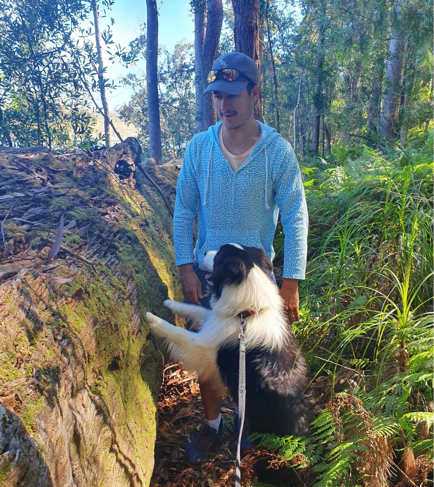
I love hiking and climbing but I also don’t love leaving my dog behind which is necessary if you head into a National Park. This is why I love the short trip up Mt Ninderry!

Mt Ninderry is the wave-shaped mountain located between Coolum and Yandina, and is probably one of the Sunshine Coast’s most underrated hikes. The best bit is, this one is pup-friendly and not very crowded.
It’s a relatively easy hike – if you remember that this is a mountain and you will have to go UP for the first half. I find myself slowing down on the steeper sections.
The mountain itself is 304-metres high and the walk you will take is 1.4km one-way.
The carpark here is quite small so you might have to park in the residential street below.
From the carpark, you start walking up and down through the bush before reaching a steeper, rocky section that goes up toward the mountain top. Some sections are covered in loose gravel that can be a little slippery, so make sure to wear shoes with good grip – especially if you have an excited 4-legged friend pulling you along.
Meandering switchbacks take you up through the bush and rocky terrain to the summit with ocean views peeping through the trees on the way up.

Once you reach the summit, the ground is quite flat and enjoyable to stroll around. There is plenty of shade at the top here too – a big contrast to Mt Coolum.

At the top, two well-constructed viewing platforms on either side of the mountain allow you to take in panoramic views of both the coastline and Mount Coolum to the east, and Yandina and the Blackall Range to the west.
You will also find big rocks along the edges of the summit that make a great backdrop for photos.

It takes me about half an hour to reach the top of this mountain and less to come down, but I always make time to stop at the top and soak in the views.
Just a note - your pup will need to be on a leash for this trip and pack some doggy bags and water for everyone.

Luang Prabang, Laos
Every now and then on your travels, you come across a place that you could lose yourself in and never leave. For me, Luang Prabang is one of those places.
Nestled in northern Laos, tucked among green mountains and majestic rivers, it’s no wonder Luang Prabang is a designated UNESCO World Heritage Site.

The small city is a combination of impressive natural surroundings, historic architecture, and friendly inhabitants. All that makes it such a lovely and inviting place, I didn’t want to leave.
Mandy and I booked last minute so ended up staying in budget accommodation close to the centre of town. This meant that hiring bicycles from our hotel was our main way of getting around. Cycling was a great way to see all the city has to offer and also escape the heat on the downhill stretches.
It is a beautiful city, with its French architecture accented with palm trees and tuk-tuks. Most signs are written in Laotian and French, although we saw a fair amount of English as well.
Here are some highlights of this visit to Luang Prabang – a place I hope to see again.
Things to do
Night market: The Luang Prabang Night Market takes place every night from 5pm, right in the centre of town. We arrived on a late afternoon flight from Siem Reap so our first stop after checking in was to the night market. The amazing Luang Prabang Night Markets is a place where locals and tourists come together to converse, shop and eat all in one location. A difference I felt at these markets was there was a complete lack of pressure or push-selling from the locals. The market’s Hmong and Lao vendors sit on mats with their wares spread around them, allowing you to browse in relative peace.
Just off the Night Market entrance, delicious smells waft from a narrow alley. This is ‘food street’ and you will want to spend some time here. Along with a range of bbq’d meats and salted fish, I found my beloved noodle soup here. After you have filled on savoury delights, don’t forget to check out the local cakes on display or, my favourite, tiny coconut pancakes. The batter is made with coconut milk, sugar and rice flour and cooked over hot coals in a round cupcake-esque baking sheet. The two halves are cooked separately then sandwiched together to make bite-sized sweets.

Delicious tiny coconut pancakes
Mount Phousi: We walked to the top of this baby for sunset and were not prepared at all for how many people had the same idea! There are 360-degree views at the top, so the effort and the crowds are worth it! My first tip is to take some water. 328 steps may not sound like much but in the humid afternoon air, it definitely saps it out of you.
You will need to pay an entrance fee of about 20,000 kips (roughly $4) and you can pay this about halfway to the top – the perfect excuse for a water break. From the top of the mountain, you can see a fabulous view of Luang Prabang and the Mekong Delta. If you are hoping to see sunset, I recommend you go early to get a good vantage point.
Garden of Eden: This local shop is a gem – pun fully intended! We discovered on the recommendation of one of Mandy’s friends who had been before. Garden of Eden is a teeny tiny wonder on the other side of a bamboo bridge. We had to get there the long way around on our bikes as the bamboo bridge is built every dry season and washes away in the wet season and only reached halfway across the river when we were there.

Garden of Eden
Here, not only can you purchase one-of-a-kind hand-made local jewellery, but even create necklaces, bracelets, and earrings of your own by following instructions from local artisans. We weren’t there at the right time for any lessons but spent quite a bit of time shopping and I came home with presents for the ladies in my family.
Visit the temples: There are some 36 temples are scattered around town. Given we only had a couple of days to explore, we limited our choices to a select few but you could lose days visiting them.
Sunset river cruise: There are several options for a sunset river cruise but we were lucky enough to tag along with the cruise run by The Belle Rive Boutique Hotel – a stunning place I desperately wanted to stay at but with only 13 rooms available, we didn’t book in time.

Mandy enjoying a cruise before sunset
The cruise departs across from the hotel in a lovely wooden boat. We were offered a drink to sip as we watched the world go by. A river cruise allows you to see Luang Prabang from a different angle and usually offers up a cracking sunset, viewed from all angles.

Sunset on the Mekong
What to eat
Aside from noodle soup, one of my favourite meals in Laos was Lao fondue. We had this delicious meal at one of the most picturesque spots I have ever been – Dyen Sabai. Located across the river - accessed ideally via that temporary bamboo bridge - this restaurant is a perfect spot for those wishing to escape the busy atmosphere of the main streets. The view from the river front of the restaurant is breathtaking.

Vegetarian Laos Fondue
For the fondue – which is more like a hotpot - a wrought iron bowl is placed in the hole in the middle of your table with coals burning. On it a spherical dome is placed with a ‘moat’ surrounding it. From there it is very much cook our own approach. You’re given a plate of raw meats, a selection of glass noodles and vegetables and huge kettle full of stock. You place the meat in the middle to cook whilst filling the ‘moat’ with stock and your selection of veg – and voila, the never-ending hotpot meal results. We washed it all down with a couple of Beer Laos before cycling back to the other side of town.

The unfinished bamboo bridge
Laos coffee is something you should definitely try on your Luang Prabang visit. Be warned though, this strong brew isn’t for the faint of heart. For those who like their coffee rich and strong, you’ve come to the right place.

Laos Coffee brewing
The Lao mostly don’t drink their coffee black, and instead diffuse it with a cocktail of powdered milk, evaporated milk and sweetened condensed milk. They brew it with a massive cloth filter, slightly resembling a large sock, and ensure the brew is extra strong. The result is a thick, sweet, earthly, delicious concoction of rocket fuel to refresh and revive.
We always sought out the places in the mornings where the locals were having their coffees and joined in. You can have it served hot or cold depending on your mood, but I like it both ways and missed this pick-me-up when I returned home.
Where to stay
Luang Prabang isn’t huge and the old town area is very compact so getting around is pretty easy. No matter where you stay you will be able to see everything easily enough.
The old town can be defined as the area within the the Luang Prabang peninsula, which is bounded by the Mekong and Nam Khan rivers. This is where you will find the stunning The Belle Rive Boutique Hotel which overlooks the Mekong. You might also want to check out Villa Santi Hotel - a boutique hotel in a renovated royal mansion. It’s set in a lush tropical garden in the back streets of the old town.
If you are looking for luxury AVANI+ Luang Prabang is a 5-star resort hotel on the main road but most of the luxury resorts are a bit further out of town. Belmond La Résidence Phou Vao is a tranquil hillside resort overlooking the ancient capital, about a 5-minute tuk-tuk ride from the centre of old town.
Book a Luang Prabang stay of your own here.
Nearby
Just a short trip out of town is the picturesque Kuang Si Falls. These famous falls are a must-see and you can read all about it on my dedicated blog here.
