


Walking to Montezuma Falls - Tassies tallest waterfall
Western Tasmania isn’t short of hikes but it is also home to Tassie’s tallest waterfall. Even better, the hike to get there is a relatively easy one!
Montezuma Falls is actually one of Tasmania’s ‘60 Great Short Walks’ and can be completed in about three hours return. However, the falls are so spectacular, you might lose some time just staring in amazement and soaking it all in.

The trail entrance is easy to spot!
We stopped here on a drive from Strahan to Cradle Mountain, using the 11.5km return walk to stretch our legs (or warm up for Cradle Mountain!)

You lose light pretty quickly in this old mining entrance
The walk follows a former tramway through wet, steep, thickly forested country and you can see signs of the mining history of the area as you wander through. Keep an eye out for a small entrance to an old mining tunnel. We walked in about five metres and lost light straight away so this is not for those with a bout of claustrophobia…
The track is really well-maintained and – this will appeal to many non-hikers – mostly flat! If I lived on the Apple Isle, I can promise I would be here a lot as you can even take your dog on lead which seems a rare experience for good waterfalls hikes as they are mostly in National Parks. We passed a few very happy, and slightly muddy, pooches on our visit.

The muddy but well-maintained trails
Despite seeing a couple of dogs and their owners, we pretty much had the trail to ourselves which is a rare treat!
The track follows the Ring River and offered up some great views down into the river valley as we walked along – my mate Catherine and her long legs setting the pace.
As with many tall waterfalls, you hear the roar before you see them. This is especially true of Montezuma as the 104m drop is tucked away around a corner.

Epic views from the base of the falls
We headed straight for the base of the falls and admired the power of Mother Nature for a while. The view from the bottom is incredible and there is plenty of space to put down your stuff and take some photos. Looking up, Montezuma Falls spills down the steep cliff in several stepped tiers.
After soaking in the view and getting a little spray we made our way to a suspension bridge over the gorge that is just before the falls.

Lust vegetation surrounds the bridge
Walking across the narrow bridge (just wide enough for one person) offers up both a different perspective of the falls, and incredible views through the valley. It really shows you how immense Montezuma Falls is.

Viewing the falls from the bridge

Crossing the suspension bridge
Once over the bridge, we thought to explore a little further and found a picnic table and what looked like a fire trail. However, with no reception and no idea where it led, we had a snack and headed back to the car.
If you want to visit and stay nearby, your best options are Strahan (65km away) or tie it in with a stay near Cradle Mountain (97km away).
There is so much to do in this part of Tasmania, we barely scratched the surface of the Wild West!

Is Morans Falls Lamington National Park’s prettiest waterfall?
Lamington National Park in the Gold Coast Hinterland is full of waterfalls, but Morans Falls may reign supreme above the others.
From the pictures you find online, it may seem like this waterfall is incredibly remote and hard to get to, but that couldn’t be further from the truth.
Just a 2.4km easy walk through sub-tropical rainforest that starts not far from O’Reilly’s Rainforest Retreat will reward you with this incredible feat of nature.
Nature on the trail
The entire trail is on a formed track and not very challenging, although there are some uphill sections. There aren’t any large stairs and the trail zig zags when going up/down hill, making it even easier on the legs
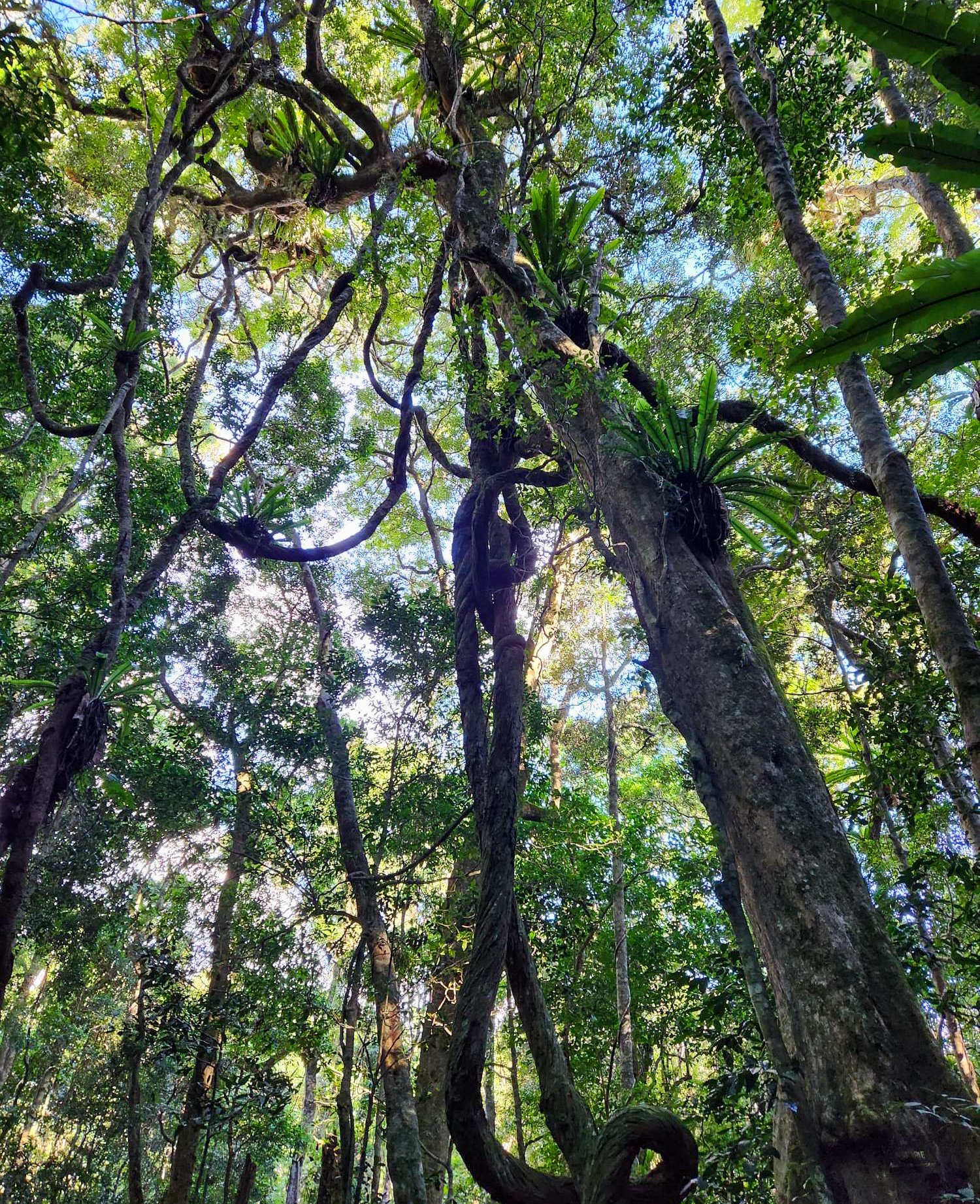
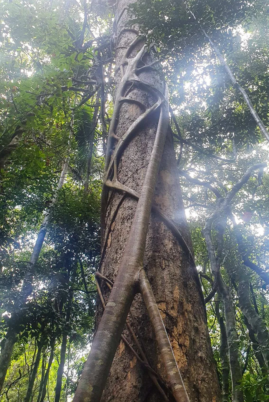
The trail itself is scenic despite being short. Plenty of twisted vines, ferns and strangler figs to admire as you make your way to the main event.

Views over the valley
Because the trail is so accessible, it can get pretty busy. We decided to pack some head torches and see if we would be lucky enough to have a nice sunset from the top of the falls given that they face west.
We were lucky there were only a handful of others doing the same thing the Friday afternoon we were there. If you really want to avoid too many people, I suggest a mid-week visit if at all possible.

Morans Falls from the lookout
We heard rumours of a short-cut track from O’Reillys but were told it can be muddy and isn’t as well marked, so we made our way to the main track. The added benefit of this, is that you walk by the official lookout point where you can view the epic falls from a distance. There is something really special about seeing all that water tumble down a cliff face.
Not far beyond the lookout, you’ll find yourself at the creek that turns into Moran Falls. There is a small concrete block pathway across the creek so you can cross over and continue walking to the second official Moran Falls lookout on the other side of the falls (although the second lookout is of the surrounding rainforest and valley rather than the falls). But, for those gram-worthy views from the top of the falls, you need to change direction and follow the creek towards the cliff – it goes without saying to watch your step and be careful around here.

Magic hour!
Plummeting 80 metres to the valley floor, Morans Falls fluctuates between a thunderous roar after rain, to a gentle trickle in the drier months. There was a decent flow on our visit, and we even ducked under for a dip – a very fresh dip!

Cooling off
The sound of the rushing water was so loud at points that you need to be pretty close to have a conversation.

Living on the edge
The uninterrupted views across the Albert River valley towards Mount Lindsey and Mount Barney are 100 per cent worth it and so was our sunset. Mother Nature really put on a show for us and it was so nice just soaking it all up.
To make it back, we headed back the way we came – definitely not attempting some sort of unknown short cut in the dark!

Explore a waterfall wonderland in Lamington National Park
If there is one thing you need to know about the Green Mountains section of Lamington National Park, it’s that it is full of waterfalls!
We spent a full day exploring this section and were lucky enough to have the best weather and not too much water that the many creek crossings weren’t too dramatic. I can imagine after heavy rains that your feet would be wet the whole time.
Staying at O’Reillys Rainforest Retreat meant that we could start whenever we wanted and still make it back for a sunset drink, but you could easily drive out here from anywhere on the Gold Coast for a day trip as well if you started early – just be aware that the windy road to the top will slow you down.

A very green start to the hike
We combined a few trails to make the most of a full day hiking in the park – starting on the West Canungra Creek circuit down to Yerralahla (Blue Pool). You ease into the day, following the Border Track for about 600m before branching in to the West Canungra Creek Circuit.
The first part dives into lush rainforest and leads you to Yerralahla Pool - there is a 400m drop in elevation from O’Reilly’s to the Blue Pool.

Relaxing by the Blue Pool
Though we hadn’t yet really worked up a sweat, we stripped off to have a quick swim before continuing.
From here, we followed the creek up stream, crisscrossing about 10 times, sometimes rock hopping and only once took our shoes off to wade across. Sometimes the track at crossings isn’t clear, so you (unlike me) you need to keep an eye out for those elusive trail markers!

Waterfalls everywhere!
Sitting by one such crossing for a lunch break, we spotted the local Spiny Blue Crayfish in one of the many deeper pools – a protected species - which looks like a cross between a yabby and a lobster but with vibrant blue markings.
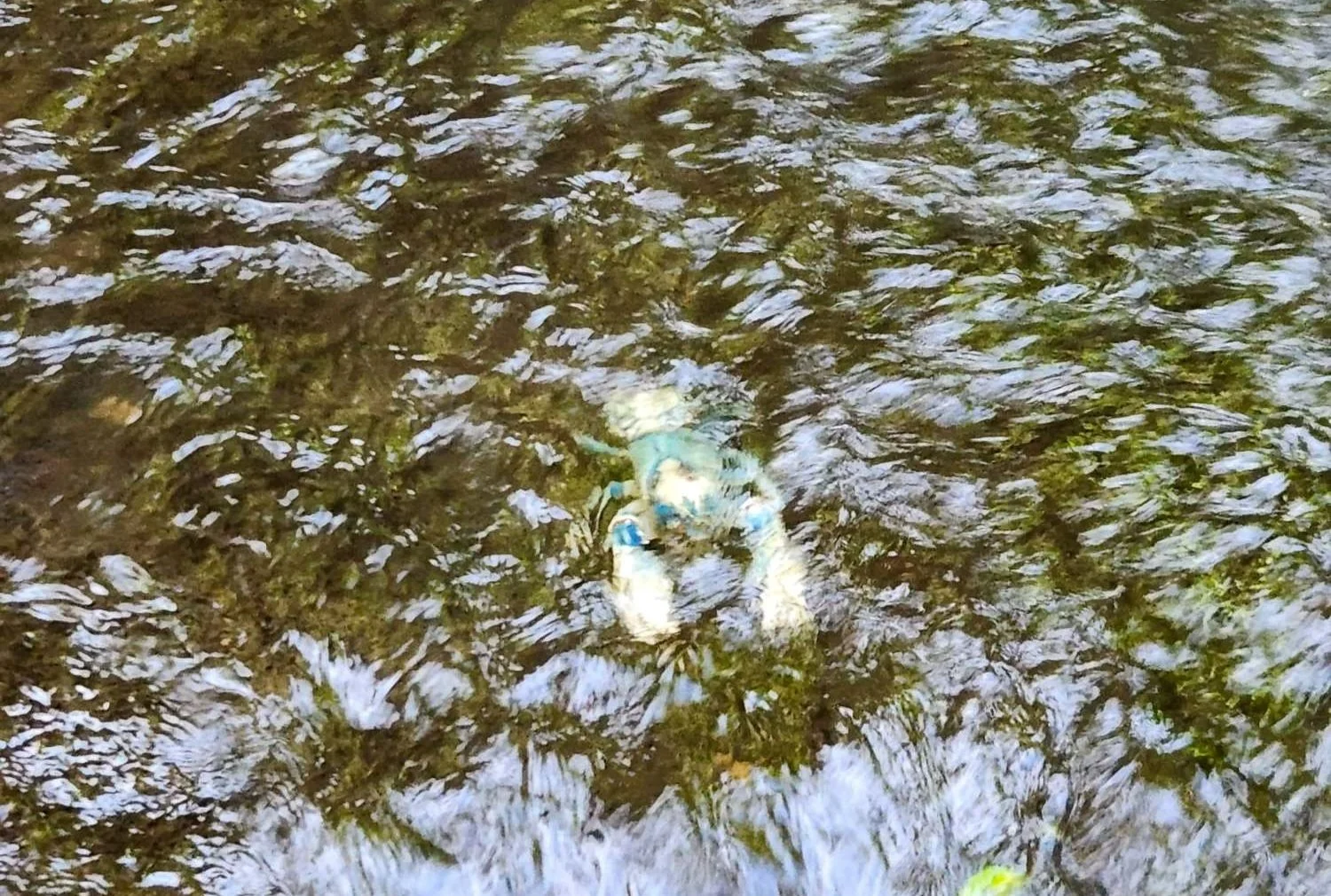
Spiny Blue Crayfish
At the junction of the Box Forest Track, there’s a decision to be made: continue along the creek, or head up the valley away from the creek. – we took the Box Forest circuit up to the Border Track that takes you back to O’Reillys .

Waterfalls aren’t the only scenery on this walk
It’s now almost the end of the waterfalls… but the last two falls (reached by short side-tracks) are the most of the day stunning in my opinion. The first signposted side-track leads to Tulleriguam Falls (Box Log Falls). These falls are tucked away and you can feel the temperature drop as you get closer. We stood here for a bit just soaking up nature’s show.

Box Log Falls
The next (short) side-trip is to Elabana Falls which is by far the busiest spot of the day with a lot of people just walking here from O’Reillys and back.
Elabana Falls is actually not one, but two falls and despite the crowds, it is still spectacular. The falls feature a tall upper section that looks like a curtain and a lower cascade that consists of multiple streams of water flowing into a natural swimming hole.

Elabana Falls
You will need to scramble over a few rocks to get the best views but the view from the track isn’t too shabby.
We stopped here for a VERY refreshing swim. The chill in the water will take your breath away. We saw plenty of small blue spiny crayfish on our swim too.

Time for a swim
Like with any natural pool, there are submerged rocks and varying water depths so sliding and not jumping is recommended – plus, it is super slippery around here.
After spending most of the day descending or being on (relatively) flat ground, it is time to ascend back out of the valley. Be prepared for some exertion at this point but the gradient is pretty gradual.
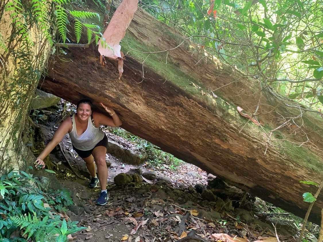
You might find some obstacles on the trail
By the time we made it back to the retreat, we had logged about 19km and it was worth every step!

Tips for Hiking the Somerset Trail
Maybe the 2nd of January wasn’t a great day to do a hike in dry bush, but we did it anyway and the views were totally worth it.
The Somerset Trail in D'Aguilar National Park is about an hour from the Sunshine Coast and also an hour from Brisbane so it is a perfect day trip from either starting point.
It is a perfect hiking destination for those who want to explore the natural beauty of Queensland. The trail will take around 3-4 hours to complete, depending on your pace. The best time to visit the Somerset Trail is during the cooler months of the year, from March to November, when the temperatures are more comfortable for hiking – unlike our visit in the peak of summer!

Palms on the trail
Getting there:
To get to the Somerset Trail, you need to drive to the southern entrance of D'Aguilar National Park. The park is easily accessible by car, and there is ample parking available at the trailhead – called The Gantry. Once you reach the trailhead, you can start your hike, following the well-marked trail.
The trail itself:
Around a 13km loop (the best kind of hike because there is no back-tracking!), the trail moves you through various terrains.

Walking the trail
The rainforest of palms and ferns changes to timberland, scribbly gum and pine forest as you make your way to the lookout.
All the recommendations are the do the loop anti-clockwise. This means the hike back from the summit is a bit shorter and most of the uphill bits are early on in the walk.
Nature showing off
The trail is clearly signposted so there is very little chance of going off-track.
Make sure to bring plenty of water, snacks and sunscreen as there are limited facilities on the trail.

Selfie at the summit
There’s not real view before or after you reach the lookout so make sure you leave enough time to really appreciate it at the top, but also enjoy the sounds and smells of the bush as you walk.
I have read that in spring, there are plenty of wildflowers to see on the trail, but we visited during a very dry summer and everything was just a bit dusty.
The summit of the Somerset Trail offers breathtaking views of the surrounding landscape. On a clear day, you can even see Somerset Dam and Wivenhoe Dam in the distance. The scenery is truly awe-inspiring and makes the long hike worth every step.

Somerset Dam in the distance
NOTE: It's important to be aware that parts of the Somerset Trail are shared with 4WD, dirt bikes and horse riders. Keep an eye out for these vehicles and always give them right of way. It's also important to be mindful of your impact on the environment and stick to the designated trail.

Exploring the rocky wonders of Girraween National Park
For years I had seen images of giant granite boulders perched precariously on top of one another showing panoramic views of the Australian bushland beyond. It was a place I absolutely HAD to visit one day and see for myself.
So when planning a getaway close to home, Stanethorpe’s wine region was an easy choice as it butts up against Girraween National Park where you will find this otherworldly landscape. Find your stay here!
There are plenty of different hiking tracks in the park – around 12 in total – so you could be exploring for days.
Given we were travelling with the dog, we didn’t want to be gone for a whole day as he wouldn’t be joining us on this exploration, so we chose to combine the Pyramid and Arch hikes which can be done in about half a day.

It’s a steep incline!
In the middle of August, we were blessed with a bright sunny day which is good because I would not want to attempt this hike with any rain.
Most of the trail up to the Arch is easy going but you will need a decent amount of fitness and some grit (and decent shoes with plenty of grip) to make it to the top of the Pyramid.

Plenty of interesting views on the hike
The walk starts from the visitor centre near Bald Rock Creek, following a well-formed track across the creek and through the trees. You can head straight up to the Pyramid after about a kilometre, but we detoured via the Arch on our way up.

Granite Arch
Here the rocks balance on each other in a way that seems like a kid came along and was building a granite city – but this is all nature’s work!
Hiking in winter I was surprised to see so much vibrant yellow wattle and little white flowers that Aiden couldn’t get enough of. It was an amazing contrast with all the hulking granite.

Vibrant wattle
From the Arch, we started to ascend a little more steeply with a series of steps. Don’t get complacent here, this is just the warm-up to the final climb so take your time and enjoy the scenery.
As we finished the last set of stairs, a massive, bare granite rock emerged in front of us. It is huge and a little intimidating when you consider the plan is to climb this exposed, steep surface.

Warm up on the stairs
There are little white marks on the granite showing the path to follow but honestly, any way you can get up is the way forward. There are some smaller rocks off to the left we hugged so there was something to hold on to – at least some of the time…
We stopped every now and then to catch our breath and take in the views (and stretch the calves).
Eventually we made our way to the top and the granite levels out. We were rewarded with not only incredible 360-degree views but some insane balancing rocks that defy gravity.

Having some fun with the balancing rocks
It is truly a breathtaking display of nature and we had the summit pretty much to ourselves on a random Thursday. I imagine it gets pretty busy on weekends but we were lucky to take our time at the top.
One of the most impressive sights is Second Pyramid which is the largest single slab of granite in the National Park. It is accessible to proper climbers only so we were more than happy to admire the views from afar.

Second Pyramid
The climb back down the slab of rock was slow going for fear of slipping – Aiden and I both did a little crab walking at points along the way - but we made it down eventually and headed off for some lunch before collecting the pup for an afternoon of dog-friendly exploring.
Honestly, there really isn’t anything like Girraween National Park that I have seen before in Australia. It is such an impressive display and one I wouldn’t mind visiting again one day.
Looking for your next escape? Book a stay here.